
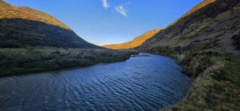
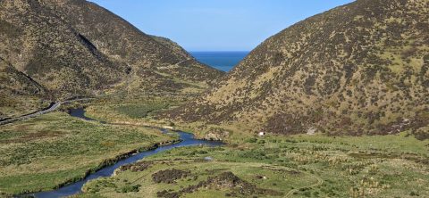
Looking south along the Wainuiomata River as it flows between two hills towards the wild southern shoreline near Baring...
New Zealand Photos
About Places Share
About
Our photos of New Zealand include both the North and South islands. Subjects are as varied as cities like Auckland, Wellington, and Christchurch. We also have photos of towns, mountains, coastline, rivers, geological features, plant life, animals, people, sport, and Maori culture. Our images date back to the 1960s and span decades to the present day.
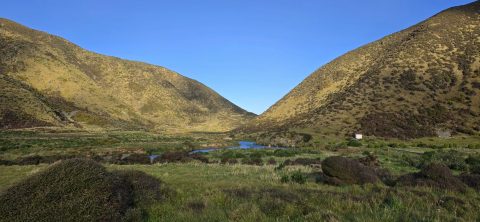
View south along the Wainuiomata River towards the coastline, with the shadow of Para Hill falling across the right-hand...
The Wainuiomata River, viewed from the Great Loop Walk beneath the shadow of Para Hill, near the Wainuiomata coast.
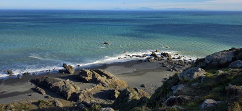
Looking down at the rugged coastline below Baring Head on the south coast of Wainuiomata. From this elevated position,...
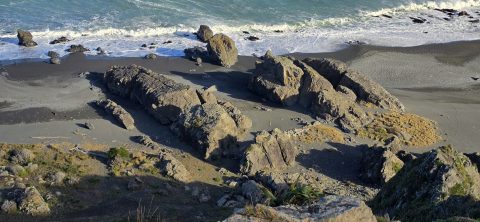
Ancient volcanic rocks are scattered along the coastline around Baring Head and much of Wainuiomata’s south coast, adding to...
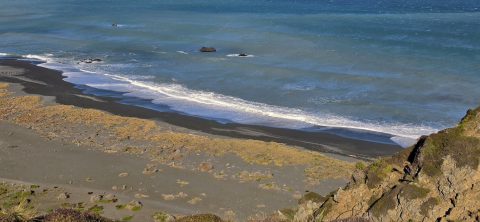
Wainuiomata has a rugged, windswept coastline with grey sand and wild coastal conditions. Pictured is the mouth of the...
Wainuiomata has a rugged, windswept coastline with grey sand and wild coastal conditions. Pictured is the mouth of the...
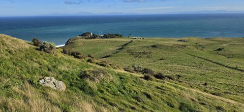
Standing on the side of Para Hill, looking towards Baring Head and Cook Strait. This area lies within East...
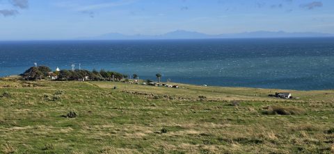
Looking towards Baring Head, with the lighthouse cottages visible near the headland and the South Island seen in the...
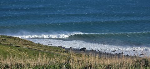
Breaking waves at Baring Head show what looks like a great left-hand break. However, the absence of surfers may...
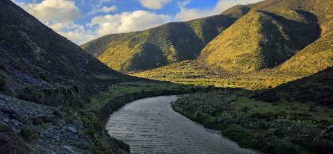
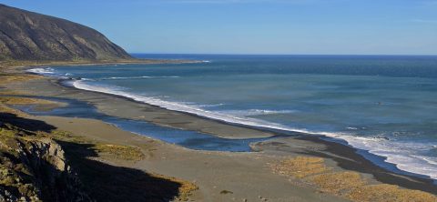
Looking across the southern section of the Wainuiomata River before it flows beyond the south coast and out into...
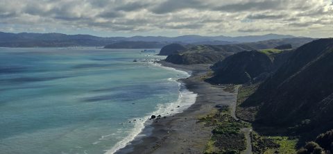
Looking down over Fitzroy Bay and along the south coast of the North Island, with the Interislander ferry visible...

Recent Comments