
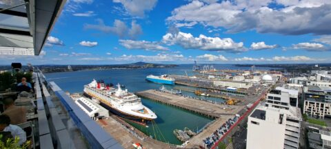
View of Ports of Auckland and the Waitematā Harbour, with a cruise ship in the scene and Rangitoto Island...
Auckland photos
About
About Auckland
Our photos of Auckland capture the unique mix of urban landscape, coastlines, and nature that merge together in New Zealand’s largest city. While it is the country’s biggest urban area, it is also surrounded by two beautiful harbors, Pacific beaches, and forested hills.
Auckland is the name of a region and a city. It is the most populous city in the country. In fact, the amount of people here outnumber all citizens of the South Island, about a third of the country in total. The largest Polynesian population in the world is contained in Auckland even outnumbering their total population elsewhere.
Auckland frequently ranks in the top five cities worldwide for livability, according to the Mercer Quality of Living Survey. The city scores highly for various reasons, such as its accessibility to natural reserves and beaches. As a result, boating is a popular pastime among Aucklanders, with more boats per person than any other city in the world. The Southern Hemisphere’s biggest marina, Westhaven Marina, is located near the city center.
The SkyTower, the tallest structure in the Southern Hemisphere, dominates Auckland’s skyline. The nearby Auckland Harbour Bridge spans the Waitemata Harbour, offering access to the picturesque Northshore. Looking out to sea from the beaches in the area provides an unobstructed view of Rangitoto Island, a conical volcano. Auckland also has stunning beaches on the west coast, such as Piha and Bethells Beach.
Auckland sits on a volcanic field consisting of 50 extinct volcanoes, many of which have been transformed into nature reserves with scenic viewpoints at their peaks. Some noteworthy cones include One Tree Hill, Mt Eden, and Mt Victoria.
For earlier photos of Auckland, visit Virtual New Zealand.
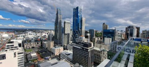
The eastern end of Auckland’s central business district is a hub for business and education, home to corporate offices,...

Wynyard Quarter is a waterfront precinct in Auckland, located on the city’s Waitematā Harbour. Once an industrial area dominated...
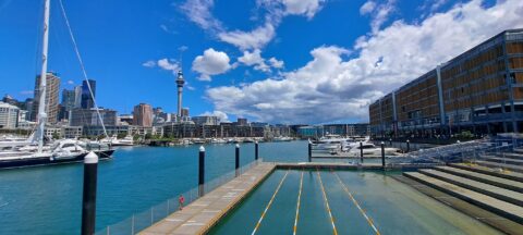
Auckland skyline as seen from Wynyard Crossing, a pedestrian and cyclist bridge connecting Viaduct Harbour to Wynyard Quarter.
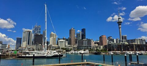
Blue sky over Auckland Harbour and skyline with the sky tower to the right as seen from the Wynyard...
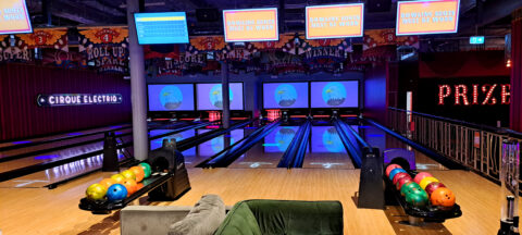
View of the bowling alley at Archie Brothers Cirque Electriq in Auckland’s Westfield Mall. There are also arcade games,...

Reception area inside Archie Brothers Cirque Electriq. The venue is located in Westfield Shopping Mall in Newmarket, Auckland.
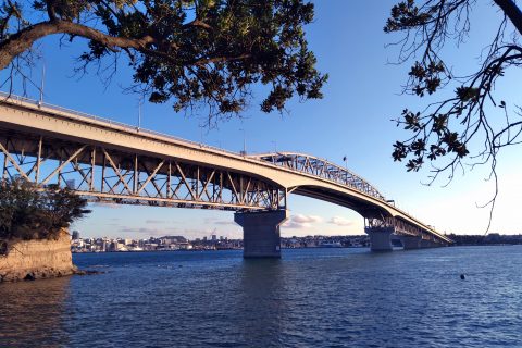
Stunning view of the Auckland Harbour Bridge as seen from the North Shore suburb of Northcote. The bridge is...
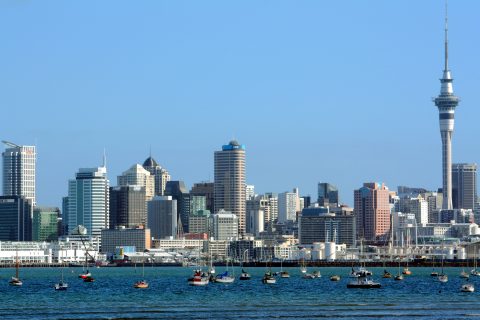
Looking at the Sky Tower and surrounding buildings in Auckland city. The Sky Tower is the tallest freestanding structure...
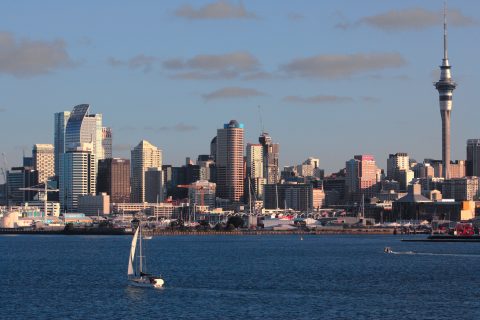
Evening light reflecting off the Auckland city skyline with a yacht in the harbor.

INEOS Team UK take one of their yachts for a test ride off the coast of Devonport in Auckland...

Recent Comments