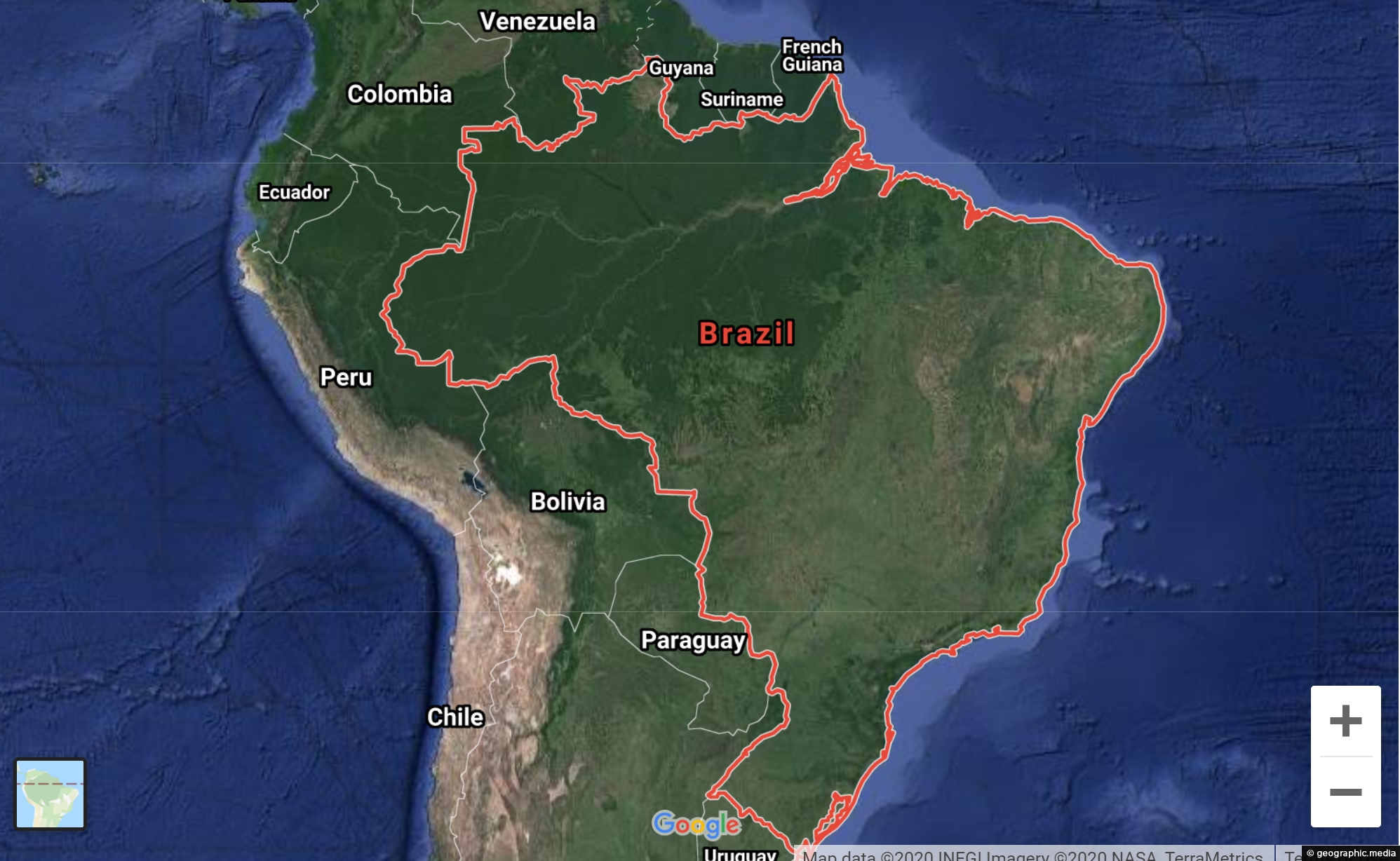
View Larger Map Navigate Brazil using our Google Map and Street View. Explore the Amazon Rainforest, view scenic coastlines,...
Brazil Maps
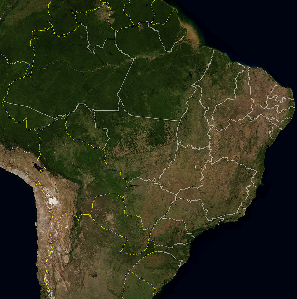
This NASA satellite image of Brazil shows clearly the Amazon Basin and the drier south east of the country....
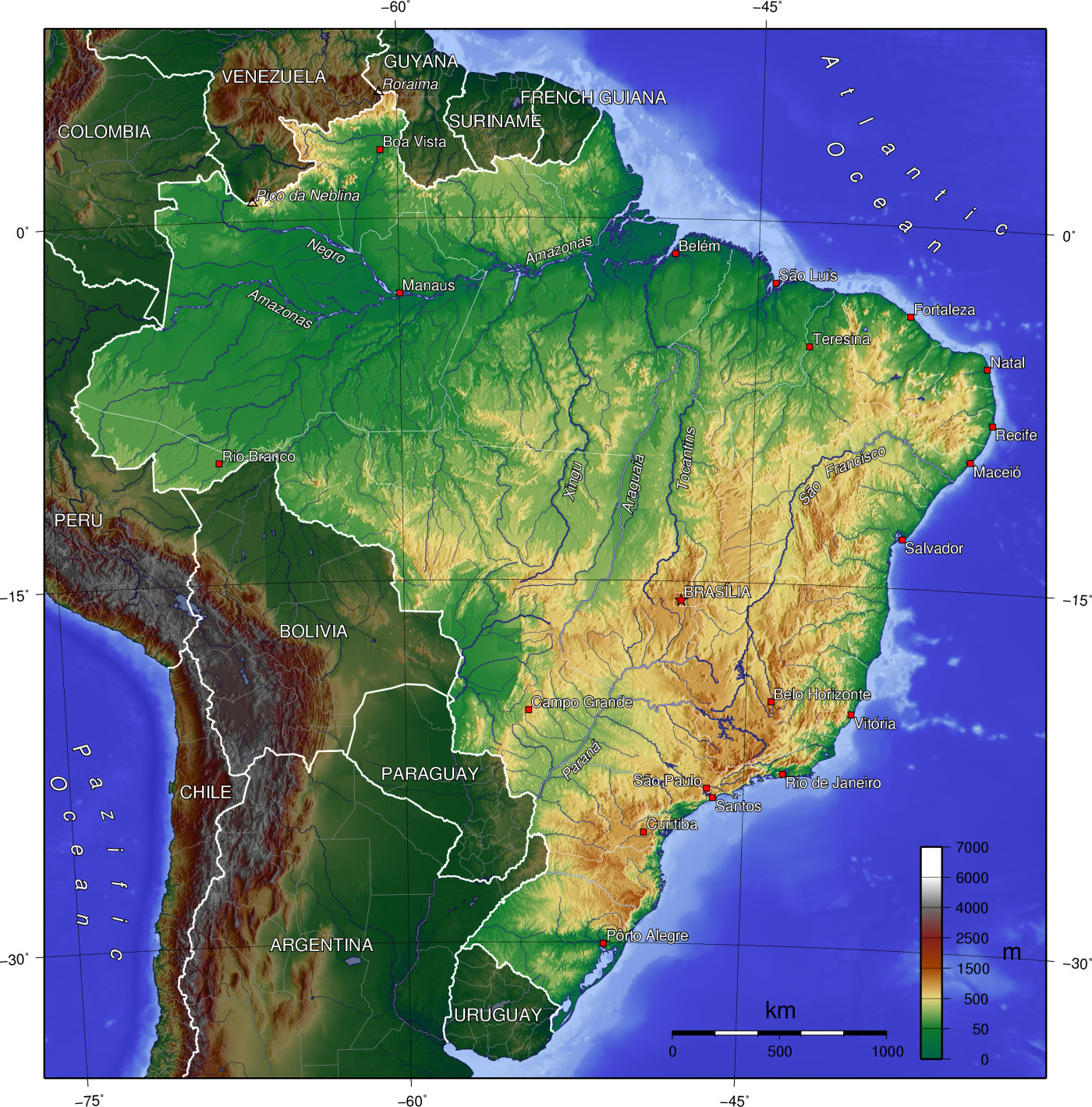
A topographical view of Brazil in the context of South America. Higher ground tends to be located in the...
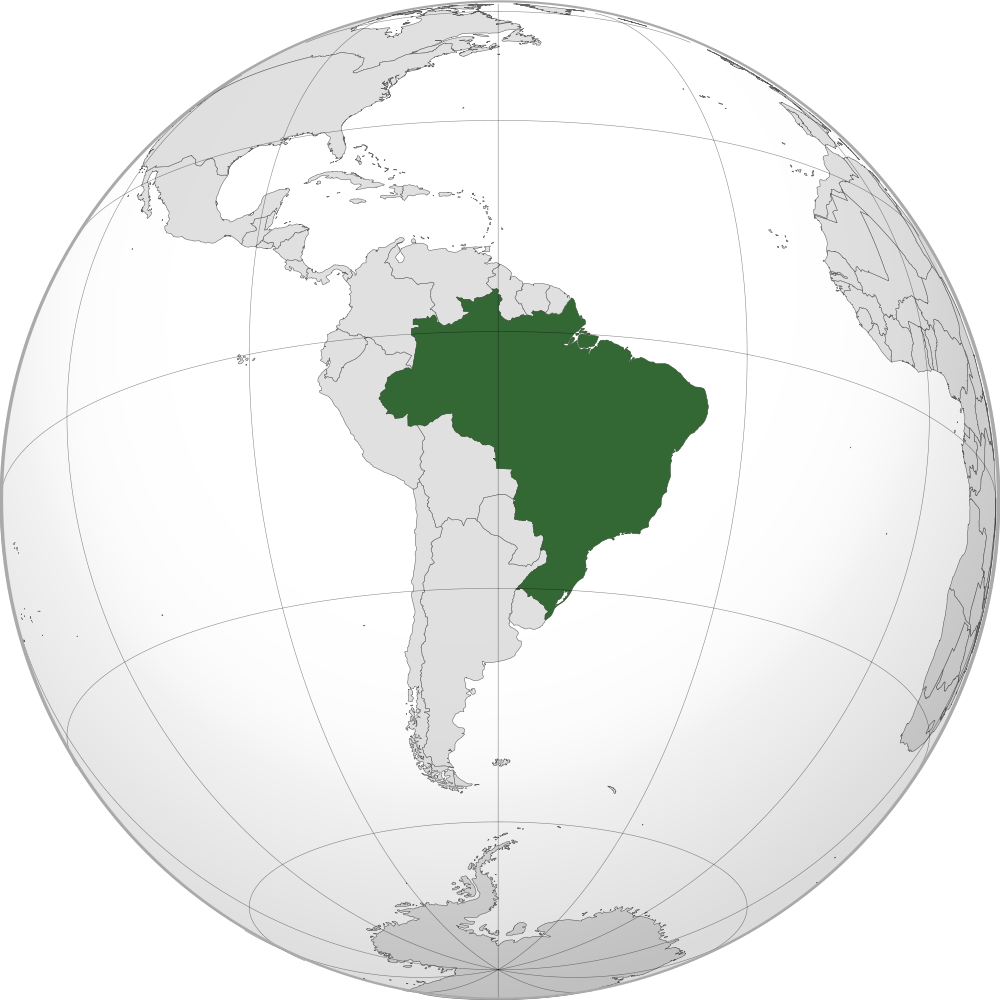
Projection of Brazil on the globe in a South American context. Brazil is the largest country by geographical area...
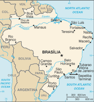
Map showing the major cities of Brazil and surrounding nations. Brasilia is the capital city with Sao Paulo...
Latest Posts
Popular Posts
- Awakening New Zealand video (100)
- Iguazu Falls as seen from Brazil (86)
- Metrocable Medellin (77)
- Spinnaker Hill View (68)
- Pauatahanui Inlet (68)
- View from Whitby (68)
- Spinnaker Hill in Whitby Porirua (67)
- The Devil’s Throat (62)
- Aerial View of Iguazu Falls (61)
- Porirua Harbour & Papakowhai (57)
- Lake Wakatipu (57)
- Salto Rivadavia & Iguassu River (56)
- Lake Tekapo & Lupins (54)
- Cascadas at Iguazu (53)
- Close up of Salto Rivadavia (53)
- Salto Rivadavia Misiones Province (53)
Subjects
AccommodationAnimalsArchitectureBeachesBirdsBoatsBridgesBuildingsCarsChurchesCitiesCliffsCoralCultureExtra Wide HorizontalFlowersForestsHarborsHomesIslandsLakesLandscape / HorizontalMapsMenMonumentsMountainsPalmsParksPeoplePlantsPortrait / VerticalRiversRoadsRuralSeaShopsSkyscrapersSnowSunsetsTownsTransportTreesVideosVolcanicWaterfalls
Recent Comments