
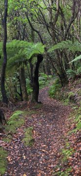
At lower elevations along the Whakanui Track, tree ferns and other moisture-loving rainforest species thrive in the sheltered forest.
Remutaka Forest Park photos
About
About the Remutaka Range
Photos of the Remutaka Range in the Wellington region
The Remutaka Range forms the southern part of the main mountain chain running through New Zealand’s North Island. This chain extends from the Gisborne region to the south coast of the Wellington region. The range also forms a natural boundary between Wellington and the Wairarapa.
Turakirae Head, on the southern coast of the North Island, marks the southern end of the range, while the Remutaka Hill Road marks its northern boundary. Beyond this point, the Tararua Range continues north.
The western side of the Remutaka Range is lush and forested, as moist air rises over the hills and produces high rainfall. In contrast, the eastern side is warmer and drier, creating conditions that have helped support the thriving wine industry on the Wairarapa plains below.
The range is home to temperate beech forest, podocarp rainforest, and alpine vegetation at higher elevations. Numerous bush tracks pass through this varied landscape, alongside rivers such as the Orongorongo River and the Wainuiomata River.
Although the Remutaka Range is not widely known among international tourists, it is highly valued by locals as a destination for bushwalking, nature, and escaping the bustle of city life. Hunting is permitted in some areas, although restrictions apply, including within parts of Remutaka Forest Park near Wainuiomata.
For more photos of the Remutaka (Rimutaka) Range, visit Virtual New Zealand or Wainuiomata.Net.
The Whakanui Track begins at the top of Sunny Grove and crosses McKerrow Ridge before descending into the Ōrongorongo...
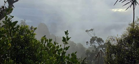
Cloud rises against McKerrow Ridge, shrouding the forested slopes of Remutaka Forest Park in mist. The area receives high...
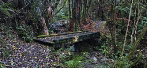
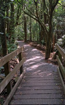
A bridge at the beginning of the Whakanui Track crossing Skerretts Creek. From here the track rises up to...
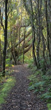
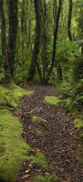
The Whakanui Track passes through scenic forest in Remutaka Forest Park. It climbs steeply, revealing different forest types as...
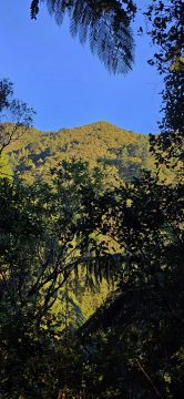
The Whakanui Track offers occasional views of the surrounding landscape where openings appear in the dense rainforest. McKerrow Ridge...
The Whakanui Track passes through typical native rainforest in this section, where ferns and beech trees dominate the landscape.
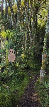
The Whakanui Track in Remutaka Forest Park, Wainuiomata, is home to more than 140 wild kiwi. Signs in the...
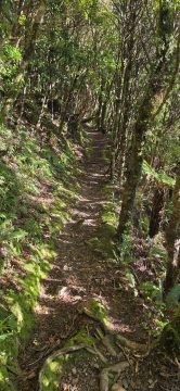
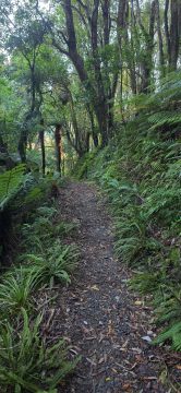
This section of the Whakanui Track follows a steep hillside, with openings that offer stunning views of the gully...
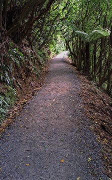
The opening section of the Orongorongo Track is relatively straight, with a surface of compacted stones that provides firm...
View of the Orongorongo Track and one of many foot bridges that allow you to cross smaller streams within...
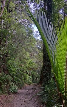
View of the Orongorongo Track in the Remutaka Forest Park. The fern to the right is a Nikau Palm...

Recent Comments