
Unusual double trunk tree located in Catchpool Valley in the Remutaka Forest Park, Wainuiomata.
Remutaka Forest Park photos
About
About the Remutaka Range
Photos of the Remutaka Range in the Wellington region
The Remutaka Range forms the southern part of the main mountain chain running through New Zealand’s North Island. This chain extends from the Gisborne region to the south coast of the Wellington region. The range also forms a natural boundary between Wellington and the Wairarapa.
Turakirae Head, on the southern coast of the North Island, marks the southern end of the range, while the Remutaka Hill Road marks its northern boundary. Beyond this point, the Tararua Range continues north.
The western side of the Remutaka Range is lush and forested, as moist air rises over the hills and produces high rainfall. In contrast, the eastern side is warmer and drier, creating conditions that have helped support the thriving wine industry on the Wairarapa plains below.
The range is home to temperate beech forest, podocarp rainforest, and alpine vegetation at higher elevations. Numerous bush tracks pass through this varied landscape, alongside rivers such as the Orongorongo River and the Wainuiomata River.
Although the Remutaka Range is not widely known among international tourists, it is highly valued by locals as a destination for bushwalking, nature, and escaping the bustle of city life. Hunting is permitted in some areas, although restrictions apply, including within parts of Remutaka Forest Park near Wainuiomata.
For more photos of the Remutaka (Rimutaka) Range, visit Virtual New Zealand or Wainuiomata.Net.
Walking across Catchpool Stream from the Catchpool Loop Track in the Remutaka Forest Park, Wainuiomata.
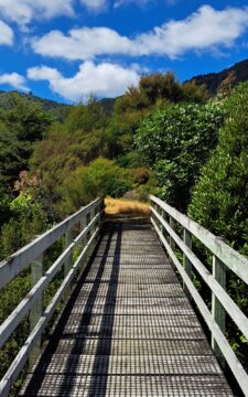
Walking trails in the Remutaka Forest Park contain numerous walking bridges to get you across creeks that flow through...
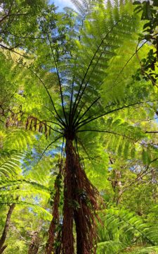
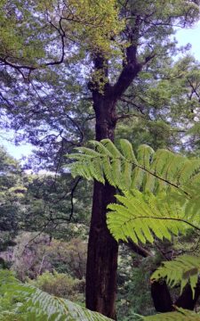
Sections of Remutaka Forest Park contain large fern trees, including black ferns and silver ferns with small fern plants...
The Five Mile Track within the Remutaka Forest Park, more specifically in Catchpool Valley, is an easy walk that...
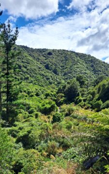
Perspective of Catchpool Valley in Wainuiomata, observed from the Five Mile Loop Track. The path swiftly delves into a...
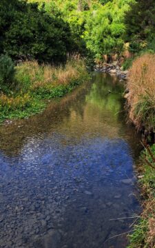
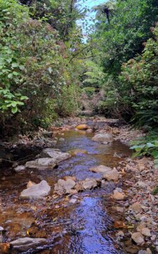
Catchpool Stream in Wainuiomata is a tributary of Wainuiomata River. The stream flows through the Remutaka Range and out...
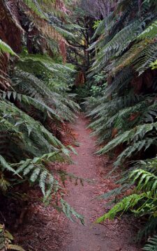
Catchpool Loop Track is a short 30 minute walk in the Remutaka Forest Park. It is a great introduction...
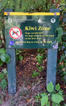
A sign alerting to walkers in the Remutaka Forest Park that there are kiwi birds in the forest and...
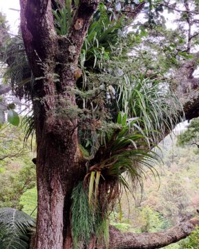
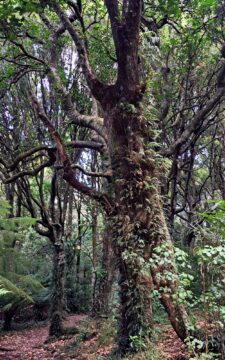
Large trees serve as a refuge for numerous types of epiphytes within the podocarp rainforests found in the southern...
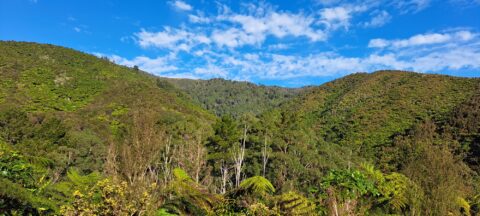
The McKerrow Track rises up the ridge in the center of the photo then along other ridges behind this...
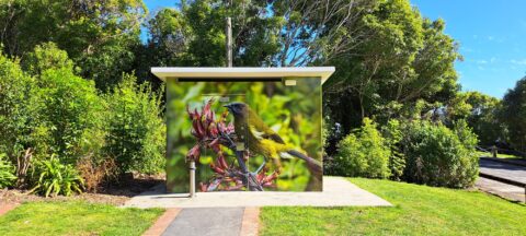
Near the beginning of the McKerrow Track is this toilet facility. The art work depicts a Yellowhead bird also...

Recent Comments