
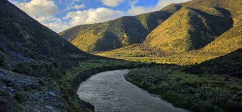
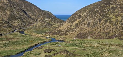
Looking south along the Wainuiomata River as it flows between two hills towards the wild southern shoreline near Baring...
Wainuiomata photos
About
About Wainuiomata
Photos of Wainuiomata including the town and surrounding landscapes, including Wainuiomata Regional Park and Remutaka Forest Park.
Wainuiomata is a suburb of Lower Hutt in the Wellington Region. It’s big and isolated enough to be considered a town in its own right, but it is administered by the Hutt Regional Council.
Wainuiomata has interesting topography. It sits in a plateau surrounded by hills on three sides which protect the suburb from Wellington’s famous wind. This results in slightly cooler temperatures in winter and warmer temperatures during summer compared with most other places in the Wellington region and Hutt Valley.
The CBD is located around Queens Street with a large Countdown Mall located behind. The suburbs flow into three main valleys with the southern most valley affording access to the South Coast via the Coast Road.
Eastward is The Village, a small area with some shops. Continuing east, one will find the Wainuiomata Recreational Area which has a dam and was once the main water source for the Wellington region. With one dam still in use today, the area is now a natural wetlands surrounded by forested hills. Within the park are a number of scenic bush walks and some swimming holes in the Wainuiomata river. There is also a museum near the old dam with some old machinery and artefacts on display. This reserve is located within the Remutaka range, a mountain chain that reaches to the south coast of the North Island.
For older photos of Wainuiomata, see Virtual New Zealand.
For a more extensive collection of photos of Wainuiomata, visit Wainuiomata.Net
Geographic.Media recommends this tour of the Wainuiomata wilderness →
View south along the Wainuiomata River towards the coastline, with the shadow of Para Hill falling across the right-hand...
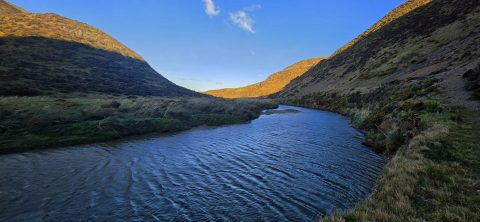
The Wainuiomata River, viewed from the Great Loop Walk beneath the shadow of Para Hill, near the Wainuiomata coast.
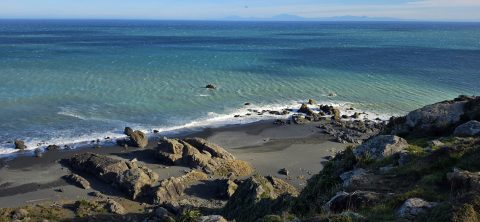
Looking down at the rugged coastline below Baring Head on the south coast of Wainuiomata. From this elevated position,...
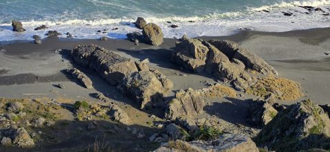
Ancient volcanic rocks are scattered along the coastline around Baring Head and much of Wainuiomata’s south coast, adding to...
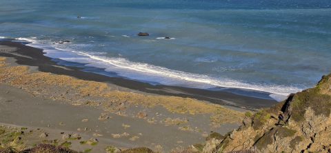
Wainuiomata has a rugged, windswept coastline with grey sand and wild coastal conditions. Pictured is the mouth of the...
Wainuiomata has a rugged, windswept coastline with grey sand and wild coastal conditions. Pictured is the mouth of the...
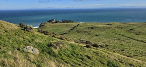
Standing on the side of Para Hill, looking towards Baring Head and Cook Strait. This area lies within East...
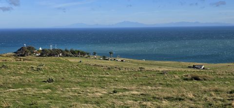
Looking towards Baring Head, with the lighthouse cottages visible near the headland and the South Island seen in the...
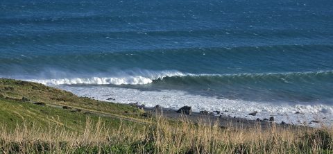
Breaking waves at Baring Head show what looks like a great left-hand break. However, the absence of surfers may...
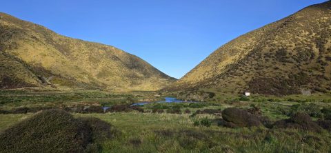
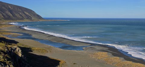
Looking across the southern section of the Wainuiomata River before it flows beyond the south coast and out into...
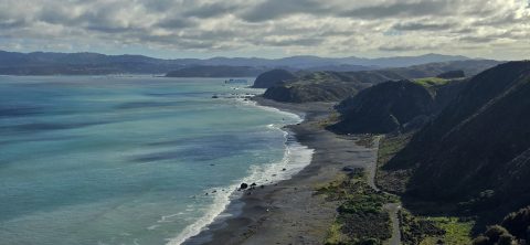
Looking down over Fitzroy Bay and along the south coast of the North Island, with the Interislander ferry visible...

Recent Comments