
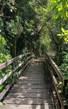
There are numerous bridges on the Orongorongo Track that traverse small streams that run down hills and empty into...
Remutaka Forest Park photos
About
About the Remutaka Range
Photos of the Remutaka Range in the Wellington region
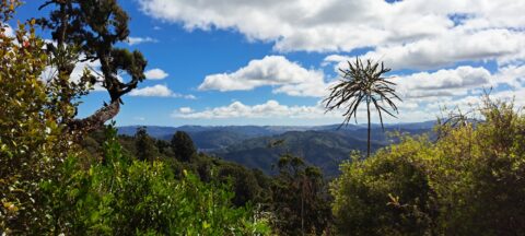
The Remutaka Range forms the southern part of the main mountain chain running through New Zealand’s North Island. This chain extends from the Gisborne region to the south coast of the Wellington region. The range also forms a natural boundary between Wellington and the Wairarapa.
Turakirae Head, on the southern coast of the North Island, marks the southern end of the range, while the Remutaka Hill Road marks its northern boundary. Beyond this point, the Tararua Range continues north.
The western side of the Remutaka Range is lush and forested, as moist air rises over the hills and produces high rainfall. In contrast, the eastern side is warmer and drier, creating conditions that have helped support the thriving wine industry on the Wairarapa plains below.
The range is home to temperate beech forest, podocarp rainforest, and alpine vegetation at higher elevations. Numerous bush tracks pass through this varied landscape, alongside rivers such as the Orongorongo River and the Wainuiomata River.
Although the Remutaka Range is not widely known among international tourists, it is highly valued by locals as a destination for bushwalking, nature, and escaping the bustle of city life. Hunting is permitted in some areas, although restrictions apply, including within parts of Remutaka Forest Park near Wainuiomata.
For more photos of the Remutaka (Rimutaka) Range, visit Virtual New Zealand or Wainuiomata.Net.

View of Clay Ridge as seen from the Five Mile Loop Track in Remutaka Forest Park, Wainuiomata, with the...
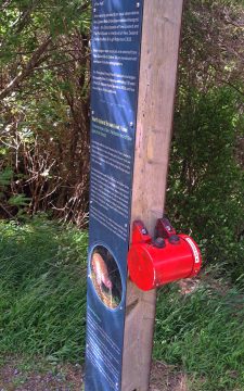
These types of information signs at the beginning of the Orongorongo Track focus on a particular native bird species....
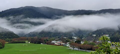
Low hanging clouds in Wainuiomata are trapped by the Remutaka Range with Richard Prouse Park in the foreground.
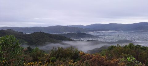
Mist over the Wainuiomata Basin and surrounding hills. Photo taken from the western hills between Wainuiomata and the rest...
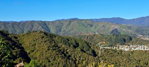
Gazing at the hills of Wainuiomata, with the Remutaka Range serving as a scenic backdrop. Wainuiomata is divided from...
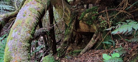
These trees moved down a steep hillside due to a slip or small landslide. The trees appear to have...
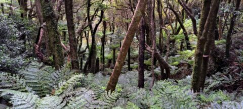
Lush forest covers the hills around Skerretts Creek in Wainuiomata. The slopes here are part of the Remutaka Mountains...
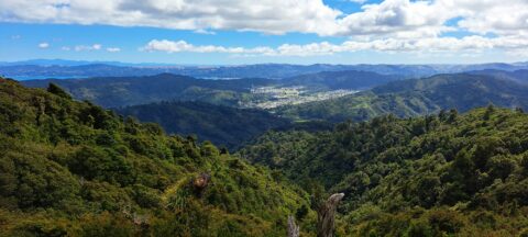
View of Wainuiomata from the Remutaka Range located in the southern North Island. Also in view are the western...
Observing the hills leading towards Wainuiomata from the summit of a ridge in the Remutaka Range, precisely along the...
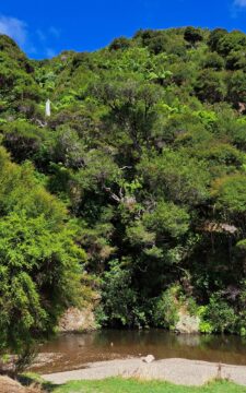
A natural swimming area in Wainuiomata Regional Park. This is Wainuiomata River which has numerous swimming areas.
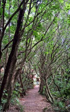
View of a typical walking trail in Catchpool Valley, located at the foothills of the Remutaka Range, in Wainuiomata.

Recent Comments