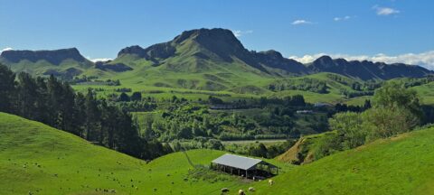
From the Mount Erin Lookout, located just outside Havelock North along Waimārama Road, you can enjoy spectacular views of...
New Zealand Photos
About
Our photos of New Zealand include both the North and South islands. Subjects are as varied as cities like Auckland, Wellington, and Christchurch. We also have photos of towns, mountains, coastline, rivers, geological features, plant life, animals, people, sport, and Maori culture. Our images date back to the 1960s and span decades to the present day.
Locations
- Abel Tasman photos
- Akatarawa Forest photos
- Auckland photos
- Blenheim photos
- Canterbury photos
- Castlepoint photos
- Central Otago photos
- Christchurch photos
- Coromandel photos
- Fiordland photos
- Fox Glacier photos
- Franz Josef Glacier photos
- Hawkes Bay photos
- Kaitoke photos
- Kapiti Coast photos
- Kapiti Island photos
- Lake Tekapo photos
- Lower Hutt photos
- Mana Island photos
- Manawatu Photos
- Marlborough Sounds photos
- Mount Bruce photos
- Mt Cook photos
- Mt Ruapehu photos
- Mt Taranaki photos
- Napier photos
- Nelson photos
- Nikau Reserve photos
- Northland photos
- Pelorus Bridge Scenic Reserve
- Porirua photos
- Puketahā
- Putangirua Pinnacles photos
- Queenstown photos
- Remutaka Range photos
- Rotorua photos
- Southern Alps photos
- Tararua Range photos
- Tasman Bay photos
- Taupo photos
- Te Mata Peak
- Titahi Bay Photos
- Tongariro National Park photos
- Upper Hutt photos
- Waimangu Valley photos
- Wainuiomata photos
- Wairarapa photos
- Wairoa photos
- Wellington photos
- Whanganui photos
Using our photos
The photos can be used without permission in school projects and websites so long as the photos are not altered in any way except resizing. Do not crop the photos and in particular do not remove the watermark in the bottom-right corner. You must give attribution if you use our photos.
For more information about using our photos, visit the About Us page.
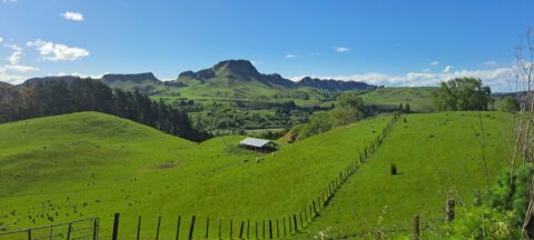
A view of lush farmland surrounds Te Mata Peak in Hawke’s Bay, New Zealand. Renowned for its fertile land,...
Waimarama Road and Te Mata Peak are closely connected as part of the stunning landscape of Hawke’s Bay, New...
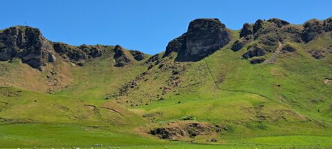
Te Mata Peak stands at 399 metres (1,309 feet), offering sweeping views of Hawke’s Bay. From its summit, visitors...
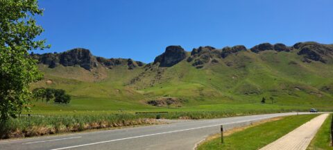
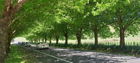
Waimarama Road itself is a scenic drive that passes through rolling farmland, orchards, and vineyards, showcasing the agricultural richness...
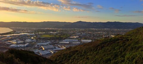
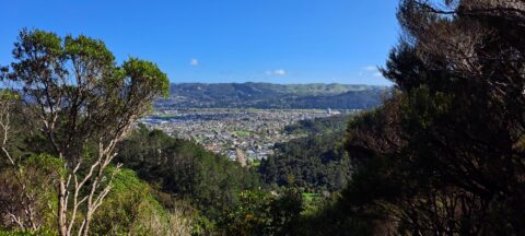
This vantage point atop the Wainuiomata Hill offers a perspective, where the urban layout of Lower Hutt spreads out...
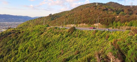
Wainuiomata Road is the sole public road leading into Wainuiomata, winding over the Eastern Hutt Hills into the Wainuiomata...
View of Wainuiomata as seen from the lookout at the top of Wainuiomata Hill. A car park at the...
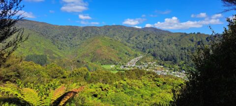
High up on a ridge in Wainuiomata Scenic Reserve, you can get a great view of Sunny Grove, Hine...
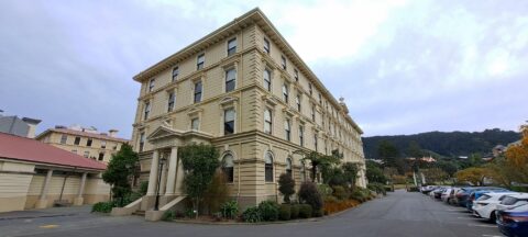
The Former Government Buildings in Wellington, completed in 1876, are one of New Zealand’s most iconic historic landmarks and...
Looking at a section of the Hutt Valley as seen from the hills behind the suburb of Naenae in...
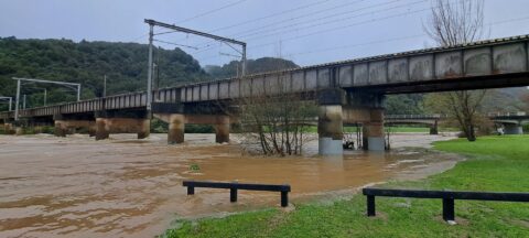
Continuous heavy rain in August and September 2024 caused the Hutt River to rise significantly above its usual height.
Related
- Abel Tasman photos
- Akatarawa Forest photos
- Auckland photos
- Blenheim photos
- Canterbury photos
- Castlepoint photos
- Central Otago photos
- Christchurch photos
- Coromandel photos
- Fiordland photos
- Fox Glacier photos
- Franz Josef Glacier photos
- Hawkes Bay photos
- Kaitoke photos
- Kapiti Coast photos
- Kapiti Island photos
- Lake Tekapo photos
- Lower Hutt photos
- Mana Island photos
- Manawatu Photos
- Marlborough Sounds photos
- Mount Bruce photos
- Mt Cook photos
- Mt Ruapehu photos
- Mt Taranaki photos
- Napier photos
- Nelson photos
- Nikau Reserve photos
- Northland photos
- Pelorus Bridge Scenic Reserve
- Porirua photos
- Puketahā
- Putangirua Pinnacles photos
- Queenstown photos
- Remutaka Range photos
- Rotorua photos
- Southern Alps photos
- Tararua Range photos
- Tasman Bay photos
- Taupo photos
- Te Mata Peak
- Titahi Bay Photos
- Tongariro National Park photos
- Upper Hutt photos
- Waimangu Valley photos
- Wainuiomata photos
- Wairarapa photos
- Wairoa photos
- Wellington photos
- Whanganui photos
Popular Posts
- Awakening New Zealand video (100)
- Iguazu Falls as seen from Brazil (87)
- Metrocable Medellin (78)
- Spinnaker Hill in Whitby Porirua (69)
- Pauatahanui Inlet (69)
- View from Whitby (68)
- Spinnaker Hill View (68)
- The Devil’s Throat (63)
- Aerial View of Iguazu Falls (61)
- Porirua Harbour & Papakowhai (58)
- Lake Wakatipu (57)
- Salto Rivadavia & Iguassu River (56)
- Close up of Salto Rivadavia (54)
- Salto Rivadavia Misiones Province (54)
- Lake Tekapo & Lupins (54)
- Nelson View (53)


Recent Comments