
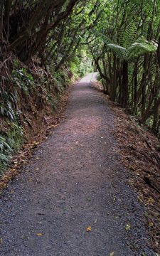
The opening section of the Orongorongo Track is relatively straight, with a surface of compacted stones that provides firm...
Remutaka Range photos
About
About the Remutaka Range
Photos of the Remutaka Range in the Wellington region
The Remutaka Range comprises the southern part of the largest chain of mountains on New Zealand’s North Island. This chain of mountains runs from the Gisborne Region to the south coast in the Wellington Region. Additionally, it forms the boundary between Wellington and the Wairarapa.
Turakirae Head, located on the southern coast of the North Island, marks the extreme southern end of the range, while the northern boundary is marked by the Remutaka Hill Road. The Tararua Range lies beyond the latter boundary.
The western side of the range is lush due to the moist air rising and producing precipitation, while the eastern side is warmer and drier, making it suitable for the thriving wine industry on the plains below.
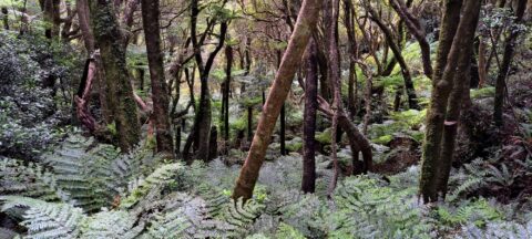
The range is home to temperate beech and rainforests, as well as alpine vegetation at higher altitudes. There are numerous bush trails that showcase the diverse flora and are accompanied by rivers such as the Orongorongo River and Wainuiomata River.
Although the Remutaka Range is not well-known to international tourists, locals consider it a destination for bushwalking and to escape from the hustle and bustle of the city. Hunting is allowed in the bush, with the exception of the Remutaka Forest Park located in the Lower Hutt suburb of Wainuiomata.
For more photos of the Remutaka (Rimutaka) Range, visit Virtual New Zealand.
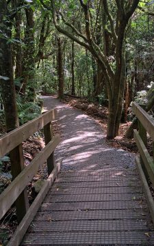
View of the Orongorongo Track and one of many foot bridges that allow you to cross smaller streams within...
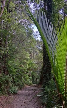
View of the Orongorongo Track in the Remutaka Forest Park. The fern to the right is a Nikau Palm...
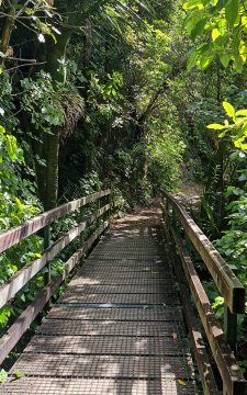
There are numerous bridges on the Orongorongo Track that traverse small streams that run down hills and empty into...

View of Clay Ridge as seen from the Five Mile Loop Track in Remutaka Forest Park, Wainuiomata, with the...
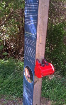
These types of information signs at the beginning of the Orongorongo Track focus on a particular native bird species....
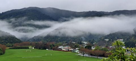
Low hanging clouds in Wainuiomata are trapped by the Remutaka Range with Richard Prouse Park in the foreground.
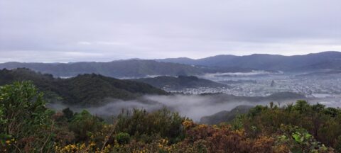
Mist over the Wainuiomata Basin and surrounding hills. Photo taken from the western hills between Wainuiomata and the rest...
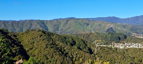
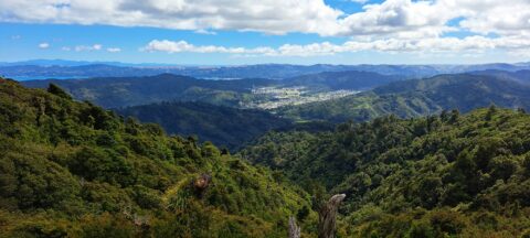
Gazing at the hills of Wainuiomata, with the Remutaka Range serving as a scenic backdrop. Wainuiomata is divided from...
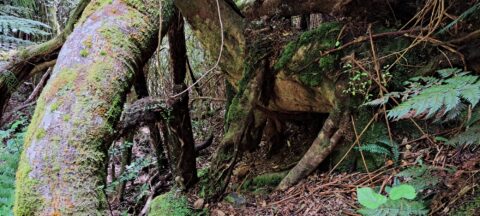
These trees moved down a steep hillside due to a slip or small landslide. The trees appear to have...
Lush forest covers the hills around Skerretts Creek in Wainuiomata. The slopes here are part of the Remutaka Mountains...
View of Wainuiomata from the Remutaka Range located in the southern North Island. Also in view are the western...

Recent Comments