
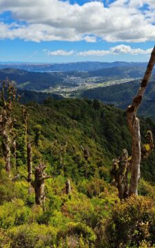
Looking down on Wainuiomata Valley from atop the Remutaka Range near Mt McKerrow in the southern North Island. Wellington...
New Zealand Photos
About Places Share
About
Our photos of New Zealand include both the North and South islands. Subjects are as varied as cities like Auckland, Wellington, and Christchurch. We also have photos of towns, mountains, coastline, rivers, geological features, plant life, animals, people, sport, and Maori culture. Our images date back to the 1960s and span decades to the present day.
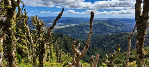
View from the top of Whakanui Track along a ridgeline, before it connects to the McKerrow Track. Wainuiomata can...
From the peaks of Wainuiomata Regional Park the views are astounding. You can see Wellington Harbour and the city.
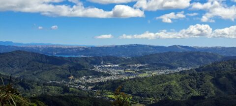
This bird’s-eye perspective of Wainuiomata illustrates how the suburb resides within its unique valley, distinct from the broader Hutt...
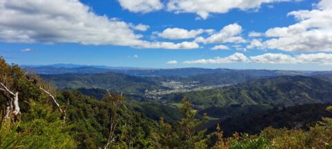
Although Wainuiomata is considered a suburb of Lower Hutt, it is nestled within its own secluded valley distinct from...
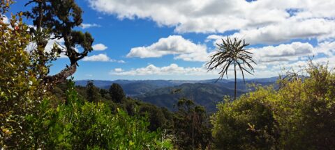
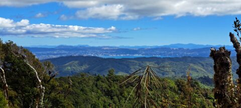
Observing the hills leading towards Wainuiomata from the summit of a ridge in the Remutaka Range, precisely along the...
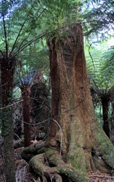
View of a giant tree in Wainuiomata in an area that was never logged. While the most of the...
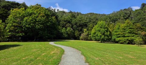
This path offers several small tracks that take you through the bush and up to the ridgeline, where you...
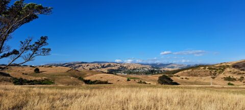
Looking at a parched landscape in Whitireia Park in Autumn just after a dry summer. Whitireia Park is located...
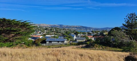
Photo taken in Whitireia Park, looking at the Porirua suburb of Titahi Bay. Porirua city center is just visible...
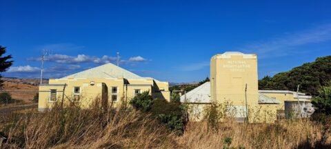
The Titahi Bay Transmitter Station was associated with towers that were used by some radio stations including Radio New...
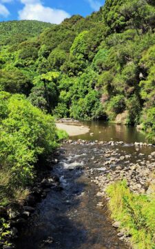
Top Pool in Wainuiomata is a natural swimming area in Wainuiomata River. It is located on the Gums Loop...

Recent Comments