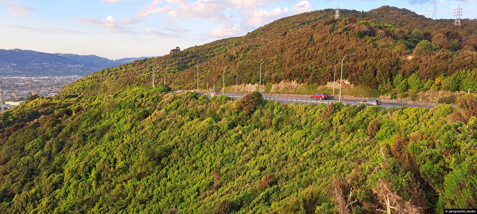
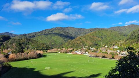
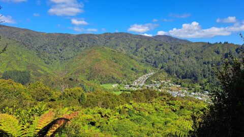
Wainuiomata Road is the sole public road leading into Wainuiomata, winding over the Eastern Hutt Hills into the Wainuiomata Valley. At its widest, the road expands to five lanes, narrowing to two lanes as it descends onto the valley floor within Wainuiomata.
Wainuiomata Road
Page Views
This post has been viewed 203 times
Related Articles
-
Waterworks Wetland
Wainuiomata photos, Extra Wide Horizontal, Forests, Wetlands
The Wainuiomata Waterworks Wetlands are part of the Wainuiomata Regional Park, which encompasses lowland native forests and adjoins the...
-
Wainuiomata Lower Dam
Wainuiomata photos, Extra Wide Horizontal, Forests, Wetlands
View of the decommissioned Wainuiomata Lower Dam (named Morton Dam). This dam once supplied water to Wellington along with...
-
Sledge Track Creek
Wainuiomata photos, Cities, Harbors, Landscape / Horizontal, Mountains, Night
The Sledge Track Creek in Wainuiomata offers a scenic view, winding through dense native bush with an old forestry...
-
Hine Road Recreation Area
Wainuiomata photos, Extra Wide Horizontal, Parks
Hine Road Recreation Area, formerly referred to as The Meadow by some, it comprised paddocks hosting grazing horses during...
-
Wainuiomata Waterworks Museum History
Wainuiomata photos, Extra Wide Horizontal, Museums
The walls tell stories of the history of the Wainuiomata waterworks. The waterworks has two dams, one decommissioned and...
-
View from The Rock in Wainuiomata
Wainuiomata photos, Extra Wide Horizontal, Mountains, Parks, Rivers
A view overlooking Richard Prouse Park and the surrounding hills from The Rock on Moores Valley Road. Once a...
-
Nikau Creek in Wainuiomata
Wainuiomata photos, Portrait / Vertical, Rivers
Looking at Nikau Creek in Wainuiomata Regional Park. The creek can be seen from a short scenic walk called...
-
Underground Shaft in Wainuiomata
Wainuiomata photos, Extra Wide Horizontal, Tunnels
This underground shaft in Wainuiomata was originally constructed in the 1880s. It was abandoned 1899 and is now completely...
0 Comments
Calendar
M | T | W | T | F | S | S |
---|---|---|---|---|---|---|
1 | ||||||
2 | 3 | 4 | 5 | 6 | 7 | 8 |
9 | 10 | 11 | 12 | 13 | 14 | 15 |
16 | 17 | 18 | 19 | 20 | 21 | 22 |
23 | 24 | 25 | 26 | 27 | 28 | 29 |
30 |
Popular Posts
- Awakening New Zealand video (100)
- Iguazu Falls as seen from Brazil (87)
- Metrocable Medellin (78)
- Pauatahanui Inlet (69)
- Spinnaker Hill in Whitby Porirua (68)
- Spinnaker Hill View (68)
- View from Whitby (68)
- The Devil’s Throat (62)
- Aerial View of Iguazu Falls (61)
- Porirua Harbour & Papakowhai (57)
- Lake Wakatipu (57)
- Salto Rivadavia & Iguassu River (56)
- Lake Tekapo & Lupins (54)
- Nelson View (53)
- Salto Rivadavia Misiones Province (53)
- Cascadas at Iguazu (53)
Subjects
AccommodationAnimalsArchitectureBeachesBirdsBoatsBridgesBuildingsCarsChurchesCitiesCoralCultureExtra Wide HorizontalFlowersForestsHarborsHomesIslandsLakesLandscape / HorizontalMapsMenMonumentsMountainsPalmsParksPeoplePlantsPortrait / VerticalRiversRoadsRuralSeaShopsSkyscrapersSnowSunsetsTownsTrailsTransportTreesVideosVolcanicWaterfalls
Recent Comments
- Lance on Concrete Hut Wainuiomata
- Tony on Concrete Hut Wainuiomata
- DavidJ on Wellington Night Skyline
- Ben on Auckland City Skyline from Westhaven Marina in 1998
- Ben on Auckland Harbour Bridge view