
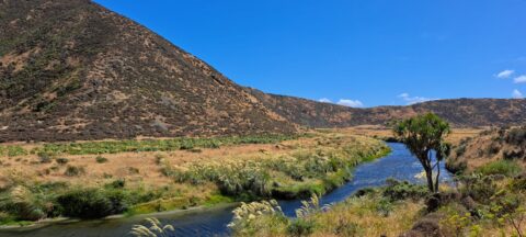
Looking down at the Wainuiomata River from the Coast Road. The river starts in a podocarp rainforest, then flows...
Wainuiomata photos
About
About Wainuiomata
Photos of Wainuiomata including the town and surrounding landscapes, including Wainuiomata Regional Park and Remutaka Forest Park.
Wainuiomata is a suburb of Lower Hutt in the Wellington Region. It’s big and isolated enough to be considered a town in its own right, but it is administered by the Hutt Regional Council.
Wainuiomata has interesting topography. It sits in a plateau surrounded by hills on three sides which protect the suburb from Wellington’s famous wind. This results in slightly cooler temperatures in winter and warmer temperatures during summer compared with most other places in the Wellington region and Hutt Valley.
The CBD is located around Queens Street with a large Countdown Mall located behind. The suburbs flow into three main valleys with the southern most valley affording access to the South Coast via the Coast Road.
Eastward is The Village, a small area with some shops. Continuing east, one will find the Wainuiomata Recreational Area which has a dam and was once the main water source for the Wellington region. With one dam still in use today, the area is now a natural wetlands surrounded by forested hills. Within the park are a number of scenic bush walks and some swimming holes in the Wainuiomata river. There is also a museum near the old dam with some old machinery and artefacts on display. This reserve is located within the Remutaka range, a mountain chain that reaches to the south coast of the North Island.
For older photos of Wainuiomata, see Virtual New Zealand.
For a more extensive collection of photos of Wainuiomata, visit Wainuiomata.Net
Geographic.Media recommends this tour of the Wainuiomata wilderness →
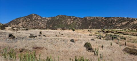
Gazing upon parched farmland during the summer months, situated along the Coast Road in Wainuiomata, New Zealand.
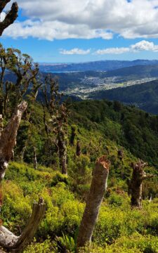
View of the Wainuiomata Valley as seen from the Remutaka Range, the last mountain range in the North Island.
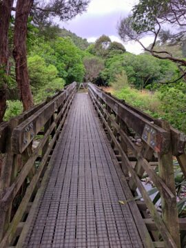
The construction of Hine Road Recreation Reserve Bridge dates back to 1989. It provides passage to Top Pool Bridge,...
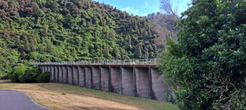
Looking at Morton Dam in the year 2024, after being decommissioned some 36 years before. It once supplied the...
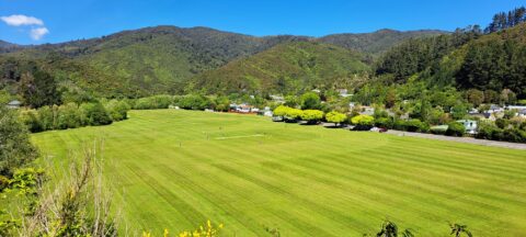
Summer at Richard Prouse Park in Wainuiomata. The park is used for the game of cricket during the summer...
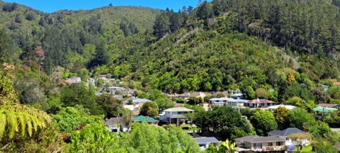
View of Sunny Grove in Wainuiomata. While the street looks sunny in the photo, it is mostly quite shady...
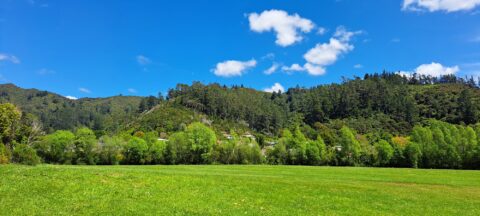
Looking at Wainuiomata River within Wainuiomata Regional Park. Also in view is the Remutaka mountain range.
A sunny day at Richard Prouse Park in Wainuiomata looking toward Hine Road and Sunny Grove. The hills are...
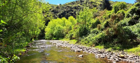
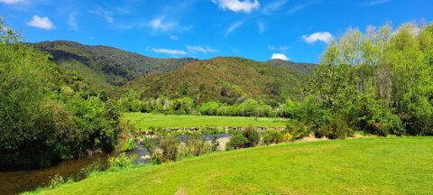
View of Wainuiomata River on the edge of Richard Prouse Park. This part of the river has a few...
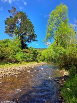
The section of the Wainuiomata River meanders along the edge of Richard Prouse Park, offering several nearby swimming spots.
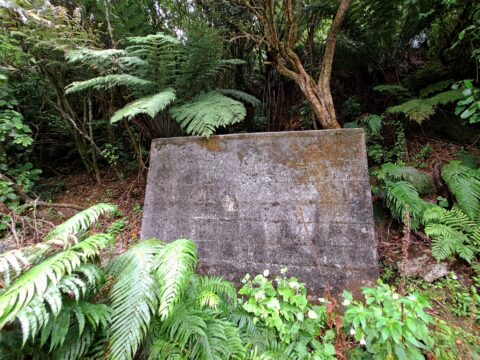
Old pumping station which has been inundated by native forest growth. The station housed a water flow meter system...

Recent Comments