
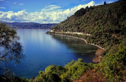
Partial view of Lake Taupo as seen from the road. Lake Taupo hides the crater of Earth’s most destructive...
New Zealand Photos
About Places Share
About
Our photos of New Zealand include both the North and South islands. Subjects are as varied as cities like Auckland, Wellington, and Christchurch. We also have photos of towns, mountains, coastline, rivers, geological features, plant life, animals, people, sport, and Maori culture. Our images date back to the 1960s and span decades to the present day.
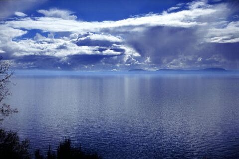
A cold front approaching Lake Taupo in New Zealand. This is the biggest lake in the country. It actually...
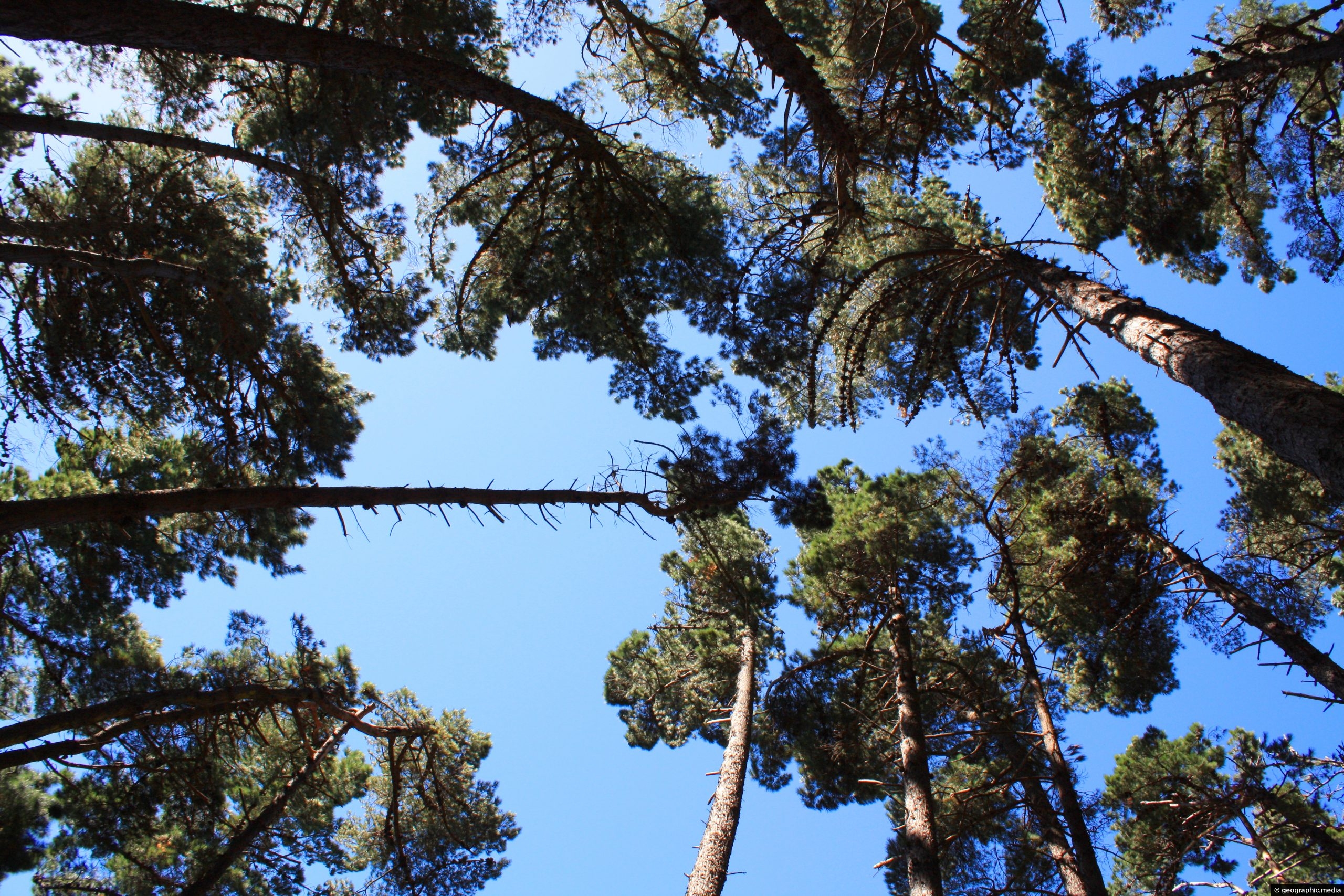
Looking up at the canopy of a pinus radiata forest on the coast of Wellington Harbour. Pinus radiata is...
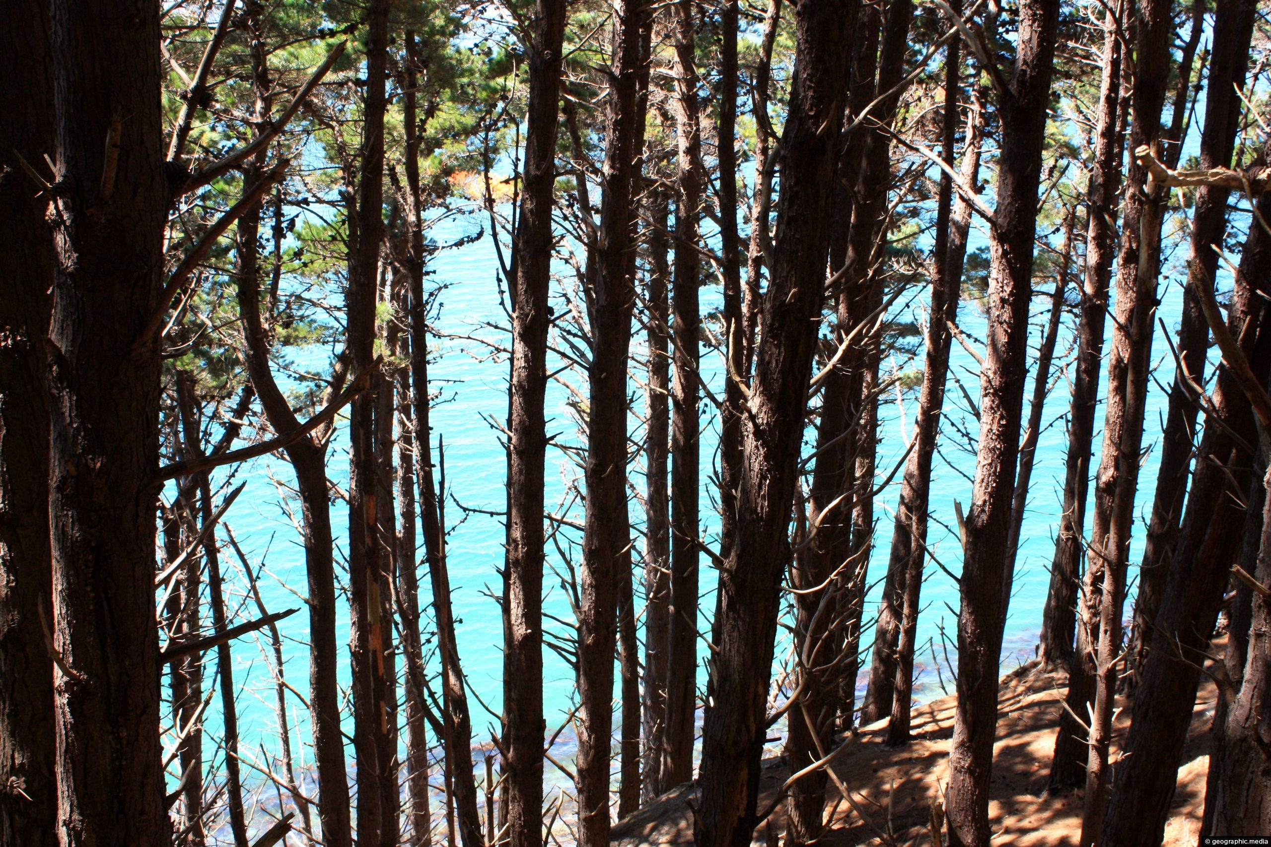
Monterey Pine forest on the slopes around Wellington Harbour. The Monterey Pine (Pinus Radiata) is a pine tree native...
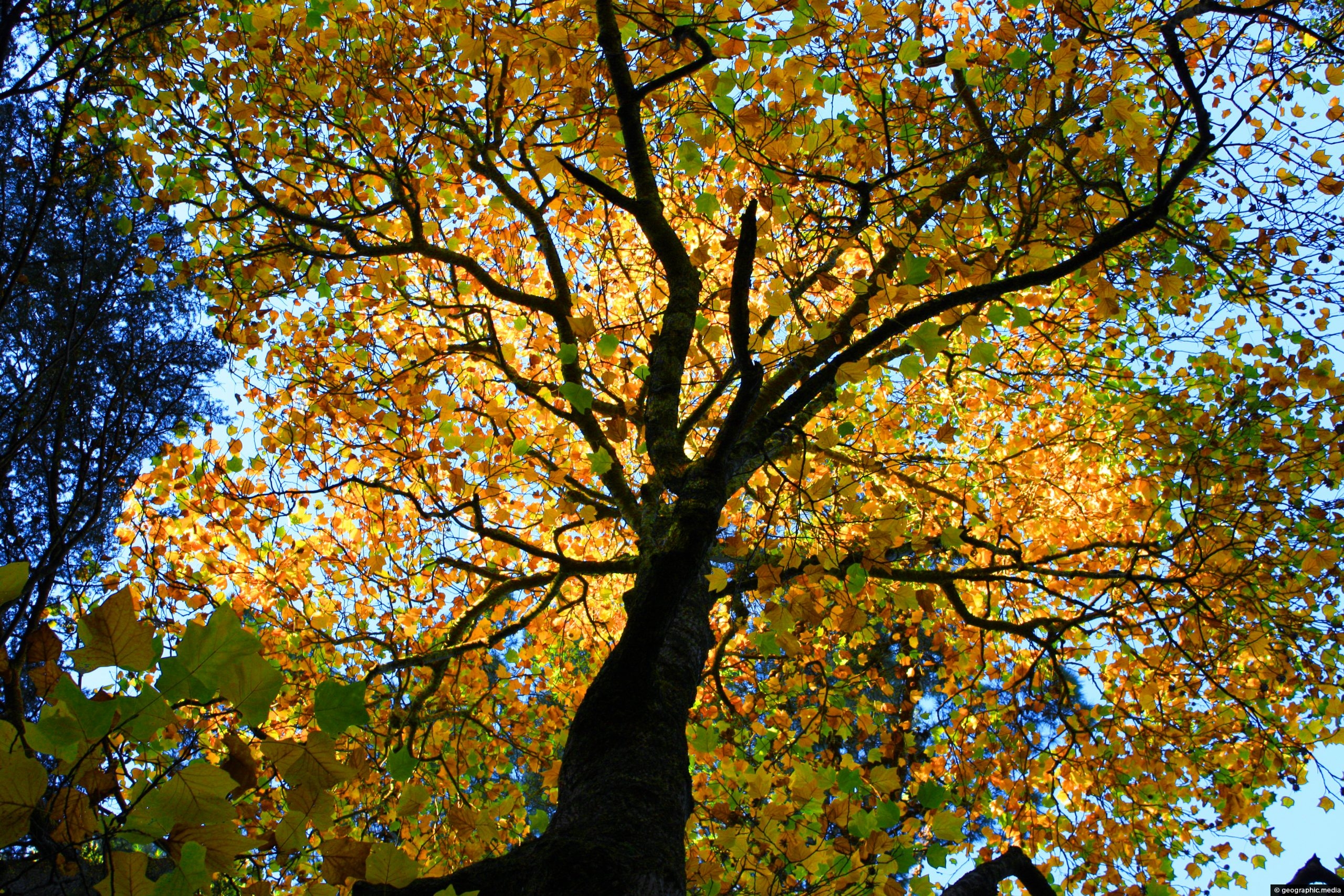
Green leaves of the American Tulip Tree slowly turning to gold. Each fall these trees put on quite a...
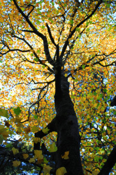
An exotic American Tulip tree in the Wellington Botanical Gardens. The American Tulip is the the tallest hardwood in...

View of a walking bridge over the Hutt River in Kaitoke Regional Park. This bridge forms part of a...
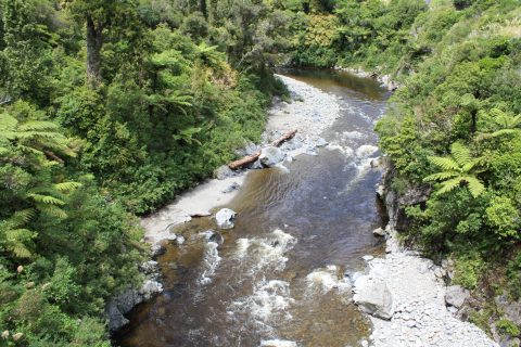
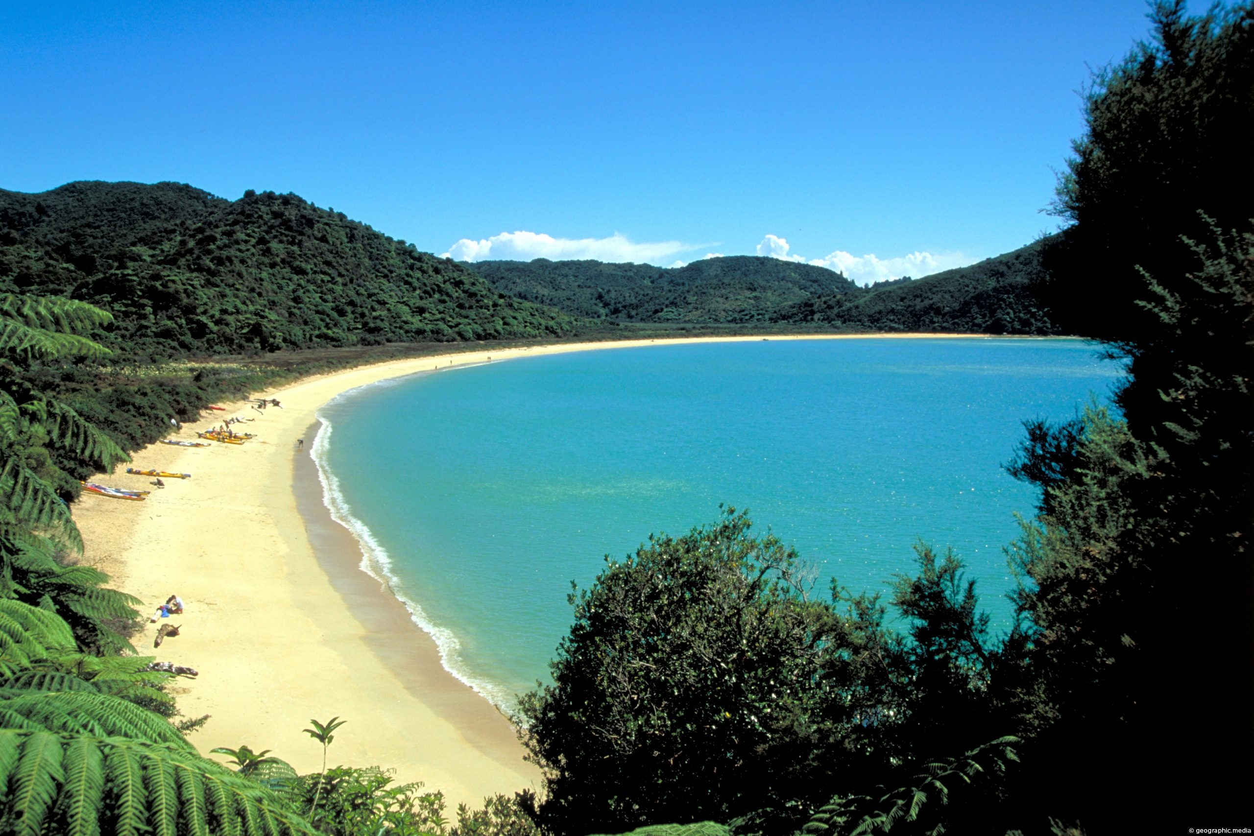
View of the upper reaches of the Hutt River inside Kaitoke Regional Park. The river has a number of...
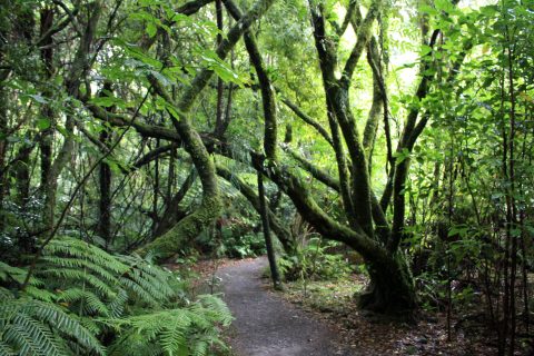
View of a circuit walk through a Podocarp rainforest in Kaitoke Regional Park. Podocarp trees are found in the...
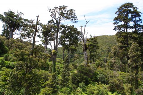
Mature rimu & kahikatea pierce the canopy of a podocarp rain forest within Kaitoke Regional Park. The park is...
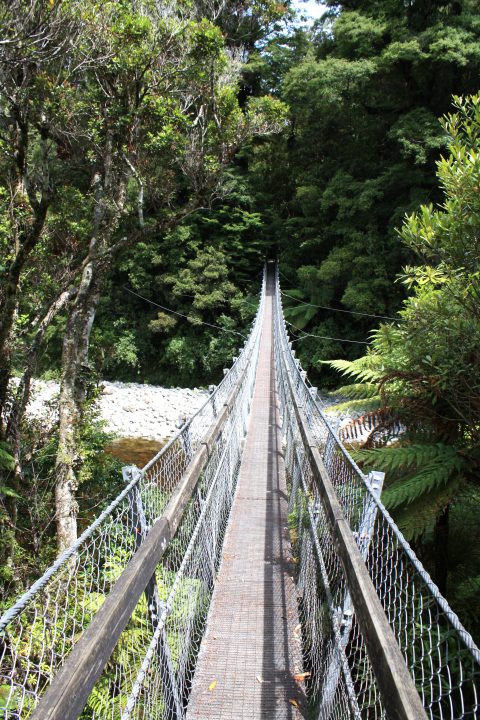
View of the swing bridge at the Rivendell carpark in Kaitoke Regional Park near Upper Hutt. The bridge takes...

Recent Comments