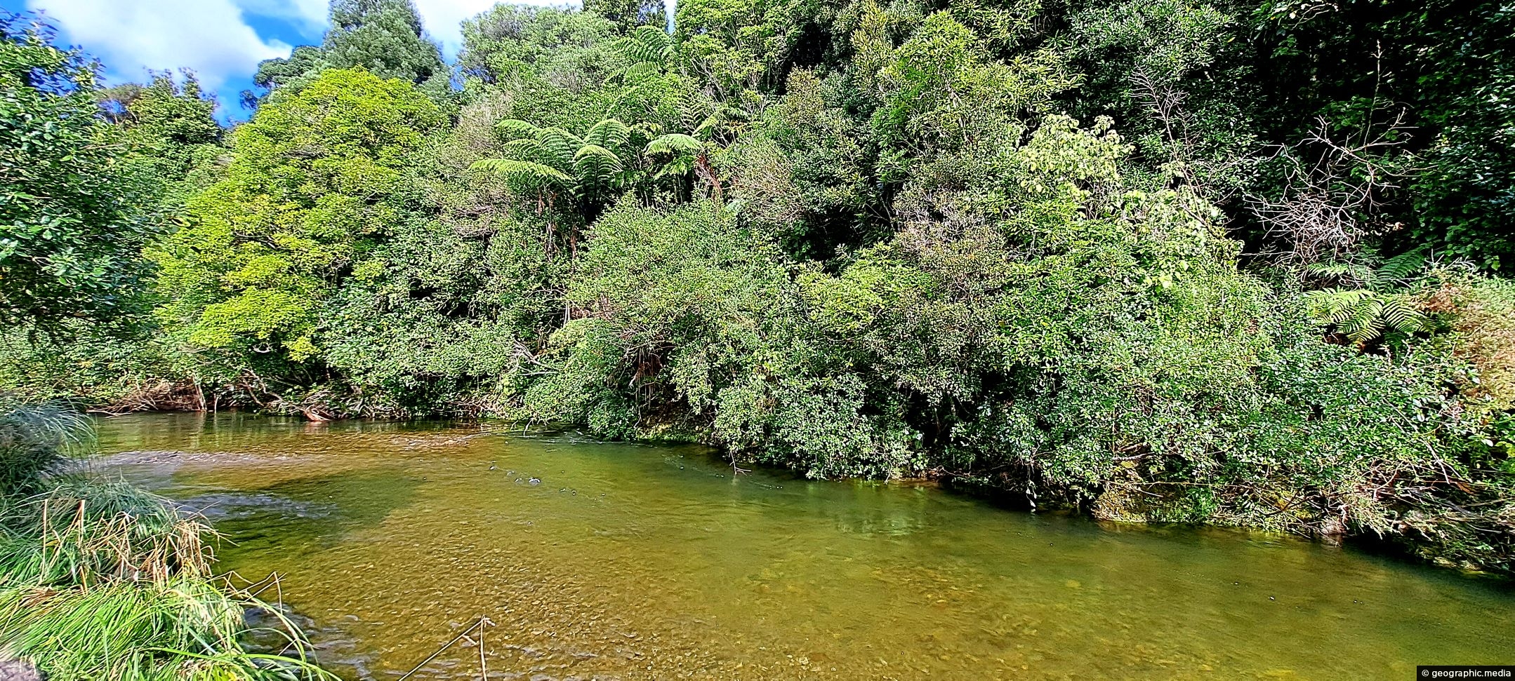
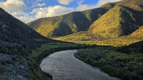
Looking at the upper reaches of the Wainuiomata River at the foothills of the Remutaka range. Access to here was difficult due to no tracks and having to traverse a large swampy field of Toetoe.
ALL / Explore Oceania / Explore New Zealand / New Zealand Photos / Wainuiomata photos / Upper Reaches of the Wainuiomata River
All original royalty-free photos, shareable maps, and informative articles.
Upper Reaches of the Wainuiomata River
Page Views
This post has been viewed 359 times
Related Articles
-
Wainuiomata Historical Museum
Wainuiomata photos, Extra Wide Horizontal, Mountains, Parks
Looking at one of the rooms in the Wainuiomata Museum that displays artefacts from the past as well as...
-
Richard Prouse Park Eastern View
Wainuiomata photos, Extra Wide Horizontal, Parks
Looking at the eastern side of Richard Prouse Park from high up a nearby hillside. Houses on Hine Road...
-
Sledge Track and Kiwi Sign
Wainuiomata photos, Forests, Portrait / Vertical, Trails
Sledge Track Creek in Wainuiomata is a habitat for kiwi, New Zealand’s national bird. These flightless and endangered birds...
-
Ravine Near Sledge Track Creek
Wainuiomata photos, Ferns, Forests, Portrait / Vertical
A ravine close to Sledge Creek Track in Reservoir Valley in Wainuiomata. The area is covered in podocarp rainforest...
-
View of Wainuiomata from the Remutaka
Wainuiomata photos, Mountains, Portrait / Vertical, Trees
Looking down on Wainuiomata Valley from atop the Remutaka Range near Mt McKerrow in the southern North Island. Wellington...
-
Harry Todd Recreation Area
Wainuiomata photos, Extra Wide Horizontal, fog, Mountains, Parks
Looking the Harry Todd Recreation Area in Wainuiomata, with towering hills and mountains trapping clouds within the valleys.
-
Queen Street Reserve in Fall
Wainuiomata photos, Autumn, Portrait / Vertical, Trees
Observing Queen Street Reserve in the fall, you’ll find a charming oasis nestled in the heart of the Wainuiomata...
-
Wainuiomata Wetlands
Wainuiomata photos, Extra Wide Horizontal, Forests, Wetlands
Wetlands in Wainuiomata within Wainuiomata Regional Park. The wetlands was once a dam that supplied water to Wellington. It...
0 Comments
Popular Posts
- Awakening New Zealand video (100)
- Iguazu Falls as seen from Brazil (87)
- Metrocable Medellin (78)
- Pauatahanui Inlet (68)
- View from Whitby (68)
- Spinnaker Hill View (68)
- Spinnaker Hill in Whitby Porirua (68)
- The Devil’s Throat (62)
- Aerial View of Iguazu Falls (61)
- Lake Wakatipu (57)
- Porirua Harbour & Papakowhai (57)
- Salto Rivadavia & Iguassu River (56)
- Lake Tekapo & Lupins (54)
- Nelson View (53)
- Cascadas at Iguazu (53)
- Close up of Salto Rivadavia (53)
Subjects
AccommodationAnimalsArchitectureBeachesBirdsBoatsBridgesBuildingsCarsChurchesCitiesCoralCultureExtra Wide HorizontalFlowersForestsHarborsHomesIslandsLakesLandscape / HorizontalMapsMenMonumentsMountainsPalmsParksPeoplePlantsPortrait / VerticalRiversRoadsRuralSeaShopsSkyscrapersSnowSunsetsTownsTrailsTransportTreesVideosVolcanicWaterfalls
Recent Comments
- Lance on Concrete Hut Wainuiomata
- DavidJ on Concrete Hut Wainuiomata
- Tony on Concrete Hut Wainuiomata
- DavidJ on Wellington Night Skyline
- Ben on Auckland City Skyline from Westhaven Marina in 1998