
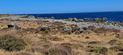
A view of the rugged coastline and native vegetation on the southern North Island, specifically in Wainuiomata. This section...
Wainuiomata photos
About
About Wainuiomata
Photos of Wainuiomata including the town and surrounding landscapes, including Wainuiomata Regional Park and Remutaka Forest Park.
Wainuiomata is a suburb of Lower Hutt in the Wellington Region. It’s big and isolated enough to be considered a town in its own right, but it is administered by the Hutt Regional Council.
Wainuiomata has interesting topography. It sits in a plateau surrounded by hills on three sides which protect the suburb from Wellington’s famous wind. This results in slightly cooler temperatures in winter and warmer temperatures during summer compared with most other places in the Wellington region and Hutt Valley.
The CBD is located around Queens Street with a large Countdown Mall located behind. The suburbs flow into three main valleys with the southern most valley affording access to the South Coast via the Coast Road.
Eastward is The Village, a small area with some shops. Continuing east, one will find the Wainuiomata Recreational Area which has a dam and was once the main water source for the Wellington region. With one dam still in use today, the area is now a natural wetlands surrounded by forested hills. Within the park are a number of scenic bush walks and some swimming holes in the Wainuiomata river. There is also a museum near the old dam with some old machinery and artefacts on display. This reserve is located within the Remutaka range, a mountain chain that reaches to the south coast of the North Island.
For older photos of Wainuiomata, see Virtual New Zealand.
For a more extensive collection of photos of Wainuiomata, visit Wainuiomata.Net
Geographic.Media recommends this tour of the Wainuiomata wilderness →
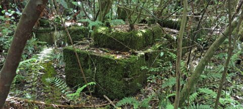
These remnants are believed to be part of a power generator that was used during the construction of the...
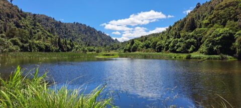
The Wainuiomata Waterworks Wetlands are part of the Wainuiomata Regional Park, which encompasses lowland native forests and adjoins the...
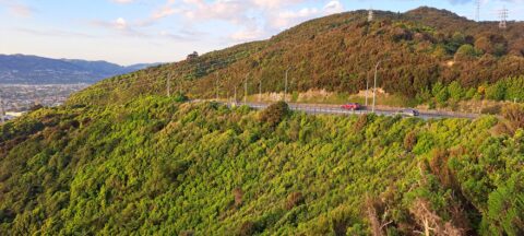
Wainuiomata Road is the sole public road leading into Wainuiomata, winding over the Eastern Hutt Hills into the Wainuiomata...

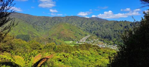
View of Wainuiomata as seen from the lookout at the top of Wainuiomata Hill. A car park at the...
High up on a ridge in Wainuiomata Scenic Reserve, you can get a great view of Sunny Grove, Hine...
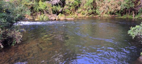
View of Sledge Track Pool in Wainuiomata. This pool is found further upstream than other good swimming holes located...
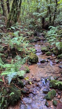
There are numerous unnamed creeks and streams in Wainuiomata Regional Park that feed into the Wainuiomata River including this...
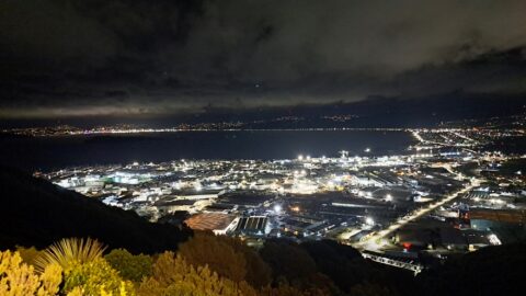
Looking at Seaview and Wellington Harbour as seen from the Wainuiomata Lookout at the top of Wainuiomata Road.
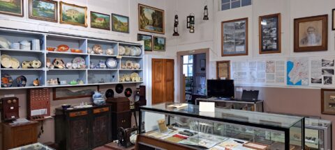
Looking at one of the rooms in the Wainuiomata Museum that displays artefacts from the past as well as...
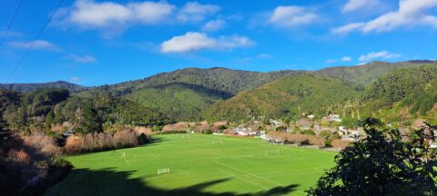
View of Richard Prouse Park as seen from Moores Valley Road. The hills in the background are part of...
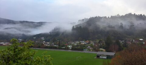
Looking at Richard Prouse Park in Wainuiomata with a misty Harry Todd Reserve in the background hills behind Hine...

Recent Comments