
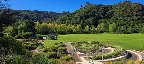
The Wainuiomata Garden of Remembrance is a modern memorial cemetery located at the end of Hine Road in Wainuiomata,...
Wainuiomata photos
About
About Wainuiomata
Photos of Wainuiomata including the town and surrounding landscapes, including Wainuiomata Regional Park and Remutaka Forest Park.
Wainuiomata is a suburb of Lower Hutt in the Wellington Region. It’s big and isolated enough to be considered a town in its own right, but it is administered by the Hutt Regional Council.
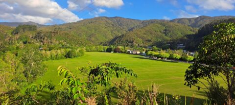
Wainuiomata has interesting topography. It sits in a plateau surrounded by hills on three sides which protect the suburb from Wellington’s famous wind. This results in slightly cooler temperatures in winter and warmer temperatures during summer compared with most other places in the Wellington region and Hutt Valley.
The CBD is located around Queens Street with a large Countdown Mall located behind. The suburbs flow into three main valleys with the southern most valley affording access to the South Coast via the Coast Road.
Eastward is The Village, a small area with some shops. Continuing east, one will find the Wainuiomata Recreational Area which has a dam and was once the main water source for the Wellington region. With one dam still in use today, the area is now a natural wetlands surrounded by forested hills. Within the park are a number of scenic bush walks and some swimming holes in the Wainuiomata river. There is also a museum near the old dam with some old machinery and artefacts on display. This reserve is located within the Remutaka range, a mountain chain that reaches to the south coast of the North Island.
For older photos of Wainuiomata, see Virtual New Zealand.
For a more extensive collection of photos of Wainuiomata, visit Wainuiomata.Net
Geographic.Media recommends this tour of the Wainuiomata wilderness →
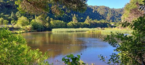
The Lower Dam Wetland is the shallow wetland area formed behind the historic Lower Dam in Wainuiomata Regional Park....
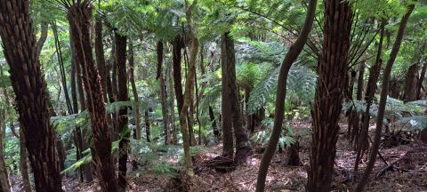
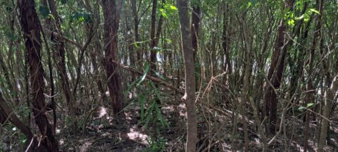
Fern trees are widespread throughout New Zealand forests and typically thrive in shaded areas with consistent rainfall.
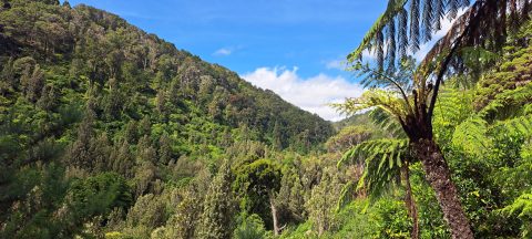
Looking into Catchpool Valley from the Orongorongo Track in Wainuiomata, where the route passes through the valley.
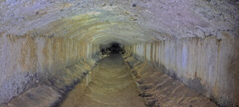
The Concrete Race, also known as the Water Race, is a buried tunnel that once carried clean river water...
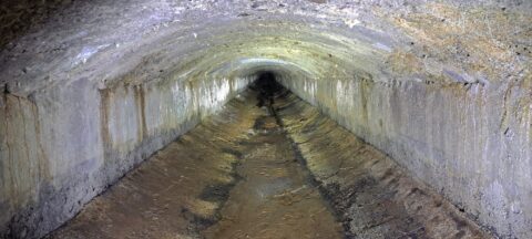
The Wainuiomata water race is a two kilometre long concrete tunnel / closed race built in the early 1880s...
Standing at the lookout on The Rock, you get a wide view across Richard Prouse Park and the surrounding...
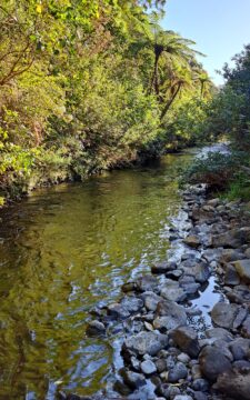
Looking at a section of the upper Wainuiomata River flowing along the base of the southern hillside in Reservoir...
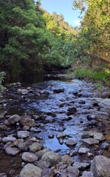
View of the Wainuiomata River in Reservoir Valley, downstream from the weirs that divert water for Wellington’s supply.
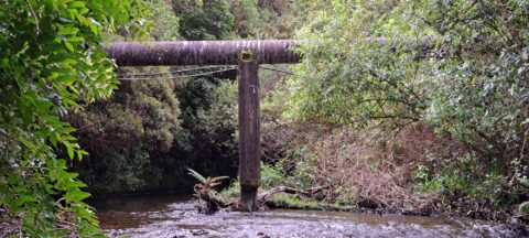
The O-K Main in Wainuiomata, also known as the Orongorongo Pipeline, carried water from the Orongorongo Catchment to Karori,...
Solomon’s Knob is a small hill in the Wainuiomata water catchment, reshaped in the early 1900s during the building...

Looking down on farmland in the Coast Road area of Wainuiomata. Coast Road flows southwards from suburban streets into...

Recent Comments