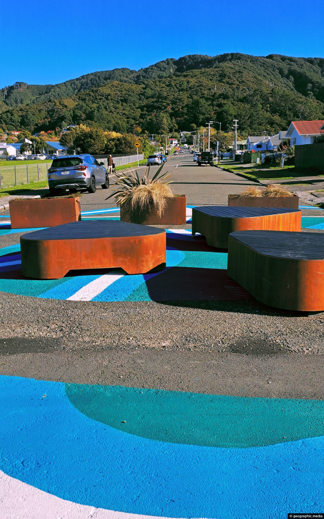
View of Rata Street in Wainuiomata looking south. This seating area is close to a public walkway that takes you to The Strand, the commercial center of the suburb.
ALL / Explore Oceania / Explore New Zealand / New Zealand Photos / Wainuiomata photos / Rata Street in Wainuiomata
All original royalty-free photos, shareable maps, and informative articles.
Rata Street in Wainuiomata
Page Views
This post has been viewed 299 times
Related Articles
-
View of Wellington from Wainuiomata Regional Park
Wainuiomata photos, Cities, Extra Wide Horizontal, Forests, Harbors, Mountains
From the peaks of Wainuiomata Regional Park the views are astounding. You can see Wellington Harbour and the city.
-
Pukeatua Bridge Wainuiomata
Wainuiomata photos, Bridges, Portrait / Vertical
Pukeatua Bridge in Wainuiomata crosses Wainuiomata Road at its highest point, 189 meters above sea level. This places the...
-
Wainuiomata Valley from the Remutaka
Wainuiomata photos, Forests, Portrait / Vertical, Trees
View of the Wainuiomata Valley as seen from the Remutaka Range, the last mountain range in the North Island.
-
Nikau Creek Valley & Mist
Wainuiomata photos, Extra Wide Horizontal, fog, Forests, Mountains, Parks
A misty day at Nikau Creek Valley in Wainuiomata Regional Park offers a striking view. During winter, Wainuiomata occasionally...
-
Hine Road Recreation Area
Wainuiomata photos, Extra Wide Horizontal, Parks
Hine Road Recreation Area, formerly referred to as The Meadow by some, it comprised paddocks hosting grazing horses during...
-
Nikau Creek Valley
Wainuiomata photos, Extra Wide Horizontal, Forests, Mountains
The sight from the summit of the western slope arm overlooks Nikau Creek Valley. On the opposing slope lies...
-
Wainuiomata River and Regional Park
Wainuiomata photos, Extra Wide Horizontal, Mountains, Rivers
Looking at Wainuiomata River within Wainuiomata Regional Park. Also in view is the Remutaka mountain range.
-
Wetlands in Wainuiomata
Wainuiomata photos, Extra Wide Horizontal, Forests, Wetlands
The suburb of Wainuiomata was largely comprised of swamp. in 1855 a massive 8.2 earthquake raised much land above...
0 Comments
Popular Posts
- Awakening New Zealand video (100)
- Iguazu Falls as seen from Brazil (87)
- Metrocable Medellin (78)
- Pauatahanui Inlet (69)
- Spinnaker Hill View (68)
- Spinnaker Hill in Whitby Porirua (68)
- View from Whitby (68)
- The Devil’s Throat (62)
- Aerial View of Iguazu Falls (61)
- Porirua Harbour & Papakowhai (57)
- Lake Wakatipu (57)
- Salto Rivadavia & Iguassu River (56)
- Lake Tekapo & Lupins (54)
- Nelson View (53)
- Salto Rivadavia Misiones Province (53)
- Cascadas at Iguazu (53)
Subjects
AccommodationAnimalsArchitectureBeachesBirdsBoatsBridgesBuildingsCarsChurchesCitiesCoralCultureExtra Wide HorizontalFlowersForestsHarborsHomesIslandsLakesLandscape / HorizontalMapsMenMonumentsMountainsPalmsParksPeoplePlantsPortrait / VerticalRiversRoadsRuralSeaShopsSkyscrapersSnowSunsetsTownsTrailsTransportTreesVideosVolcanicWaterfalls
Recent Comments
- Lance on Concrete Hut Wainuiomata
- Tony on Concrete Hut Wainuiomata
- DavidJ on Wellington Night Skyline
- Ben on Auckland City Skyline from Westhaven Marina in 1998
- Ben on Auckland Harbour Bridge view