
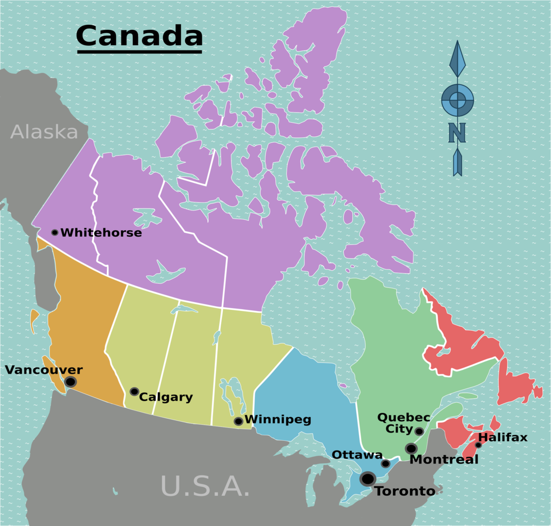
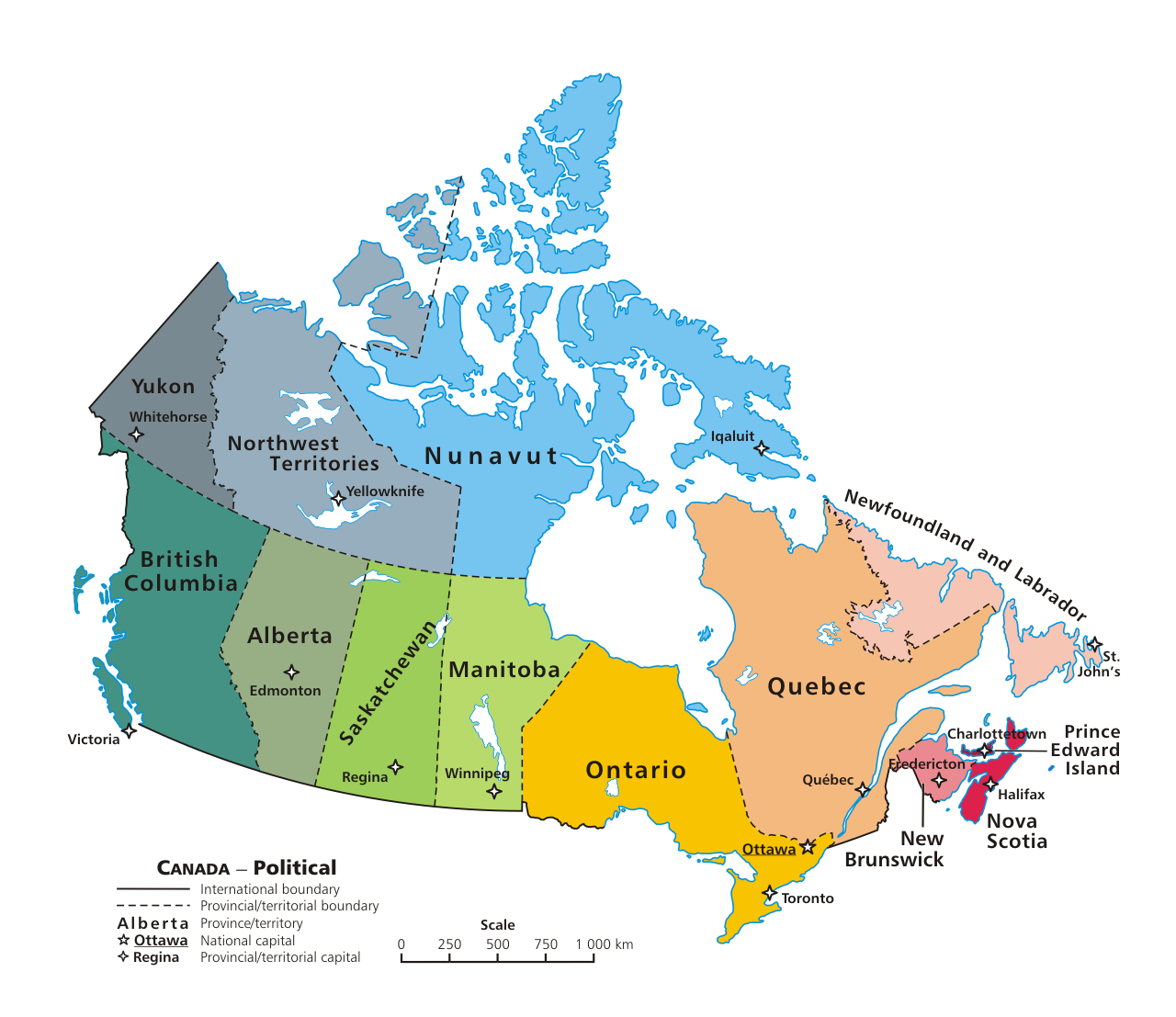
Canada is divided into six regions, each containing one or more provinces or territories. This map also shows major cities. Regions are distinct from each other and are a useful way to view Canada, especially if you plan of travelling there.
Regions & associated provinces & territories include:
- Pacific: British Columbia.
- Prairies: Alberta, Manitoba, Saskatchewan.
- Ontario: Ontario.
- Quebec: Quebec
- Atlantic: New Brunswick, Newfoundland and Labrador, Nova Scotia, Prince Edward Island.
- The North: Northwest Territories, Nunavut, Yukon.
