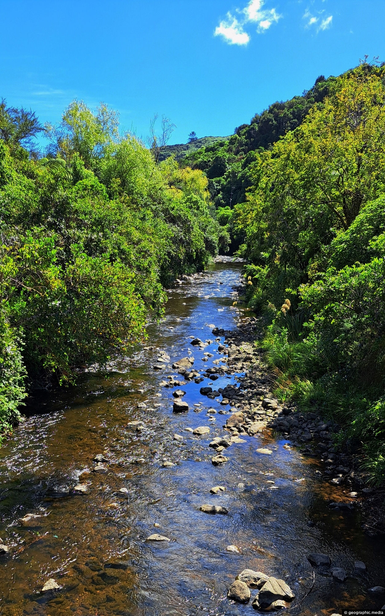
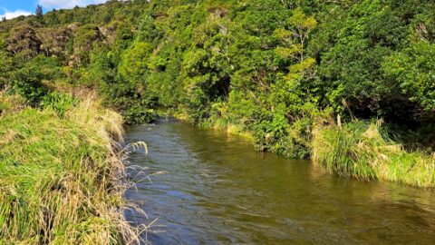
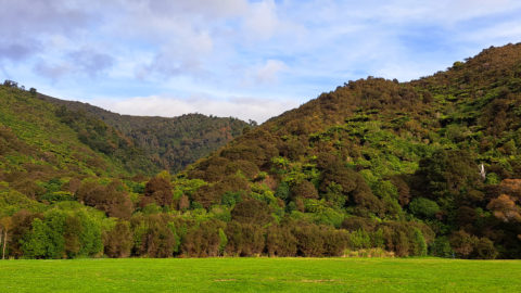
Wainuiomata River as it passes through Hine Road Recreation Area in Wainuiomata. This is an important recreational asset as well as a water source.
ALL / Explore Oceania / Explore New Zealand / New Zealand Photos / Wainuiomata photos / Wainuiomata River at Hine Road
All original royalty-free photos, shareable maps, and informative articles.
Wainuiomata River at Hine Road
Page Views
This post has been viewed 303 times
Related Articles
-
Wainuiomata Valley
Wainuiomata photos, Cities, Extra Wide Horizontal, Mountains
Although Wainuiomata is considered a suburb of Lower Hutt, it is nestled within its own secluded valley distinct from...
-
Underground Shaft in Wainuiomata
Wainuiomata photos, Extra Wide Horizontal, Tunnels
This underground shaft in Wainuiomata was originally constructed in the 1880s. It was abandoned 1899 and is now completely...
-
Autumn Colors & Wainuiomata River
Wainuiomata photos, Portrait / Vertical, Rivers, Trees
Autumn colors at Wainuiomata River, viewed from Main Road Bridge. The river, the principal waterway of Wainuiomata, flows through...
-
Wainuiomata Recreational Area Wetlands
Wainuiomata photos, Extra Wide Horizontal, Forests, Wetlands
The decommissioned Wainuiomata Lower Dam which once supplied water to Wellington is now a natural wetland.
-
Turakirae Head Scientific Reserve
Wainuiomata photos, Beaches, Extra Wide Horizontal
Turakirae Head Scientific Reserve located on the southern coast of Wainuiomata in New Zealand, is renowned for its geological...
-
Ōrongorongo Station
Wainuiomata photos, Extra Wide Horizontal, Mountains, Rural
Ōrongorongo Station is a large and historic rural property located near the southern end of Coast Road in Wainuiomata,...
-
Upstream Wainuiomata River
Wainuiomata photos, Portrait / Vertical, Rivers
The view of Wainuiomata River near Sledge Track Pool, a natural swimming area. About 100 metres upstream from here,...
-
Wainuiomata River Lower Reaches
Wainuiomata photos, Extra Wide Horizontal, Rivers
View of the lower reaches of Wainuiomata River in New Zealand’s Wellington Region. The upper reaches of this river...
0 Comments
Calendar
M | T | W | T | F | S | S |
---|---|---|---|---|---|---|
1 | 2 | 3 | 4 | |||
5 | 6 | 7 | 8 | 9 | 10 | 11 |
12 | 13 | 14 | 15 | 16 | 17 | 18 |
19 | 20 | 21 | 22 | 23 | 24 | 25 |
26 | 27 | 28 | 29 | 30 | 31 |
Popular Posts
- Awakening New Zealand video (100)
- Iguazu Falls as seen from Brazil (87)
- Metrocable Medellin (78)
- Pauatahanui Inlet (69)
- Spinnaker Hill in Whitby Porirua (68)
- Spinnaker Hill View (68)
- View from Whitby (68)
- The Devil’s Throat (62)
- Aerial View of Iguazu Falls (61)
- Porirua Harbour & Papakowhai (57)
- Lake Wakatipu (57)
- Salto Rivadavia & Iguassu River (56)
- Lake Tekapo & Lupins (54)
- Nelson View (53)
- Salto Rivadavia Misiones Province (53)
- Cascadas at Iguazu (53)
Subjects
AccommodationAnimalsArchitectureBeachesBirdsBoatsBridgesBuildingsCarsChurchesCitiesCoralCultureExtra Wide HorizontalFlowersForestsHarborsHomesIslandsLakesLandscape / HorizontalMapsMenMonumentsMountainsPalmsParksPeoplePlantsPortrait / VerticalRiversRoadsRuralSeaShopsSkyscrapersSnowSunsetsTownsTrailsTransportTreesVideosVolcanicWaterfalls
Recent Comments
- Lance on Concrete Hut Wainuiomata
- Tony on Concrete Hut Wainuiomata
- DavidJ on Wellington Night Skyline
- Ben on Auckland City Skyline from Westhaven Marina in 1998
- Ben on Auckland Harbour Bridge view