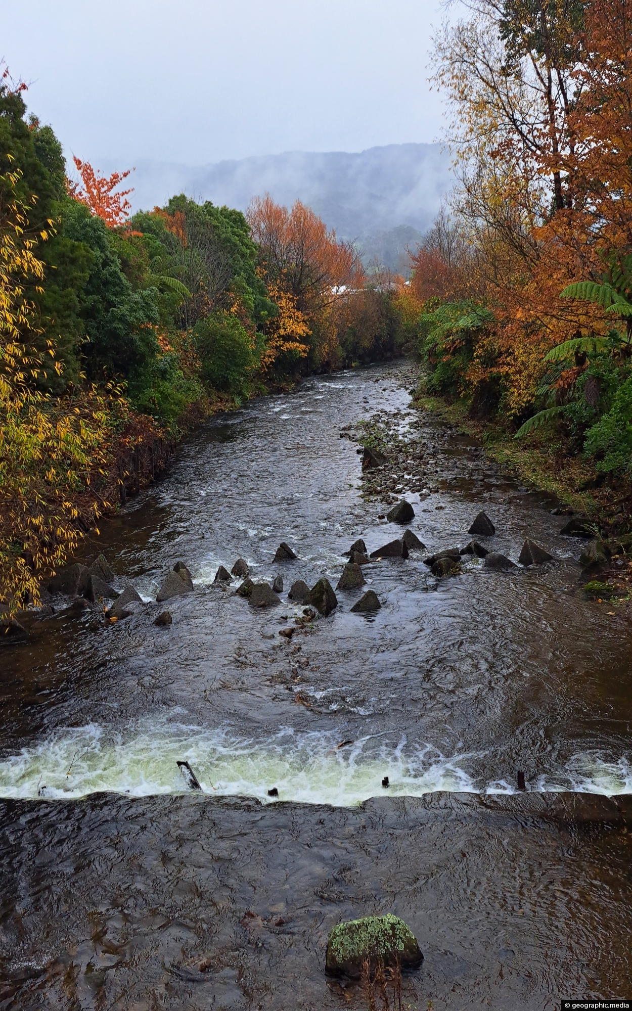
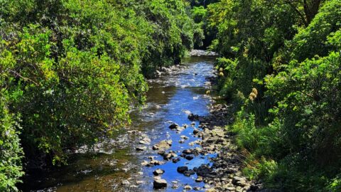
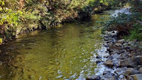
Looking at Wainuiomata River in autumn in Rotary Park. The park features a grassy pathway that follows Wainuiomata River till it joins Black Creek.
ALL / Explore Oceania / Explore New Zealand / New Zealand Photos / Wainuiomata photos / Upstream Wainuiomata River
All original royalty-free photos, shareable maps, and informative articles.
Upstream Wainuiomata River
Page Views
This post has been viewed 188 times
Related Articles
-
Remutaka Hills Wainuiomata
Wainuiomata photos, Extra Wide Horizontal, Forests
Looking at a forested foothill in the Remutaka Range. The Lower Hutt suburb of Wainuiomata is set below these...
-
Unnamed Creek in Wainuiomata Regional Park
Wainuiomata photos, Forests, Portrait / Vertical, Rivers
There are numerous unnamed creeks and streams in Wainuiomata Regional Park that feed into the Wainuiomata River including this...
-
Ōrongorongo River
Wainuiomata photos, Extra Wide Horizontal, Mountains, Rivers
The Ōrongorongo River is a prominent waterway in the Wellington region of New Zealand, flowing from the Rimutaka Ranges...
-
Giant Tree in Wainuiomata Regional Park
Wainuiomata photos, Portrait / Vertical, Trees
View of a giant tree in Wainuiomata in an area that was never logged. While the most of the...
-
Wainuiomata Waterworks Museum Display
Wainuiomata photos, Extra Wide Horizontal, Museums
A display inside the Wainuiomata Recreational Area Museum. The museum is dedicated to the history of the waterworks when...
-
Reservoir Road Gate in Wainuiomata
Wainuiomata photos, Extra Wide Horizontal, Forests, Roads
There are also a number of bush tracks into the park that take you through native bush and a...
-
Wainuiomata River Lower Reaches
Wainuiomata photos, Extra Wide Horizontal, Rivers
View of the lower reaches of Wainuiomata River in New Zealand’s Wellington Region. The upper reaches of this river...
-
Lower Dam Spillway Wainuiomata Waterworks
Wainuiomata photos, Dams, Extra Wide Horizontal, Forests, Rivers
Looking down on the spillway for the lower dam. Despite being decommissioned, the spillway allows water from the Wainuiomata...
0 Comments
Calendar
M | T | W | T | F | S | S |
---|---|---|---|---|---|---|
1 | 2 | |||||
3 | 4 | 5 | 6 | 7 | 8 | 9 |
10 | 11 | 12 | 13 | 14 | 15 | 16 |
17 | 18 | 19 | 20 | 21 | 22 | 23 |
24 | 25 | 26 | 27 | 28 |
Popular Posts
- Awakening New Zealand video (100)
- Iguazu Falls as seen from Brazil (87)
- Metrocable Medellin (78)
- Pauatahanui Inlet (69)
- Spinnaker Hill in Whitby Porirua (68)
- Spinnaker Hill View (68)
- View from Whitby (68)
- The Devil’s Throat (62)
- Aerial View of Iguazu Falls (61)
- Porirua Harbour & Papakowhai (57)
- Lake Wakatipu (57)
- Salto Rivadavia & Iguassu River (56)
- Lake Tekapo & Lupins (54)
- Nelson View (53)
- Salto Rivadavia Misiones Province (53)
- Cascadas at Iguazu (53)
Subjects
AccommodationAnimalsArchitectureBeachesBirdsBoatsBridgesBuildingsCarsChurchesCitiesCoralCultureExtra Wide HorizontalFlowersForestsHarborsHomesIslandsLakesLandscape / HorizontalMapsMenMonumentsMountainsPalmsParksPeoplePlantsPortrait / VerticalRiversRoadsRuralSeaShopsSkyscrapersSnowSunsetsTownsTrailsTransportTreesVideosVolcanicWaterfalls
Recent Comments
- Lance on Concrete Hut Wainuiomata
- Tony on Concrete Hut Wainuiomata
- DavidJ on Wellington Night Skyline
- Ben on Auckland City Skyline from Westhaven Marina in 1998
- Ben on Auckland Harbour Bridge view