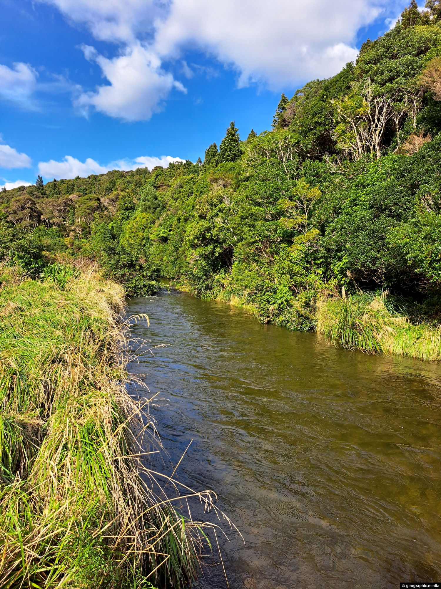
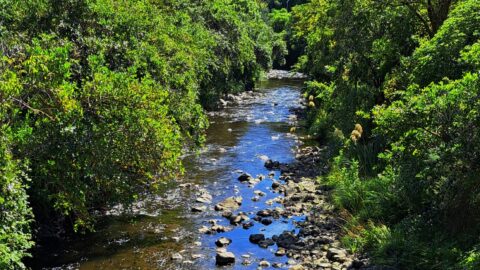
Looking at an almost inaccessible part of the Wainuiomata River. There are no tracks leading here, but you gain access if you are willing to traverse dense bush.
ALL / Explore Oceania / Explore New Zealand / New Zealand Photos / Wainuiomata photos / Upper Reaches of Wainuiomata River
All original royalty-free photos, shareable maps, and informative articles.
Upper Reaches of Wainuiomata River
Page Views
This post has been viewed 524 times
Related Articles
-
Top Pool Wainuiomata
Wainuiomata photos, Extra Wide Horizontal, Forests, Rivers
View of Top Pool a natural swimming hole in Wainuiomata River. Access is gained from the carpark at the...
-
Underground Shaft in Wainuiomata
Wainuiomata photos, Extra Wide Horizontal, Tunnels
This underground shaft in Wainuiomata was originally constructed in the 1880s. It was abandoned 1899 and is now completely...
-
Wainuiomata Recreational Area Homes
Wainuiomata photos, Extra Wide Horizontal, Homes, Roads
Looking at some old homes in the Wainuiomata Recreational Area. These homes among others once housed dam workers and...
-
Shingle Fan
Wainuiomata photos, Extra Wide Horizontal, Mountains
This shingle fan reveals a massive accumulation of scree cascading from the hillside, spreading out in a fan-like shape...
-
Wainuiomata Valley from the Remutaka
Wainuiomata photos, Forests, Portrait / Vertical, Trees
View of the Wainuiomata Valley as seen from the Remutaka Range, the last mountain range in the North Island.
-
Top Pool in Wainuiomata
Wainuiomata photos, Portrait / Vertical, Rivers
Top Pool in Wainuiomata is a natural swimming area in Wainuiomata River. It is located on the Gums Loop...
-
Wainuiomata Lower Dam
Wainuiomata photos, Extra Wide Horizontal, Forests, Wetlands
View of the decommissioned Wainuiomata Lower Dam (named Morton Dam). This dam once supplied water to Wellington along with...
-
Turakirae Head Scientific Reserve
Wainuiomata photos, Beaches, Extra Wide Horizontal
Turakirae Head Scientific Reserve located on the southern coast of Wainuiomata in New Zealand, is renowned for its geological...
0 Comments
Calendar
M | T | W | T | F | S | S |
---|---|---|---|---|---|---|
1 | 2 | |||||
3 | 4 | 5 | 6 | 7 | 8 | 9 |
10 | 11 | 12 | 13 | 14 | 15 | 16 |
17 | 18 | 19 | 20 | 21 | 22 | 23 |
24 | 25 | 26 | 27 | 28 |
Popular Posts
- Awakening New Zealand video (100)
- Iguazu Falls as seen from Brazil (87)
- Metrocable Medellin (78)
- Pauatahanui Inlet (69)
- Spinnaker Hill in Whitby Porirua (68)
- Spinnaker Hill View (68)
- View from Whitby (68)
- The Devil’s Throat (62)
- Aerial View of Iguazu Falls (61)
- Porirua Harbour & Papakowhai (57)
- Lake Wakatipu (57)
- Salto Rivadavia & Iguassu River (56)
- Lake Tekapo & Lupins (54)
- Nelson View (53)
- Salto Rivadavia Misiones Province (53)
- Cascadas at Iguazu (53)
Subjects
AccommodationAnimalsArchitectureBeachesBirdsBoatsBridgesBuildingsCarsChurchesCitiesCoralCultureExtra Wide HorizontalFlowersForestsHarborsHomesIslandsLakesLandscape / HorizontalMapsMenMonumentsMountainsPalmsParksPeoplePlantsPortrait / VerticalRiversRoadsRuralSeaShopsSkyscrapersSnowSunsetsTownsTrailsTransportTreesVideosVolcanicWaterfalls
Recent Comments
- Lance on Concrete Hut Wainuiomata
- Tony on Concrete Hut Wainuiomata
- DavidJ on Wellington Night Skyline
- Ben on Auckland City Skyline from Westhaven Marina in 1998
- Ben on Auckland Harbour Bridge view