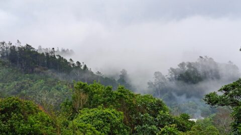
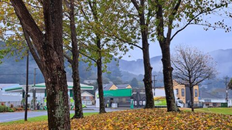
Moores Valley Road on a misty winter’s day in Wainuiomata presents a picturesque scene. One of the oldest roads in the area, it begins at The Village, meanders through a rural valley, and concludes at Brookfield.
ALL / Explore Oceania / Explore New Zealand / New Zealand Photos / Wainuiomata photos / Moores Valley Road in Mist
All original royalty-free photos, shareable maps, and informative articles.
Moores Valley Road in Mist
Page Views
This post has been viewed 154 times
Related Articles
-
Eastern Edge of the Remutaka Range
Wainuiomata photos, Extra Wide Horizontal, Mountains
This view captures the eastern edge of the Remutaka Range in Palliser Bay, which can be accessed either via...
-
Lower Dam Spillway Lookout
Wainuiomata photos, Dams, Extra Wide Horizontal, Forests, Rivers
View of the spillway and lookout. The Wainuiomata River is channeled from a wetland, continuing its course beneath as...
-
View from The Rock in Wainuiomata
Wainuiomata photos, Extra Wide Horizontal, Mountains, Parks, Rivers
A view overlooking Richard Prouse Park and the surrounding hills from The Rock on Moores Valley Road. Once a...
-
Richard Prouse Park Eastern View
Wainuiomata photos, Extra Wide Horizontal, Parks
Looking at the eastern side of Richard Prouse Park from high up a nearby hillside. Houses on Hine Road...
-
Richard Prouse Park Tunnel
Wainuiomata photos, Extra Wide Horizontal, Tunnels
The Richard Prouse Park Tunnel was constructed between 1881 and 1882. It is situated in the vicinity of the...
-
Top Pool Wainuiomata
Wainuiomata photos, Extra Wide Horizontal, Forests, Rivers
View of Top Pool a natural swimming hole in Wainuiomata River. Access is gained from the carpark at the...
-
Richard Prouse Park
Wainuiomata photos, Extra Wide Horizontal, Mountains, Sport
View of Richard Prouse Park in Wainuiomata. The park has football and cricket pitches. The Wainuiomata River forms much...
-
Wainuiomata River and Native Forest
Wainuiomata photos, Extra Wide Horizontal, Ferns, Forests, Rivers
Peering through native forest at the Wainuiomata River below. The hill in the background is a foothill in the...
0 Comments
Calendar
M | T | W | T | F | S | S |
---|---|---|---|---|---|---|
1 | 2 | |||||
3 | 4 | 5 | 6 | 7 | 8 | 9 |
10 | 11 | 12 | 13 | 14 | 15 | 16 |
17 | 18 | 19 | 20 | 21 | 22 | 23 |
24 | 25 | 26 | 27 | 28 |
Popular Posts
- Awakening New Zealand video (100)
- Iguazu Falls as seen from Brazil (87)
- Metrocable Medellin (78)
- Pauatahanui Inlet (69)
- Spinnaker Hill View (68)
- Spinnaker Hill in Whitby Porirua (68)
- View from Whitby (68)
- The Devil’s Throat (62)
- Aerial View of Iguazu Falls (61)
- Porirua Harbour & Papakowhai (57)
- Lake Wakatipu (57)
- Salto Rivadavia & Iguassu River (56)
- Lake Tekapo & Lupins (54)
- Nelson View (53)
- Salto Rivadavia Misiones Province (53)
- Cascadas at Iguazu (53)
Subjects
AccommodationAnimalsArchitectureBeachesBirdsBoatsBridgesBuildingsCarsChurchesCitiesCoralCultureExtra Wide HorizontalFlowersForestsHarborsHomesIslandsLakesLandscape / HorizontalMapsMenMonumentsMountainsPalmsParksPeoplePlantsPortrait / VerticalRiversRoadsRuralSeaShopsSkyscrapersSnowSunsetsTownsTrailsTransportTreesVideosVolcanicWaterfalls
Recent Comments
- Lance on Concrete Hut Wainuiomata
- Tony on Concrete Hut Wainuiomata
- DavidJ on Wellington Night Skyline
- Ben on Auckland City Skyline from Westhaven Marina in 1998
- Ben on Auckland Harbour Bridge view