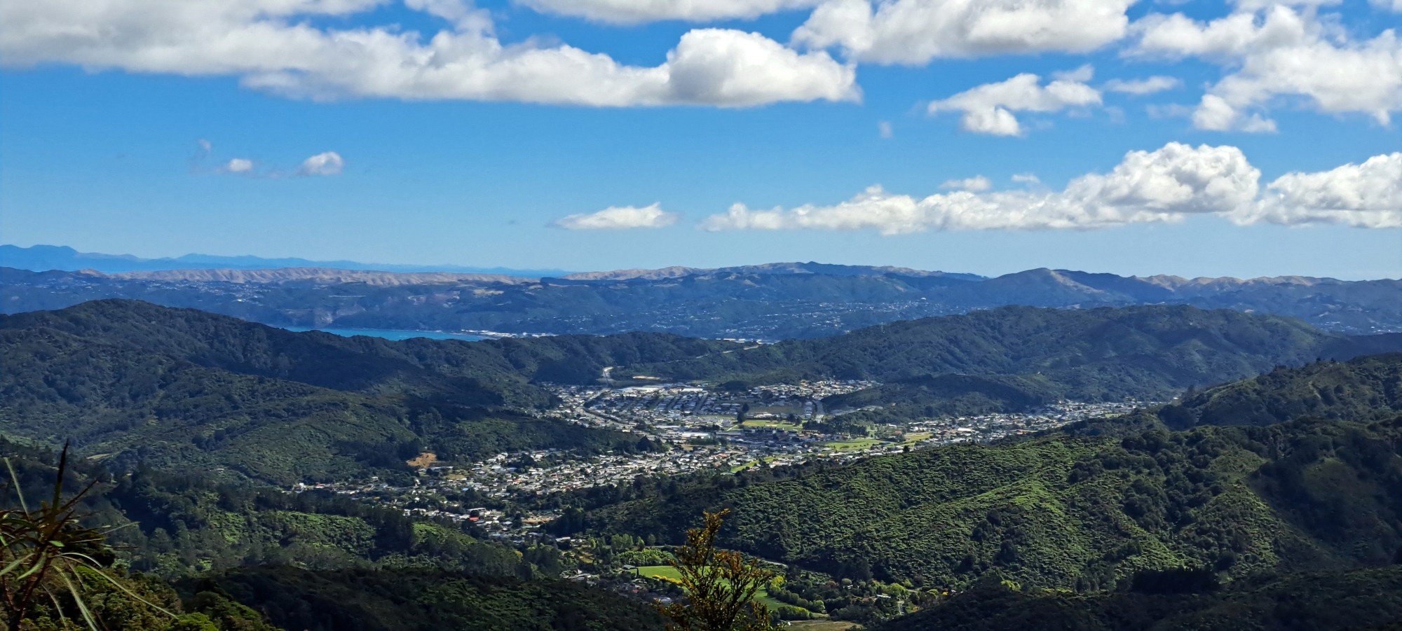
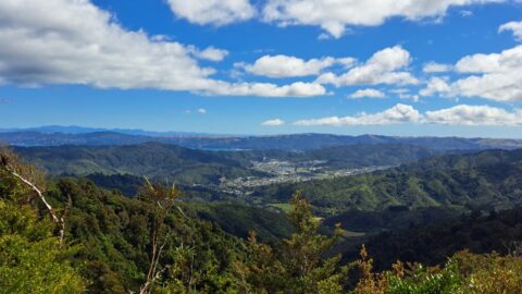
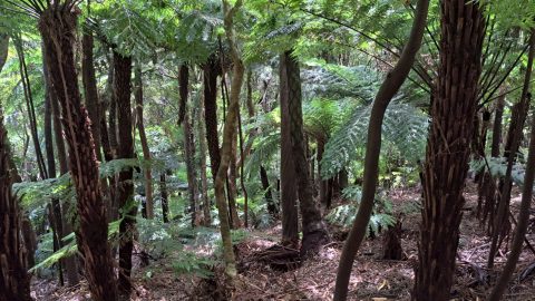
This bird’s-eye perspective of Wainuiomata illustrates how the suburb resides within its unique valley, distinct from the broader Hutt Valley.
ALL / Explore Oceania / Explore New Zealand / New Zealand Photos / Wainuiomata photos / Aerial view of Wainuiomata
All original royalty-free photos, shareable maps, and informative articles.
Aerial view of Wainuiomata
Page Views
This post has been viewed 274 times
Related Articles
-
Wainuiomata River and Native Forest
Wainuiomata photos, Extra Wide Horizontal, Ferns, Forests, Rivers
Peering through native forest at the Wainuiomata River below. The hill in the background is a foothill in the...
-
Parched Farmland in Wainuiomata
Wainuiomata photos, Extra Wide Horizontal, Roads, Rural
Gazing upon parched farmland during the summer months, situated along the Coast Road in Wainuiomata, New Zealand.
-
View of Wainuiomata from the Remutaka
Wainuiomata photos, Mountains, Portrait / Vertical, Trees
Looking down on Wainuiomata Valley from atop the Remutaka Range near Mt McKerrow in the southern North Island. Wellington...
-
Reservoir Road in Wainuiomata
Wainuiomata photos, Extra Wide Horizontal, Forests, Roads
Reservoir Road in the Wainuiomata Waterworks Recreation Area gives you access to the dams and many walks in the...
-
Waterworks Wetland
Wainuiomata photos, Extra Wide Horizontal, Forests, Wetlands
The Wainuiomata Waterworks Wetlands are part of the Wainuiomata Regional Park, which encompasses lowland native forests and adjoins the...
-
Sledge Track in Wainuiomata
Wainuiomata photos, Forests, Portrait / Vertical, Trails
Sledge Track Creek in Wainuiomata is a one and a half hour walk in Wainuiomata Regional Park. It offers...
-
Wainuiomata Recreational Area Homes
Wainuiomata photos, Extra Wide Horizontal, Homes, Roads
Looking at some old homes in the Wainuiomata Recreational Area. These homes among others once housed dam workers and...
-
Track in Poole Crescent Reserve
Wainuiomata photos, Portrait / Vertical, Rivers, Trees
Autumn in Poole Crescent Reserve in Wainuiomata in Lower Hutt. The track and reserve runs parallel with Wainuiomata River.
0 Comments
Calendar
M | T | W | T | F | S | S |
---|---|---|---|---|---|---|
1 | 2 | |||||
3 | 4 | 5 | 6 | 7 | 8 | 9 |
10 | 11 | 12 | 13 | 14 | 15 | 16 |
17 | 18 | 19 | 20 | 21 | 22 | 23 |
24 | 25 | 26 | 27 | 28 |
Popular Posts
- Awakening New Zealand video (100)
- Iguazu Falls as seen from Brazil (87)
- Metrocable Medellin (78)
- Pauatahanui Inlet (69)
- Spinnaker Hill View (68)
- Spinnaker Hill in Whitby Porirua (68)
- View from Whitby (68)
- The Devil’s Throat (62)
- Aerial View of Iguazu Falls (61)
- Porirua Harbour & Papakowhai (57)
- Lake Wakatipu (57)
- Salto Rivadavia & Iguassu River (56)
- Lake Tekapo & Lupins (54)
- Nelson View (53)
- Salto Rivadavia Misiones Province (53)
- Cascadas at Iguazu (53)
Subjects
AccommodationAnimalsArchitectureBeachesBirdsBoatsBridgesBuildingsCarsChurchesCitiesCoralCultureExtra Wide HorizontalFlowersForestsHarborsHomesIslandsLakesLandscape / HorizontalMapsMenMonumentsMountainsPalmsParksPeoplePlantsPortrait / VerticalRiversRoadsRuralSeaShopsSkyscrapersSnowSunsetsTownsTrailsTransportTreesVideosVolcanicWaterfalls
Recent Comments
- Lance on Concrete Hut Wainuiomata
- Tony on Concrete Hut Wainuiomata
- DavidJ on Wellington Night Skyline
- Ben on Auckland City Skyline from Westhaven Marina in 1998
- Ben on Auckland Harbour Bridge view