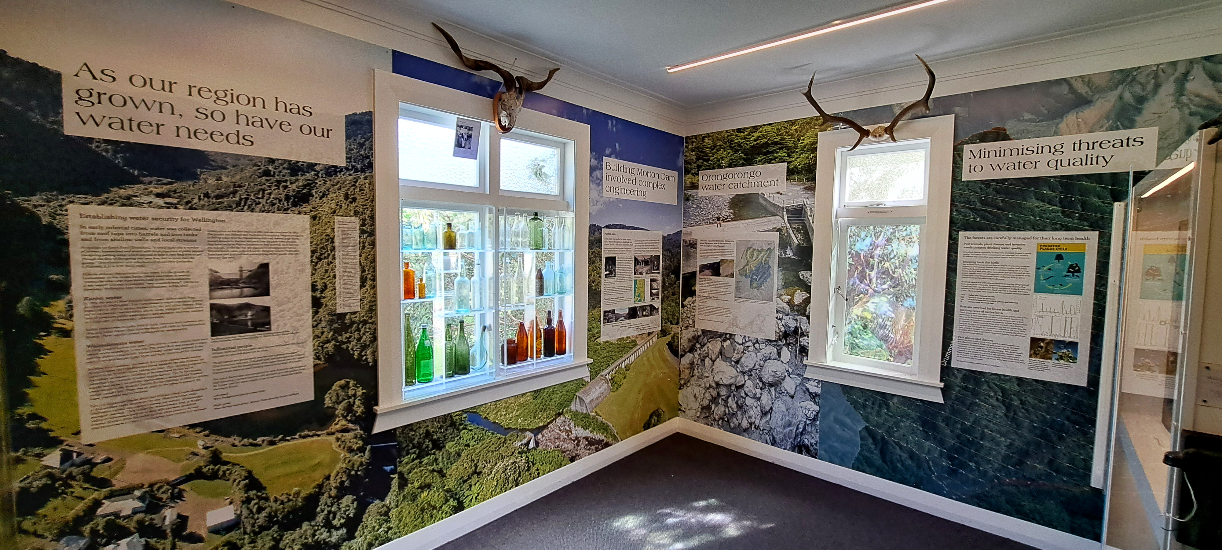
The walls tell stories of the history of the Wainuiomata waterworks. The waterworks has two dams, one decommissioned and a larger one that is still in use. The area also housed a community of workers and their families. Their stories are recorded in this museum.
ALL / Explore Oceania / Explore New Zealand / New Zealand Photos / Wainuiomata photos / Wainuiomata Waterworks Museum History
All original royalty-free photos, shareable maps, and informative articles.
Wainuiomata Waterworks Museum History
Page Views
This post has been viewed 534 times
Related Articles
-
Wainuiomata Wetlands
Wainuiomata photos, Extra Wide Horizontal, Forests, Wetlands
Wetlands in Wainuiomata within Wainuiomata Regional Park. The wetlands was once a dam that supplied water to Wellington. It...
-
Autumn at Wainuiomata River
Wainuiomata photos, Portrait / Vertical, Rivers
Wainuiomata River surrounded by Autumn colors. This view can be seen from Hine Road Recreation Area at the end...
-
Lower Dam Spillway Lookout
Wainuiomata photos, Dams, Extra Wide Horizontal, Forests, Rivers
View of the spillway and lookout. The Wainuiomata River is channeled from a wetland, continuing its course beneath as...
-
Wainuiomata River and Regional Park
Wainuiomata photos, Extra Wide Horizontal, Mountains, Rivers
Looking at Wainuiomata River within Wainuiomata Regional Park. Also in view is the Remutaka mountain range.
-
Hine Road Recreation Area
Wainuiomata photos, Extra Wide Horizontal, Parks
Hine Road Recreation Area, formerly referred to as The Meadow by some, it comprised paddocks hosting grazing horses during...
-
Upper Reaches of the Wainuiomata River
Wainuiomata photos, Extra Wide Horizontal, Forests, Rivers
Looking at the upper reaches of the Wainuiomata River at the foothills of the Remutaka range. Access to here...
-
Underground Shaft in Wainuiomata
Wainuiomata photos, Extra Wide Horizontal, Tunnels
This underground shaft in Wainuiomata was originally constructed in the 1880s. It was abandoned 1899 and is now completely...
-
Wainuiomata River Lower Reaches
Wainuiomata photos, Extra Wide Horizontal, Rivers
View of the lower reaches of Wainuiomata River in New Zealand’s Wellington Region. The upper reaches of this river...
0 Comments
Calendar
M | T | W | T | F | S | S |
---|---|---|---|---|---|---|
1 | 2 | 3 | 4 | |||
5 | 6 | 7 | 8 | 9 | 10 | 11 |
12 | 13 | 14 | 15 | 16 | 17 | 18 |
19 | 20 | 21 | 22 | 23 | 24 | 25 |
26 | 27 | 28 | 29 | 30 | 31 |
Popular Posts
- Awakening New Zealand video (100)
- Iguazu Falls as seen from Brazil (87)
- Metrocable Medellin (78)
- Pauatahanui Inlet (69)
- Spinnaker Hill in Whitby Porirua (68)
- Spinnaker Hill View (68)
- View from Whitby (68)
- The Devil’s Throat (62)
- Aerial View of Iguazu Falls (61)
- Porirua Harbour & Papakowhai (57)
- Lake Wakatipu (57)
- Salto Rivadavia & Iguassu River (56)
- Lake Tekapo & Lupins (54)
- Nelson View (53)
- Salto Rivadavia Misiones Province (53)
- Cascadas at Iguazu (53)
Subjects
AccommodationAnimalsArchitectureBeachesBirdsBoatsBridgesBuildingsCarsChurchesCitiesCoralCultureExtra Wide HorizontalFlowersForestsHarborsHomesIslandsLakesLandscape / HorizontalMapsMenMonumentsMountainsPalmsParksPeoplePlantsPortrait / VerticalRiversRoadsRuralSeaShopsSkyscrapersSnowSunsetsTownsTrailsTransportTreesVideosVolcanicWaterfalls
Recent Comments
- Lance on Concrete Hut Wainuiomata
- Tony on Concrete Hut Wainuiomata
- DavidJ on Wellington Night Skyline
- Ben on Auckland City Skyline from Westhaven Marina in 1998
- Ben on Auckland Harbour Bridge view