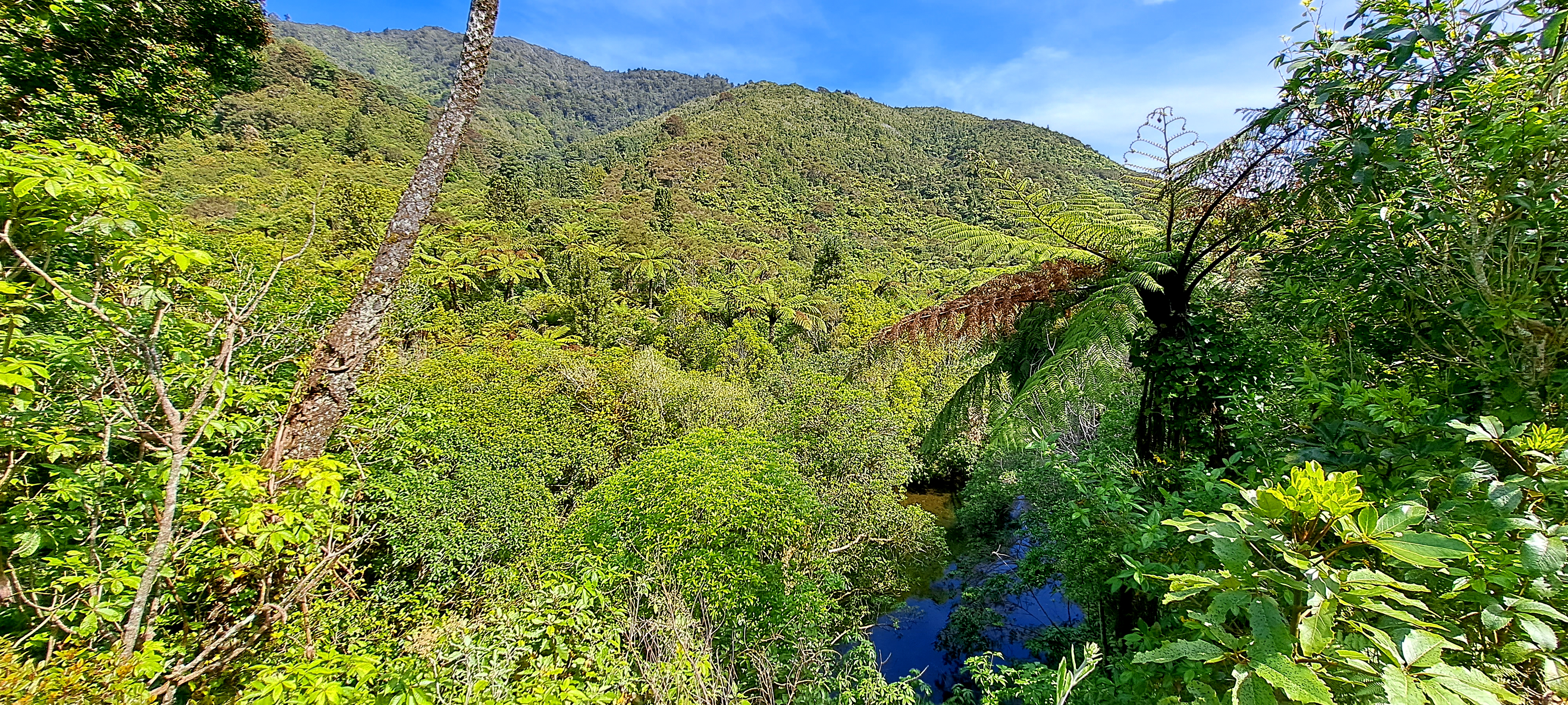
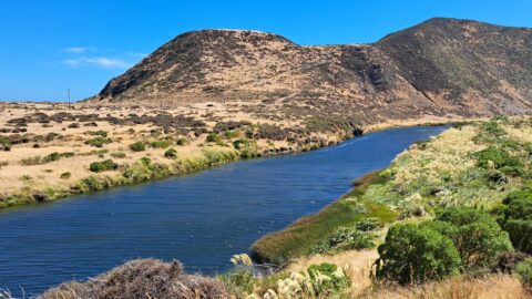
Peering through native forest at the Wainuiomata River below. The hill in the background is a foothill in the Remutaka Range. The tall fern to the right is called a Black Fern.
ALL / Explore Oceania / Explore New Zealand / New Zealand Photos / Wainuiomata photos / Wainuiomata River and Native Forest
All original royalty-free photos, shareable maps, and informative articles.
Wainuiomata River and Native Forest
Page Views
This post has been viewed 593 times
Related Articles
-
Wainuiomata Waterworks Museum History
Wainuiomata photos, Extra Wide Horizontal, Museums
The walls tell stories of the history of the Wainuiomata waterworks. The waterworks has two dams, one decommissioned and...
-
Nikau Creek in Wainuiomata
Wainuiomata photos, Portrait / Vertical, Rivers
Looking at Nikau Creek in Wainuiomata Regional Park. The creek can be seen from a short scenic walk called...
-
View of Wainuiomata
Wainuiomata photos, Aerial, Extra Wide Horizontal, Mountains, Towns
View of Wainuiomata as seen from the lookout at the top of Wainuiomata Hill. A car park at the...
-
Autumn at Queen Street Reserve
Wainuiomata photos, Autumn, Portrait / Vertical
Autumn colors at Queen Street Reserve in the heart of Wainuiomata. The reserve is bounded by Queen Street, Fitzherbert...
-
Richard Prouse Park Eastern View
Wainuiomata photos, Extra Wide Horizontal, Parks
Looking at the eastern side of Richard Prouse Park from high up a nearby hillside. Houses on Hine Road...
-
Wainuiomata Recreational Area Homes
Wainuiomata photos, Extra Wide Horizontal, Homes, Roads
Looking at some old homes in the Wainuiomata Recreational Area. These homes among others once housed dam workers and...
-
Pukeatua Bridge Wainuiomata
Wainuiomata photos, Bridges, Portrait / Vertical
Pukeatua Bridge in Wainuiomata crosses Wainuiomata Road at its highest point, 189 meters above sea level. This places the...
-
Wainuiomata Valley from the Remutaka
Wainuiomata photos, Forests, Portrait / Vertical, Trees
View of the Wainuiomata Valley as seen from the Remutaka Range, the last mountain range in the North Island.
0 Comments
Calendar
M | T | W | T | F | S | S |
---|---|---|---|---|---|---|
1 | 2 | |||||
3 | 4 | 5 | 6 | 7 | 8 | 9 |
10 | 11 | 12 | 13 | 14 | 15 | 16 |
17 | 18 | 19 | 20 | 21 | 22 | 23 |
24 | 25 | 26 | 27 | 28 |
Popular Posts
- Awakening New Zealand video (100)
- Iguazu Falls as seen from Brazil (87)
- Metrocable Medellin (78)
- Pauatahanui Inlet (69)
- Spinnaker Hill in Whitby Porirua (68)
- Spinnaker Hill View (68)
- View from Whitby (68)
- The Devil’s Throat (62)
- Aerial View of Iguazu Falls (61)
- Porirua Harbour & Papakowhai (57)
- Lake Wakatipu (57)
- Salto Rivadavia & Iguassu River (56)
- Lake Tekapo & Lupins (54)
- Nelson View (53)
- Salto Rivadavia Misiones Province (53)
- Cascadas at Iguazu (53)
Subjects
AccommodationAnimalsArchitectureBeachesBirdsBoatsBridgesBuildingsCarsChurchesCitiesCoralCultureExtra Wide HorizontalFlowersForestsHarborsHomesIslandsLakesLandscape / HorizontalMapsMenMonumentsMountainsPalmsParksPeoplePlantsPortrait / VerticalRiversRoadsRuralSeaShopsSkyscrapersSnowSunsetsTownsTrailsTransportTreesVideosVolcanicWaterfalls
Recent Comments
- Lance on Concrete Hut Wainuiomata
- Tony on Concrete Hut Wainuiomata
- DavidJ on Wellington Night Skyline
- Ben on Auckland City Skyline from Westhaven Marina in 1998
- Ben on Auckland Harbour Bridge view