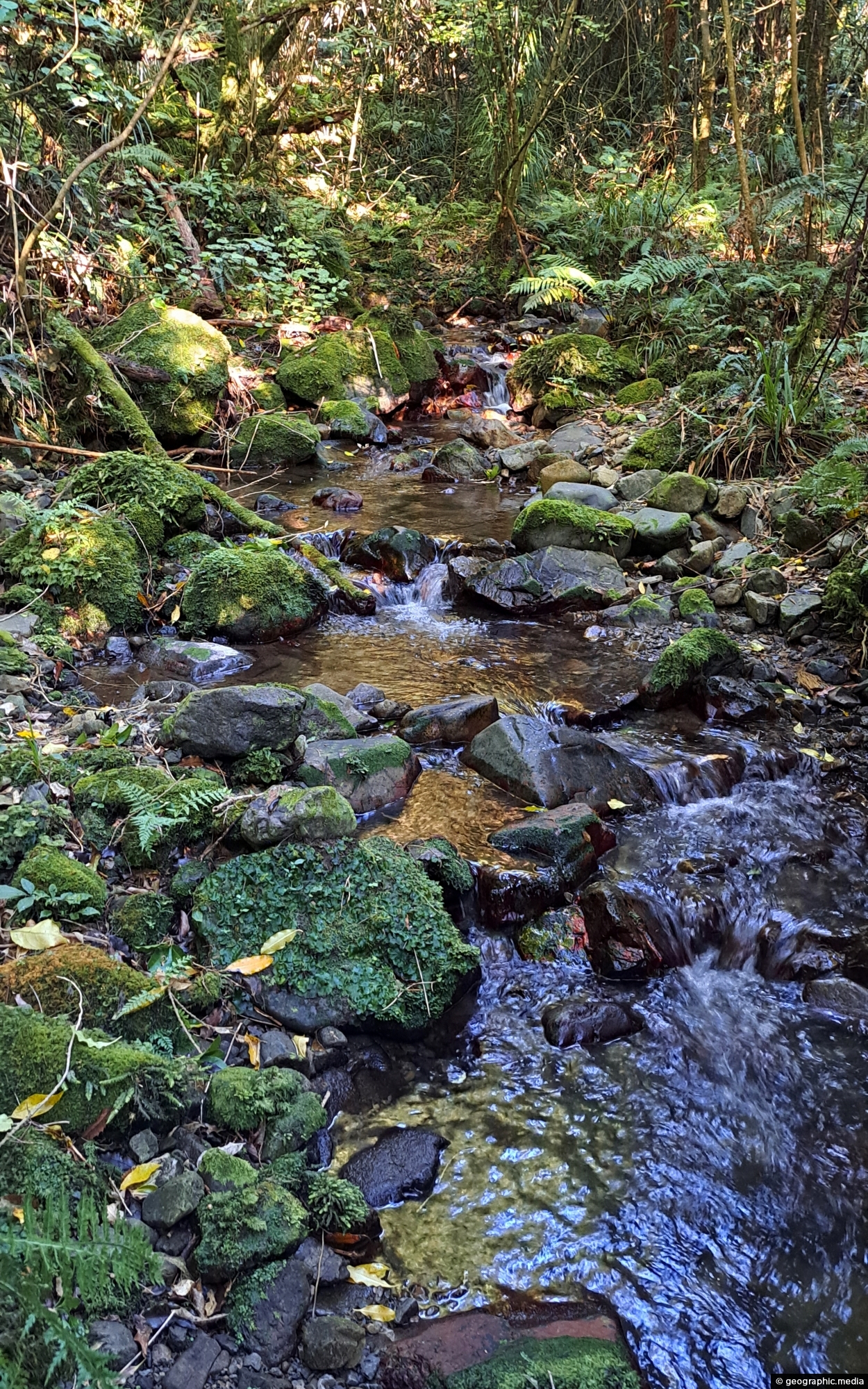
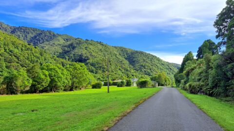
Looking at Nikau Creek in Wainuiomata Regional Park. The creek can be seen from a short scenic walk called Nikau Creek Track which branches off Gums Loop Walk.
ALL / Explore Oceania / Explore New Zealand / New Zealand Photos / Wainuiomata photos / Nikau Creek in Wainuiomata
All original royalty-free photos, shareable maps, and informative articles.
Nikau Creek in Wainuiomata
Page Views
This post has been viewed 315 times
Related Articles
-
Reservoir Road Gate in Wainuiomata
Wainuiomata photos, Extra Wide Horizontal, Forests, Roads
There are also a number of bush tracks into the park that take you through native bush and a...
-
Nikau Creek Valley & Mist
Wainuiomata photos, Extra Wide Horizontal, fog, Forests, Mountains, Parks
A misty day at Nikau Creek Valley in Wainuiomata Regional Park offers a striking view. During winter, Wainuiomata occasionally...
-
Whakanui Track View
Wainuiomata photos, Cities, Extra Wide Horizontal, Forests, Mountains
View from the top of Whakanui Track along a ridgeline, before it connects to the McKerrow Track. Wainuiomata can...
-
Sunny Grove Wainuiomata
Wainuiomata photos, Extra Wide Horizontal, Forests, Homes, Mountains
View of Sunny Grove in Wainuiomata. While the street looks sunny in the photo, it is mostly quite shady...
-
Old Tree Covered in Epiphytes
Wainuiomata photos, Portrait / Vertical, Trees
This old tree has hosts many different epiphyte species. An epiphyte refers to a plant species that thrives by...
-
Lower Dam Spillway Lookout
Wainuiomata photos, Dams, Extra Wide Horizontal, Forests, Rivers
View of the spillway and lookout. The Wainuiomata River is channeled from a wetland, continuing its course beneath as...
-
Wainuiomata Recreational Area Museum
Wainuiomata photos, Extra Wide Horizontal, Homes, Museums
View of the museum in the Wainuiomata Recreational Area. This house among others originally homed workers at the dam.
-
Richard Prouse Park Tunnel
Wainuiomata photos, Extra Wide Horizontal, Tunnels
The Richard Prouse Park Tunnel (once known as Colemans Tunnel) was constructed between 1881 and 1882. It is situated...
0 Comments
Calendar
M | T | W | T | F | S | S |
---|---|---|---|---|---|---|
1 | 2 | 3 | 4 | |||
5 | 6 | 7 | 8 | 9 | 10 | 11 |
12 | 13 | 14 | 15 | 16 | 17 | 18 |
19 | 20 | 21 | 22 | 23 | 24 | 25 |
26 | 27 | 28 | 29 | 30 | 31 |
Popular Posts
- Awakening New Zealand video (100)
- Iguazu Falls as seen from Brazil (87)
- Metrocable Medellin (78)
- Pauatahanui Inlet (69)
- Spinnaker Hill in Whitby Porirua (68)
- Spinnaker Hill View (68)
- View from Whitby (68)
- The Devil’s Throat (62)
- Aerial View of Iguazu Falls (61)
- Porirua Harbour & Papakowhai (57)
- Lake Wakatipu (57)
- Salto Rivadavia & Iguassu River (56)
- Lake Tekapo & Lupins (54)
- Nelson View (53)
- Salto Rivadavia Misiones Province (53)
- Cascadas at Iguazu (53)
Subjects
AccommodationAnimalsArchitectureBeachesBirdsBoatsBridgesBuildingsCarsChurchesCitiesCoralCultureExtra Wide HorizontalFlowersForestsHarborsHomesIslandsLakesLandscape / HorizontalMapsMenMonumentsMountainsPalmsParksPeoplePlantsPortrait / VerticalRiversRoadsRuralSeaShopsSkyscrapersSnowSunsetsTownsTrailsTransportTreesVideosVolcanicWaterfalls
Recent Comments
- Lance on Concrete Hut Wainuiomata
- Tony on Concrete Hut Wainuiomata
- DavidJ on Wellington Night Skyline
- Ben on Auckland City Skyline from Westhaven Marina in 1998
- Ben on Auckland Harbour Bridge view