
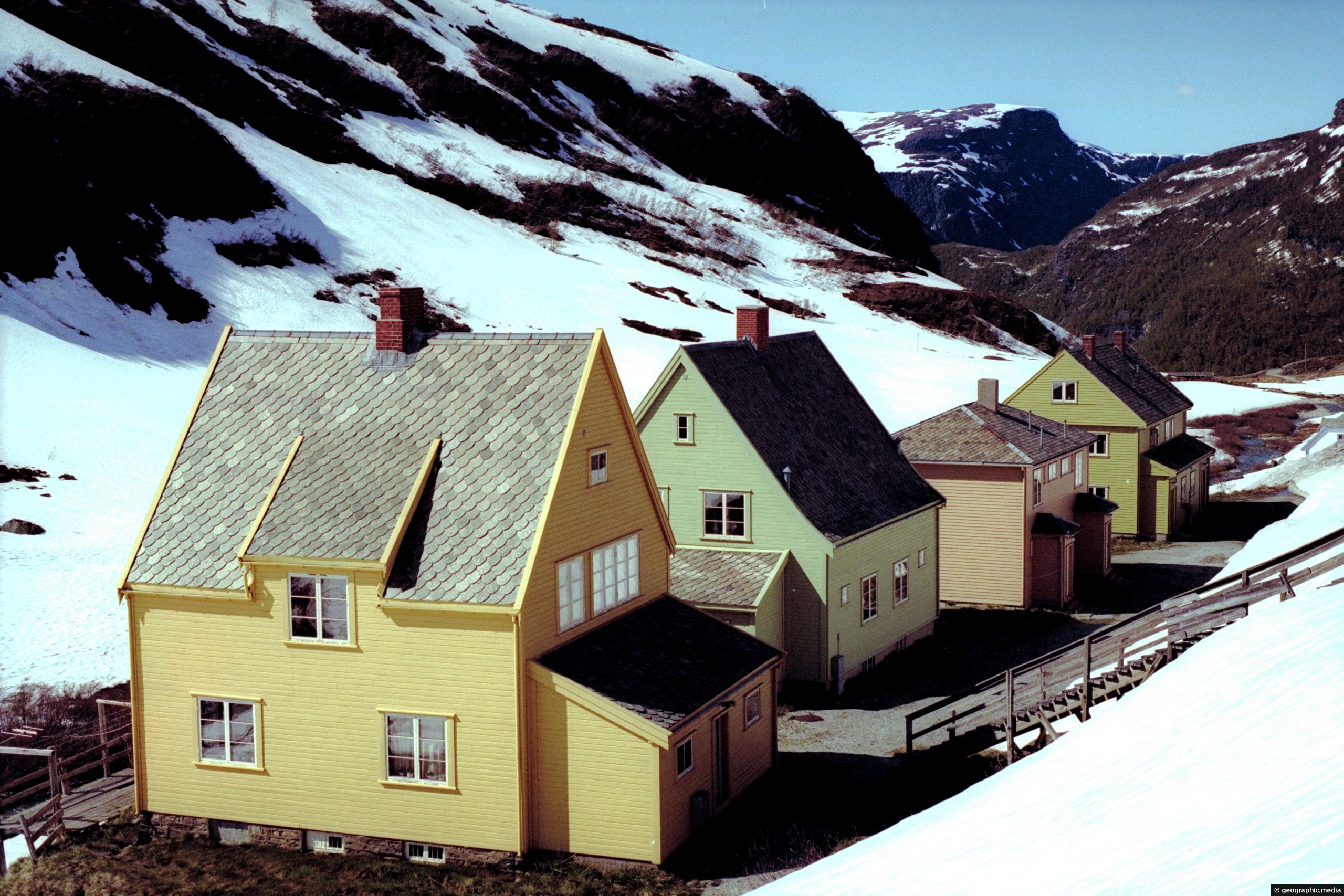
Some homes in Myrdal, Norway. Myrdal is on route to two must do rail trips. This small settlement lies on the scenic...
Myrdal Norway
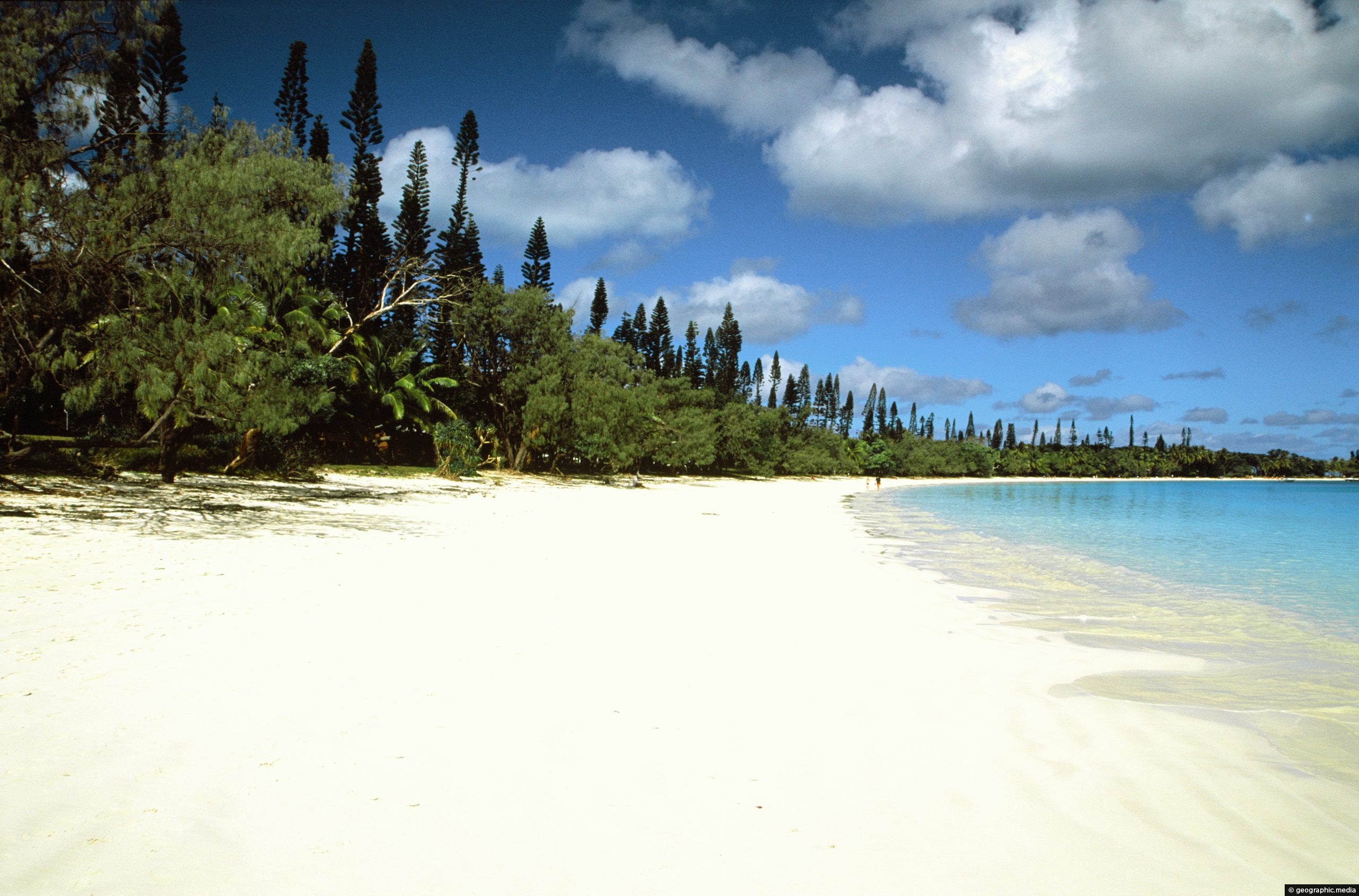
View of the main beach at Kuto Bay on the Isle of Pines. In view is tropical vegetation including...
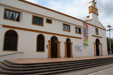
Iglesia Santa Ana de Anapoima is a church located in the town of Anapoima, Colombia. It is a historic...
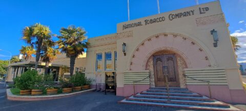
The National Tobacco Company Building in Napier is one of New Zealand’s finest examples of Art Deco architecture, combined...
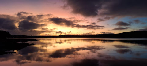
Gorgeous sunset over Pāuatahanui Inlet in Porirua Harbour. The inlet is home to the only remaining large estuarine wetland...
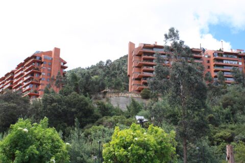
Looking at apartments on the eastern hills in suburb of Usaquen. This is a wealthy part of Bogota in...

The Tongariro Crossing is an alpine walk located in the center of New Zealand’s North Island. It is often...
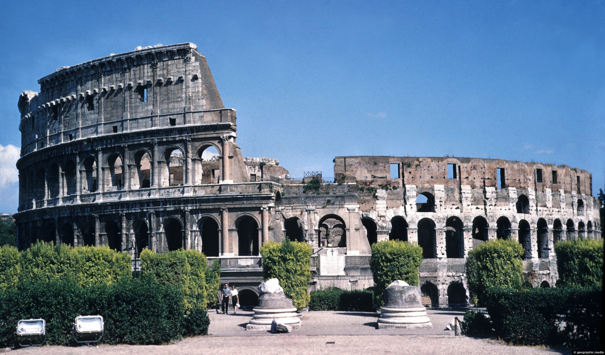
Expansive view of The Colosseum in the center of Rome (circa 1961). The Colosseum was the biggest amphitheater in...
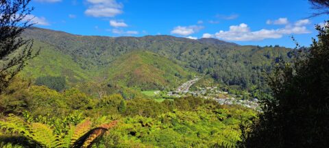
High up on a ridge in Wainuiomata Scenic Reserve, you can get a great view of Sunny Grove, Hine...
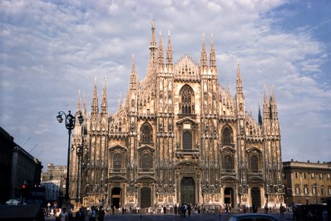
Milan Cathedral in Italy is the third largest cathedral in the world. The largest in the world is St....
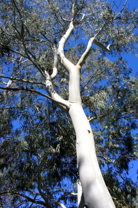
A giant eucalyptus tree with white bark reaching skyward. The tree belongs to a number of eucalypt species commonly...

Recent Comments