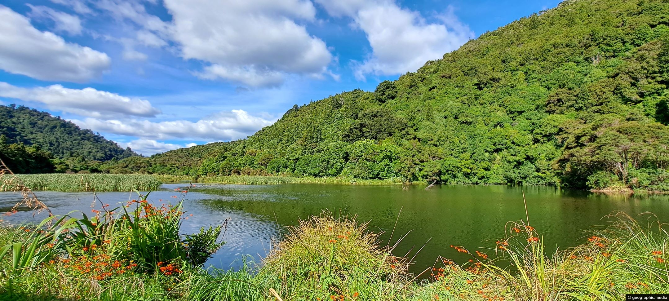
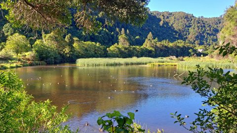
The suburb of Wainuiomata was largely comprised of swamp. in 1855 a massive 8.2 earthquake raised much land above these swamps and encouraging housing development. There are still pockets of wetlands such as this one.
ALL / Explore Oceania / Explore New Zealand / New Zealand Photos / Wainuiomata photos / Wetlands in Wainuiomata
All original royalty-free photos, shareable maps, and informative articles.
Wetlands in Wainuiomata
Page Views
This post has been viewed 537 times
Related Articles
-
Morton Dam in Wainuiomata
Wainuiomata photos, Dams
Looking at Morton Dam in the year 2024, after being decommissioned some 36 years before. It once supplied the...
-
Old Shed and Machine Parts at the Waterworks Museum
Wainuiomata photos, Extra Wide Horizontal, Forests
Looking at a shed that housed a machine that aided in supplying water to the Wellington region. Today this...
-
Giant Tree in Wainuiomata Regional Park
Wainuiomata photos, Portrait / Vertical, Trees
View of a giant tree in Wainuiomata in an area that was never logged. While the most of the...
-
Lower Dam Spillway Wainuiomata Waterworks
Wainuiomata photos, Dams, Extra Wide Horizontal, Forests, Rivers
Looking down on the spillway for the lower dam. Despite being decommissioned, the spillway allows water from the Wainuiomata...
-
Nikau Creek in Wainuiomata
Wainuiomata photos, Portrait / Vertical, Rivers
Looking at Nikau Creek in Wainuiomata Regional Park. The creek can be seen from a short scenic walk called...
-
Sledge Track and Kiwi Sign
Wainuiomata photos, Forests, Portrait / Vertical, Trails
Sledge Track Creek in Wainuiomata is a habitat for kiwi, New Zealand’s national bird. These flightless and endangered birds...
-
Wainuiomata River in Autumn
Wainuiomata photos, Autumn, Extra Wide Horizontal, Rivers
Tranquil beauty of the Wainuiomata River gracefully flowing through an Autumn landscape. Location is Hine Road Recreation Area.
-
Ultimate Pool in Wainuiomata River
Wainuiomata photos, Extra Wide Horizontal, Forests, Rivers
Ultimate Pool is further up Wainuiomata River from Top Pool. Access is gained via Reservoir Road or Gums Loop...
0 Comments
Calendar
M | T | W | T | F | S | S |
---|---|---|---|---|---|---|
1 | 2 | |||||
3 | 4 | 5 | 6 | 7 | 8 | 9 |
10 | 11 | 12 | 13 | 14 | 15 | 16 |
17 | 18 | 19 | 20 | 21 | 22 | 23 |
24 | 25 | 26 | 27 | 28 |
Popular Posts
- Awakening New Zealand video (100)
- Iguazu Falls as seen from Brazil (87)
- Metrocable Medellin (78)
- Pauatahanui Inlet (69)
- Spinnaker Hill View (68)
- Spinnaker Hill in Whitby Porirua (68)
- View from Whitby (68)
- The Devil’s Throat (62)
- Aerial View of Iguazu Falls (61)
- Porirua Harbour & Papakowhai (57)
- Lake Wakatipu (57)
- Salto Rivadavia & Iguassu River (56)
- Lake Tekapo & Lupins (54)
- Nelson View (53)
- Salto Rivadavia Misiones Province (53)
- Cascadas at Iguazu (53)
Subjects
AccommodationAnimalsArchitectureBeachesBirdsBoatsBridgesBuildingsCarsChurchesCitiesCoralCultureExtra Wide HorizontalFlowersForestsHarborsHomesIslandsLakesLandscape / HorizontalMapsMenMonumentsMountainsPalmsParksPeoplePlantsPortrait / VerticalRiversRoadsRuralSeaShopsSkyscrapersSnowSunsetsTownsTrailsTransportTreesVideosVolcanicWaterfalls
Recent Comments
- Lance on Concrete Hut Wainuiomata
- Tony on Concrete Hut Wainuiomata
- DavidJ on Wellington Night Skyline
- Ben on Auckland City Skyline from Westhaven Marina in 1998
- Ben on Auckland Harbour Bridge view