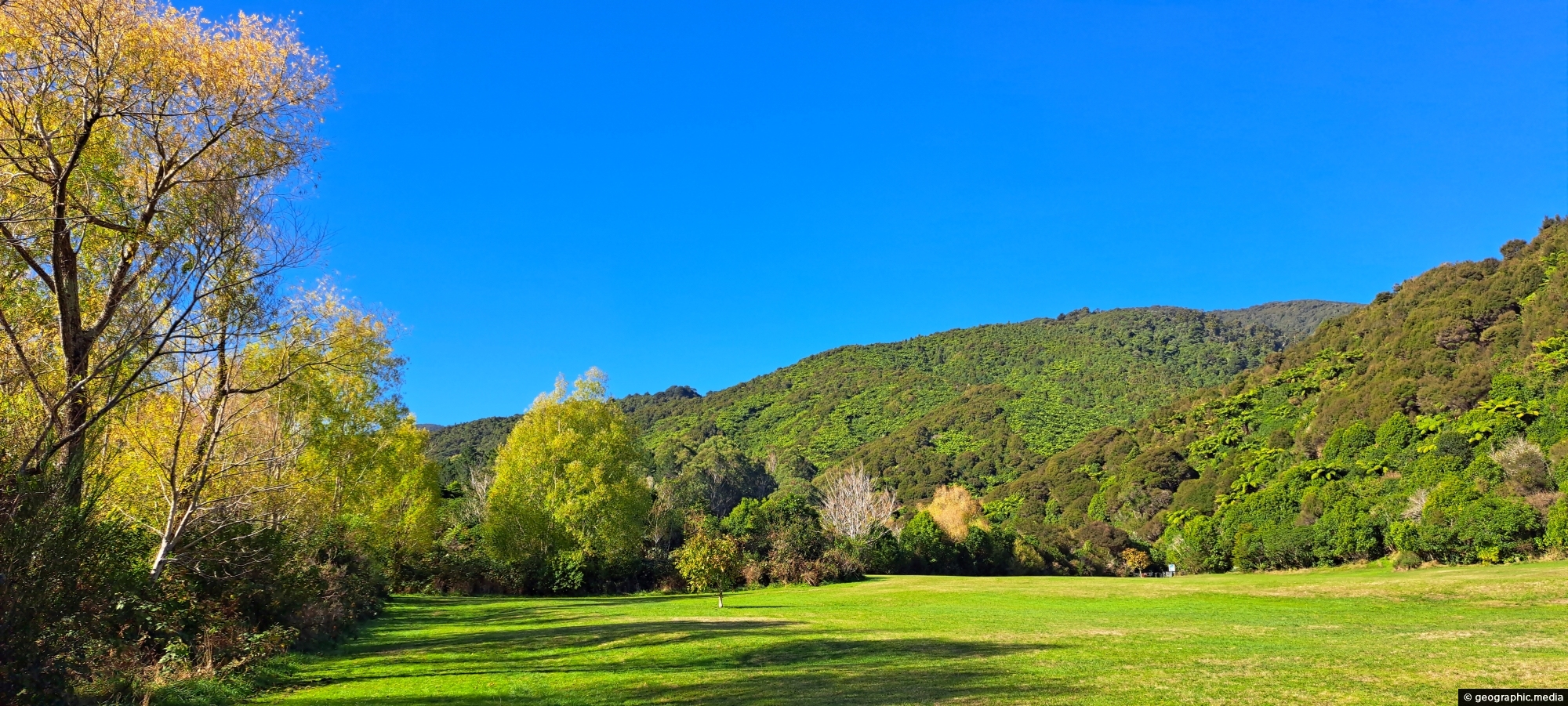
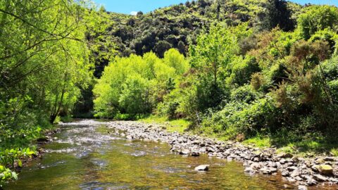
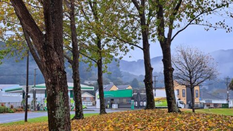
What was once called The Meadow is now Hine Road Recreation Area, a grassy area that sits alongside Wainuiomata River. It is a popular place for walking dogs and visiting the nearby historic cemeteries. The hills in the background are part of Wainuiomata Regional Park.
ALL / Explore Oceania / Explore New Zealand / New Zealand Photos / Wainuiomata photos / The Meadow in Wainuiomata
All original royalty-free photos, shareable maps, and informative articles.
The Meadow in Wainuiomata
Page Views
This post has been viewed 205 times
Related Articles
-
View of Wainuiomata from the Remutaka
Wainuiomata photos, Mountains, Portrait / Vertical, Trees
Looking down on Wainuiomata Valley from atop the Remutaka Range near Mt McKerrow in the southern North Island. Wellington...
-
Hine Road in Wainuiomata
Wainuiomata photos, Autumn, Extra Wide Horizontal, Roads, Trees
Hine Road in Wainuiomata explodes into color every Autumn. The street is lined with deciduous trees with pine trees...
-
Harry Todd Recreation Area
Wainuiomata photos, Extra Wide Horizontal, fog, Mountains, Parks
Looking the Harry Todd Recreation Area in Wainuiomata, with towering hills and mountains trapping clouds within the valleys.
-
Richard Prouse Park Eastern View
Wainuiomata photos, Extra Wide Horizontal, Parks
Looking at the eastern side of Richard Prouse Park from high up a nearby hillside. Houses on Hine Road...
-
Wainuiomata River and Regional Park
Wainuiomata photos, Extra Wide Horizontal, Mountains, Rivers
Looking at Wainuiomata River within Wainuiomata Regional Park. Also in view is the Remutaka mountain range.
-
Old Tree Covered in Epiphytes
Wainuiomata photos, Portrait / Vertical, Trees
This old tree has hosts many different epiphyte species. An epiphyte refers to a plant species that thrives by...
-
Coastline prior to the 1855 Wairarapa earthquake
Wainuiomata photos, Beaches, Extra Wide Horizontal
This view shows rocks that once formed the coastline prior to the 1855 Wairarapa earthquake. The powerful 8.2 magnitude...
-
Mist Filled Valleys
Wainuiomata photos, Extra Wide Horizontal, Forests, Mountains
A windless day in Wainuiomata with both western and eastern hills trapping low cloud and mist inside the valley.
0 Comments
Calendar
M | T | W | T | F | S | S |
---|---|---|---|---|---|---|
1 | 2 | 3 | 4 | |||
5 | 6 | 7 | 8 | 9 | 10 | 11 |
12 | 13 | 14 | 15 | 16 | 17 | 18 |
19 | 20 | 21 | 22 | 23 | 24 | 25 |
26 | 27 | 28 | 29 | 30 | 31 |
Popular Posts
- Awakening New Zealand video (100)
- Iguazu Falls as seen from Brazil (87)
- Metrocable Medellin (78)
- Pauatahanui Inlet (69)
- Spinnaker Hill View (68)
- Spinnaker Hill in Whitby Porirua (68)
- View from Whitby (68)
- The Devil’s Throat (62)
- Aerial View of Iguazu Falls (61)
- Porirua Harbour & Papakowhai (57)
- Lake Wakatipu (57)
- Salto Rivadavia & Iguassu River (56)
- Lake Tekapo & Lupins (54)
- Nelson View (53)
- Salto Rivadavia Misiones Province (53)
- Cascadas at Iguazu (53)
Subjects
AccommodationAnimalsArchitectureBeachesBirdsBoatsBridgesBuildingsCarsChurchesCitiesCoralCultureExtra Wide HorizontalFlowersForestsHarborsHomesIslandsLakesLandscape / HorizontalMapsMenMonumentsMountainsPalmsParksPeoplePlantsPortrait / VerticalRiversRoadsRuralSeaShopsSkyscrapersSnowSunsetsTownsTrailsTransportTreesVideosVolcanicWaterfalls
Recent Comments
- Lance on Concrete Hut Wainuiomata
- Tony on Concrete Hut Wainuiomata
- DavidJ on Wellington Night Skyline
- Ben on Auckland City Skyline from Westhaven Marina in 1998
- Ben on Auckland Harbour Bridge view