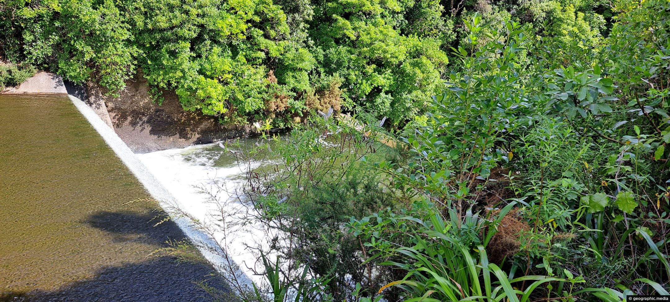
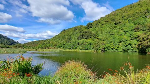
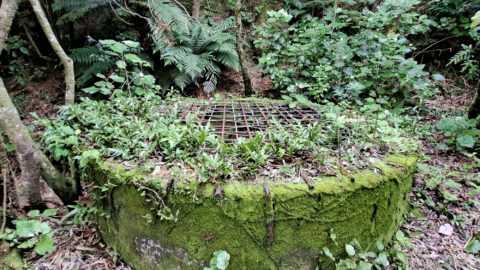
Looking down on the spillway for the lower dam. Despite being decommissioned, the spillway allows water from the Wainuiomata river and wetlands to flow to lower ground.
ALL / Explore Oceania / Explore New Zealand / New Zealand Photos / Wainuiomata photos / Lower Dam Spillway Wainuiomata Waterworks
All original royalty-free photos, shareable maps, and informative articles.
Lower Dam Spillway Wainuiomata Waterworks
Page Views
This post has been viewed 480 times
Related Articles
-
Morepork Owl
Wainuiomata photos, Animals, Extra Wide Horizontal, Forests
Observing a morepork (ruru), commonly referred to as the brown owl. Indigenous to New Zealand and Norfolk Island, this...
-
Coastline prior to the 1855 Wairarapa earthquake
Wainuiomata photos, Beaches, Extra Wide Horizontal
This view shows rocks that once formed the coastline prior to the 1855 Wairarapa earthquake. The powerful 8.2 magnitude...
-
Richard Prouse Park Eastern View
Wainuiomata photos, Extra Wide Horizontal, Parks
Looking at the eastern side of Richard Prouse Park from high up a nearby hillside. Houses on Hine Road...
-
Richard Prouse Park and Harry Todd Recreation Reserve
Wainuiomata photos, Extra Wide Horizontal, Mountains, Parks
Overlooking Richard Prouse Park, with Harry Todd Recreation Reserve on the hillside to the right and Wainuiomata Regional Park...
-
Upstream Wainuiomata River
Wainuiomata photos, Portrait / Vertical, Rivers
The view of Wainuiomata River near Sledge Track Pool, a natural swimming area. About 100 metres upstream from here,...
-
River at Richard Prouse Park
Wainuiomata photos, Extra Wide Horizontal, Forests, Rivers
View of Wainuiomata River on the edge of Richard Prouse Park. This part of the river has a few...
-
Wainuiomata Valley
Wainuiomata photos, Cities, Extra Wide Horizontal, Mountains
Although Wainuiomata is considered a suburb of Lower Hutt, it is nestled within its own secluded valley distinct from...
-
Kahikatea Canopy
Wainuiomata photos, Forests, Portrait / Vertical, Trees
Young kahikatea trees forming a canopy inside a regenerating podocarp rainforest in Wainuiomata Regional Park. These trees can reach...
0 Comments
Calendar
M | T | W | T | F | S | S |
---|---|---|---|---|---|---|
1 | 2 | 3 | 4 | |||
5 | 6 | 7 | 8 | 9 | 10 | 11 |
12 | 13 | 14 | 15 | 16 | 17 | 18 |
19 | 20 | 21 | 22 | 23 | 24 | 25 |
26 | 27 | 28 | 29 | 30 | 31 |
Popular Posts
- Awakening New Zealand video (100)
- Iguazu Falls as seen from Brazil (87)
- Metrocable Medellin (78)
- Pauatahanui Inlet (69)
- Spinnaker Hill in Whitby Porirua (68)
- Spinnaker Hill View (68)
- View from Whitby (68)
- The Devil’s Throat (62)
- Aerial View of Iguazu Falls (61)
- Porirua Harbour & Papakowhai (57)
- Lake Wakatipu (57)
- Salto Rivadavia & Iguassu River (56)
- Lake Tekapo & Lupins (54)
- Nelson View (53)
- Salto Rivadavia Misiones Province (53)
- Cascadas at Iguazu (53)
Subjects
AccommodationAnimalsArchitectureBeachesBirdsBoatsBridgesBuildingsCarsChurchesCitiesCoralCultureExtra Wide HorizontalFlowersForestsHarborsHomesIslandsLakesLandscape / HorizontalMapsMenMonumentsMountainsPalmsParksPeoplePlantsPortrait / VerticalRiversRoadsRuralSeaShopsSkyscrapersSnowSunsetsTownsTrailsTransportTreesVideosVolcanicWaterfalls
Recent Comments
- Lance on Concrete Hut Wainuiomata
- Tony on Concrete Hut Wainuiomata
- DavidJ on Wellington Night Skyline
- Ben on Auckland City Skyline from Westhaven Marina in 1998
- Ben on Auckland Harbour Bridge view