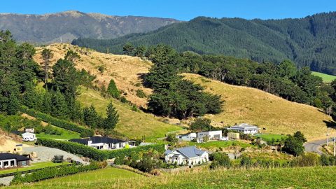
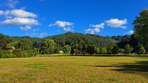
Whitemans Valley is a rural valley near the city of Upper Hutt in the lower North Island. Situated to the east of the Upper Hutt basin, the valley is characterised by rolling farmland, lifestyle properties, and patches of regenerating native bush.
ALL / Explore Oceania / Explore New Zealand / New Zealand Photos / Upper Hutt photos / View of Whitemans Valley
All original royalty-free photos, shareable maps, and informative articles.
View of Whitemans Valley
Page Views
This post has been viewed 245 times
Related Articles
-
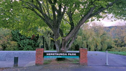
Heretaunga Park Entrance
Upper Hutt photos, Extra Wide Horizontal, Parks
Heretaunga Park entrance amd sign on Kiwi Street in Upper Hutt. Heretaunga Park offers amenities such as a playground,...
-
Maidstone Park Walks
Upper Hutt photos, Extra Wide Horizontal, Forests, Parks
This path offers several small tracks that take you through the bush and up to the ridgeline, where you...
-
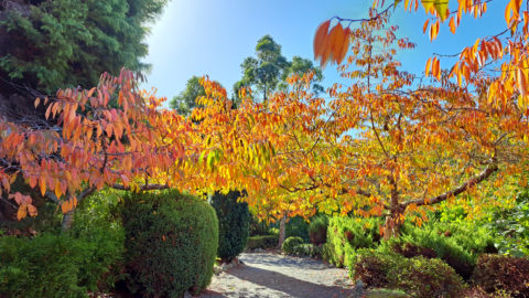
Aston Norwood Gardens Walk
Upper Hutt photos, Autumn, Landscape / Horizontal, Trees
Walking through Aston Norwood Gardens during fall in Upper Hutt. The gardens has a wedding venue allowing for some...
-
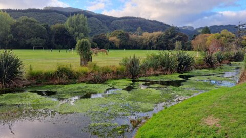
Māwaihākona Stream & Park
Upper Hutt photos, Extra Wide Horizontal, Parks, Rivers
View of Māwaihākona Stream within Heretaunga Park in Upper Hutt. The location is close to Silverstream College.
-
Whitemans Valley Farm Houses
Upper Hutt photos, Extra Wide Horizontal, Homes, Rural
Viewing several farmhouses in Whitemans Valley near Upper Hutt. The valley is predominantly rural, with a number of connecting...
-
Pinehaven Reserve
Upper Hutt photos, Extra Wide Horizontal, Parks
Pinehaven reserve sits at the center of Pinehaven, a suburb in Upper Hutt. Within the reserve is a large...
-
St Pats Rugby Field
Upper Hutt photos, Extra Wide Horizontal, Frost, Parks
A picturesque view of the rugby field at St Pats College in Silverstream, Upper Hutt. In winter, it’s not...
-
Flooded Hutt River in 2024
Upper Hutt photos, Extra Wide Horizontal, Floods, Rivers
Continuous heavy rain in August and September 2024 caused the Hutt River to rise significantly above its usual height.
0 Comments
Popular Posts
- Awakening New Zealand video (100)
- Iguazu Falls as seen from Brazil (87)
- Metrocable Medellin (78)
- Pauatahanui Inlet (69)
- Spinnaker Hill View (69)
- Spinnaker Hill in Whitby Porirua (69)
- View from Whitby (68)
- The Devil’s Throat (63)
- Aerial View of Iguazu Falls (61)
- Porirua Harbour & Papakowhai (58)
- Lake Wakatipu (57)
- Salto Rivadavia & Iguassu River (56)
- Salto Rivadavia Misiones Province (54)
- Close up of Salto Rivadavia (54)
- Cascadas at Iguazu (54)
- Lake Tekapo & Lupins (54)
Subjects
AccommodationAnimalsArchitectureBeachesBirdsBoatsBridgesBuildingsCarsChurchesCitiesCoralCultureExtra Wide HorizontalFlowersForestsHarborsHomesIslandsLakesLandscape / HorizontalMapsMenMonumentsMountainsPalmsParksPeoplePlantsPortrait / VerticalRiversRoadsRuralSeaShopsSkyscrapersSnowSunsetsTownsTrailsTransportTreesVideosVolcanicWaterfalls
Recent Comments
- DavidJ on The True Size of Australia
- Anonymous on The True Size of Australia
- Lance on Concrete Hut Wainuiomata
- Tony on Concrete Hut Wainuiomata
- DavidJ on Wellington Night Skyline