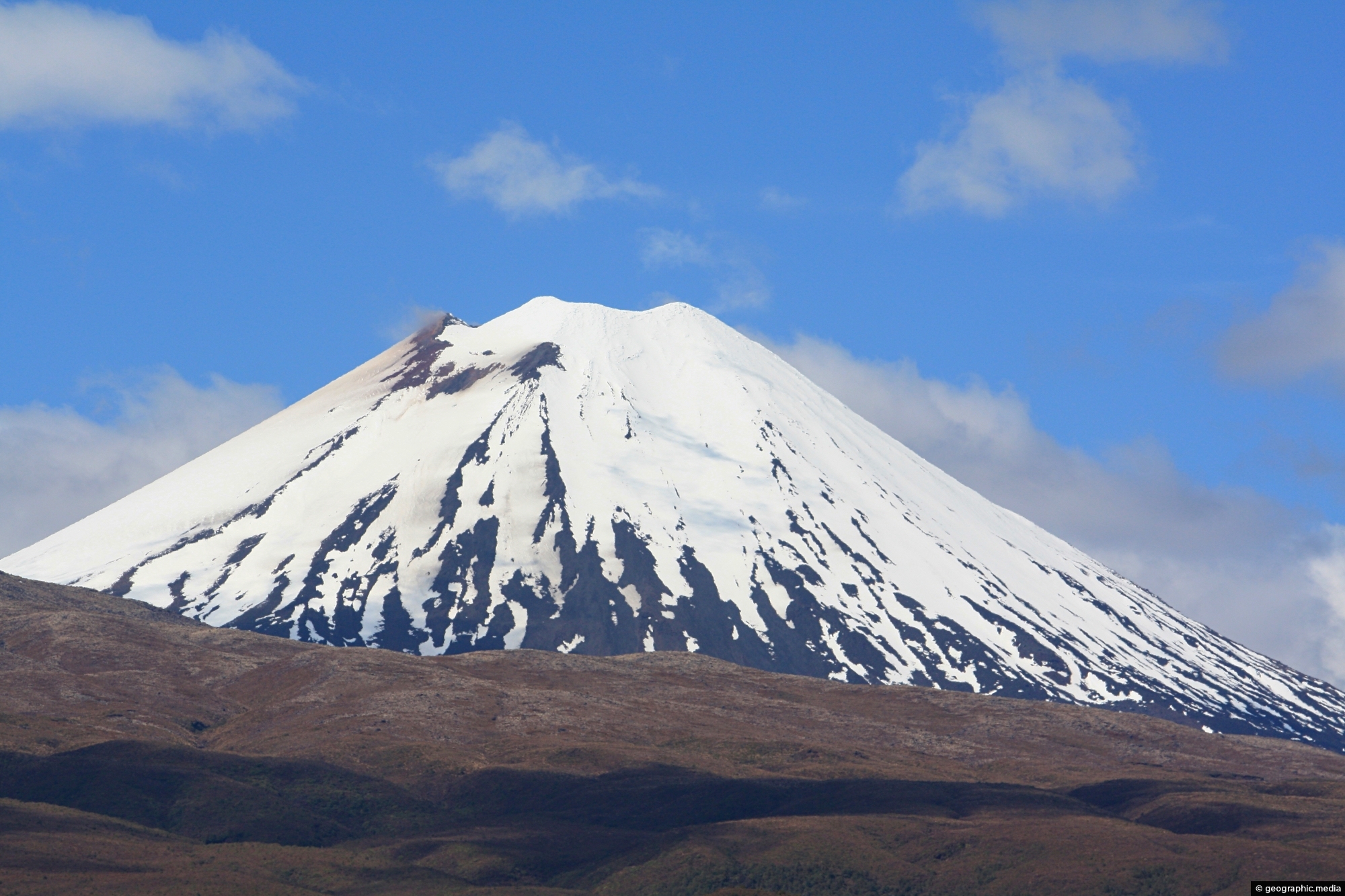
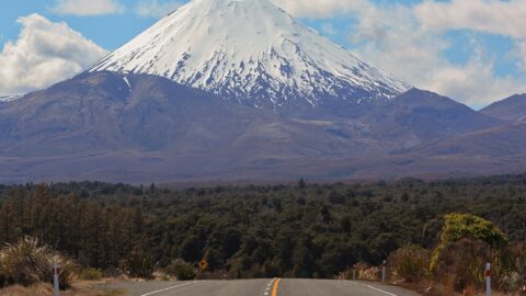
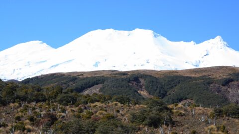
View of Mount Ngauruhoe and surrounding tussock hills in New Zealand’s Tongariro National Park. The volcano is an almost perfect cone shaped peak.
Mount Ngauruhoe View
Page Views
This post has been viewed 1,603 times
Related Articles
-
Toetoe
Tongariro National Park photos, Landscape / Horizontal, Plants, Wetlands
Looking at a swamp covered in toetoe in Tongariro National Park. Toetoe, also known as Cortaderia toetoe, is a...
-
Ohakune Mountain Road View
Tongariro National Park photos, Landscape / Horizontal, Mountains, Roads, Snow, Volcanic
Driving up Ohakune Mountain Road with the snow capped peak of Ruapehu in view. The road starts near the...
-
Mt Ruapehu & Tussock Field
Tongariro National Park photos, Landscape / Horizontal, Mountains, Plants, Snow, Volcanic, Wetlands
An unobstructed view of Mount Ruapehu in the central North Island from a large wetlands area containing native grasses....
-
Mount Ngauruhoe & Tussock Plains
Tongariro National Park photos, Landscape / Horizontal, Mountains, Snow, Volcanic
Mount Ngauruhoe is surrounded by tussock plains on the east and western sides. This view is seen from State...
-
Mount Ngauruhoe & Highway
Tongariro National Park photos, Landscape / Horizontal, Mountains, Snow, Volcanic
Mount Ngauruhoe comes into view on State Highway 47 in Tongariro National Park. The volcano is part of the...
-
Boardwalk & Tarns
Tongariro National Park photos, Lakes, Landscape / Horizontal, Mountains, Snow, Volcanic, Wetlands
The boardwalk over a wetland area containing tarns which are small mountain lakes. The walkway protects the fragile natural...
-
Ruapehu Peak View
Tongariro National Park photos, Landscape / Horizontal, Mountains, Roads, Snow, Volcanic
The snow capped peak of Mount Ruapehu can be seen clearly above areas of forest, tussock, and ancient lava...
-
Ohakune isite Visitor Information Centre
Tongariro National Park photos, Buildings, Landscape / Horizontal
The Ohakune isite Visitor Information Centre specialize in local insights and advice for travelers exploring the Ruapehu region. They...
0 Comments
Calendar
M | T | W | T | F | S | S |
---|---|---|---|---|---|---|
1 | 2 | 3 | 4 | |||
5 | 6 | 7 | 8 | 9 | 10 | 11 |
12 | 13 | 14 | 15 | 16 | 17 | 18 |
19 | 20 | 21 | 22 | 23 | 24 | 25 |
26 | 27 | 28 | 29 | 30 | 31 |
Popular Posts
- Awakening New Zealand video (100)
- Iguazu Falls as seen from Brazil (87)
- Metrocable Medellin (78)
- Pauatahanui Inlet (69)
- Spinnaker Hill in Whitby Porirua (68)
- Spinnaker Hill View (68)
- View from Whitby (68)
- The Devil’s Throat (62)
- Aerial View of Iguazu Falls (61)
- Porirua Harbour & Papakowhai (57)
- Lake Wakatipu (57)
- Salto Rivadavia & Iguassu River (56)
- Lake Tekapo & Lupins (54)
- Nelson View (53)
- Salto Rivadavia Misiones Province (53)
- Cascadas at Iguazu (53)
Subjects
AccommodationAnimalsArchitectureBeachesBirdsBoatsBridgesBuildingsCarsChurchesCitiesCoralCultureExtra Wide HorizontalFlowersForestsHarborsHomesIslandsLakesLandscape / HorizontalMapsMenMonumentsMountainsPalmsParksPeoplePlantsPortrait / VerticalRiversRoadsRuralSeaShopsSkyscrapersSnowSunsetsTownsTrailsTransportTreesVideosVolcanicWaterfalls
Recent Comments
- Lance on Concrete Hut Wainuiomata
- Tony on Concrete Hut Wainuiomata
- DavidJ on Wellington Night Skyline
- Ben on Auckland City Skyline from Westhaven Marina in 1998
- Ben on Auckland Harbour Bridge view