
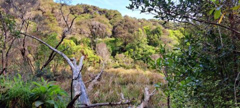
A tree is slowly rotting in a natural wetlands area inside the Wainuiomata Regional Park. The park is located...
Remutaka Range photos
About
About the Remutaka Range
Photos of the Remutaka Range in the Wellington region
The Remutaka Range comprises the southern part of the largest chain of mountains on New Zealand’s North Island. This chain of mountains runs from the Gisborne Region to the south coast in the Wellington Region. Additionally, it forms the boundary between Wellington and the Wairarapa.
Turakirae Head, located on the southern coast of the North Island, marks the extreme southern end of the range, while the northern boundary is marked by the Remutaka Hill Road. The Tararua Range lies beyond the latter boundary.
The western side of the range is lush due to the moist air rising and producing precipitation, while the eastern side is warmer and drier, making it suitable for the thriving wine industry on the plains below.
The range is home to temperate beech and rainforests, as well as alpine vegetation at higher altitudes. There are numerous bush trails that showcase the diverse flora and are accompanied by rivers such as the Orongorongo River and Wainuiomata River.
Although the Remutaka Range is not well-known to international tourists, locals consider it a destination for bushwalking and to escape from the hustle and bustle of the city. Hunting is allowed in the bush, with the exception of the Remutaka Forest Park located in the Lower Hutt suburb of Wainuiomata.
For more photos of the Remutaka (Rimutaka) Range, visit Virtual New Zealand.
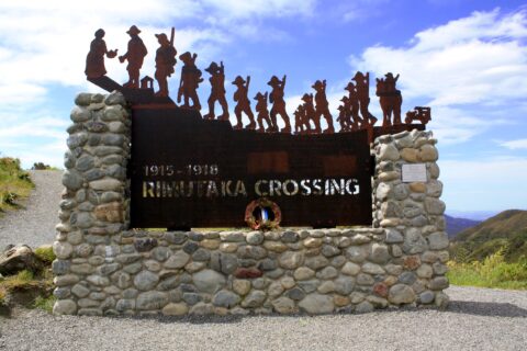
In honor of the soldiers who left for World War I from the Featherston Military Camp, a unique commemorative...
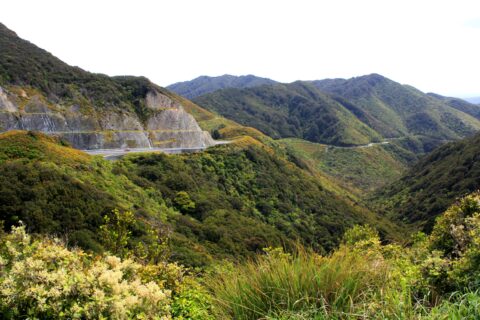
View of the Remutaka Hill Road which connects Wellington to the Wairarapa. The road also marks the boundary between...
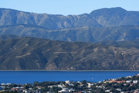
View from Mt Victoria looking past Wellington Harbour toward coastline near Eastbourne and the Remutaka Range in the background....
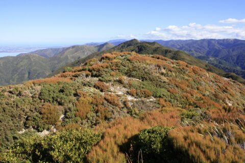
View of alpine vegetation on a mountain top in the Remutaka ranges. Lake Wairarapa can just be seen in...
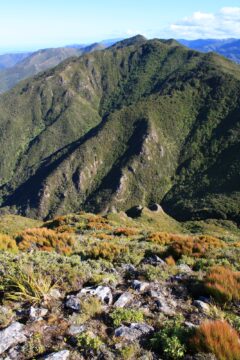
A mountain slope in the Remutaka ranges with the Wairarapa plains in the background. This range separates Wairarapa to...
Mount Climie is a peak located in the Rimutaka Range on the southern end of the North Island of...
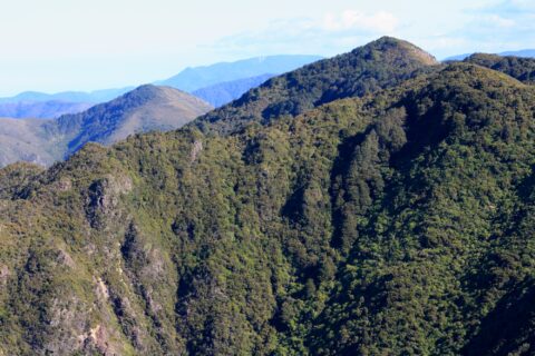
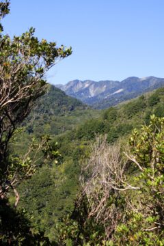
Subalpine view of the Remutaka Range, looking south, with Mount Climie prominently visible. Tunnel Gully serves as a key...
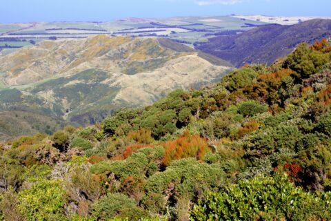
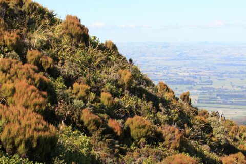
Looking at the eastern foothills of the Remutaka range with the Wairarapa region below. Lake Wairarapa can be seen...
Looking at the Remutaka Forest Park near the entrance on the Coast Road in Wainuiomata. The park contains numerous...
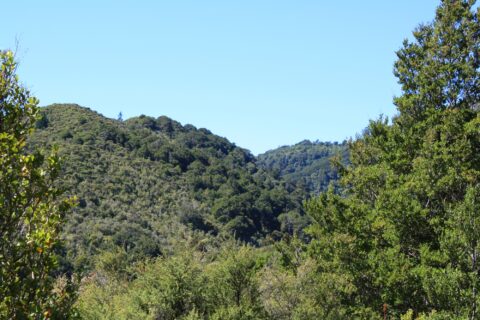
From within Remutaka Forest Park, one can view Clay Ridge, which can be accessed via a trail that commences...
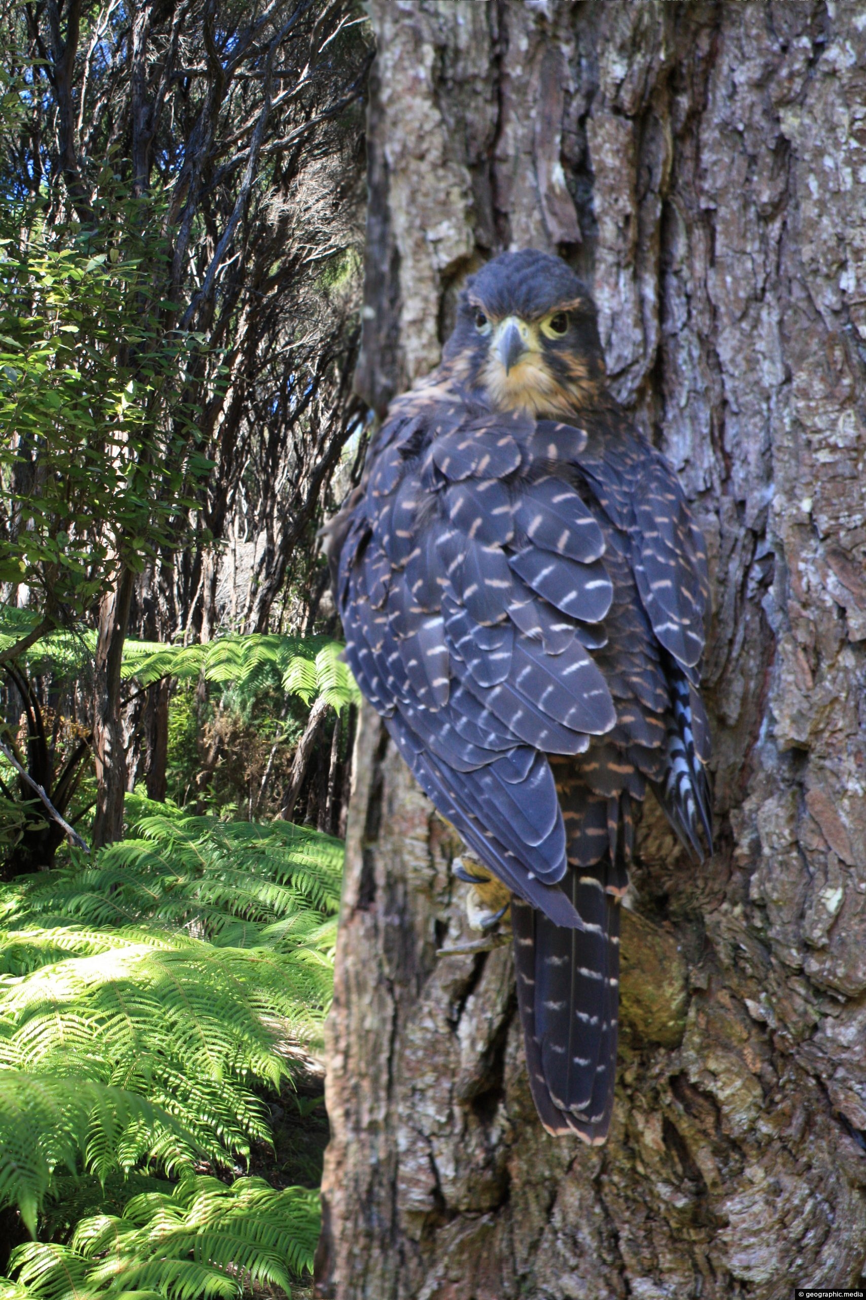
The New Zealand Falcon (Kārearea) is the only living bird of prey endemic to New Zealand. It exists south...

Recent Comments