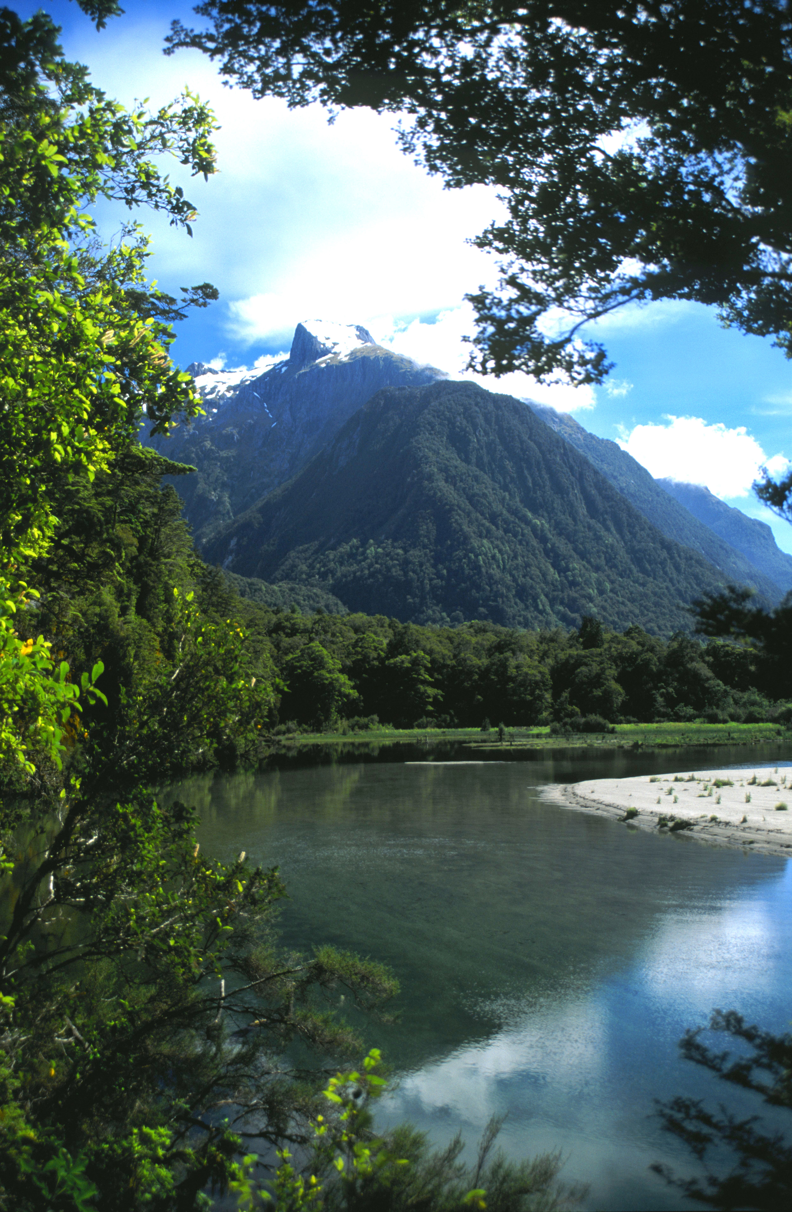
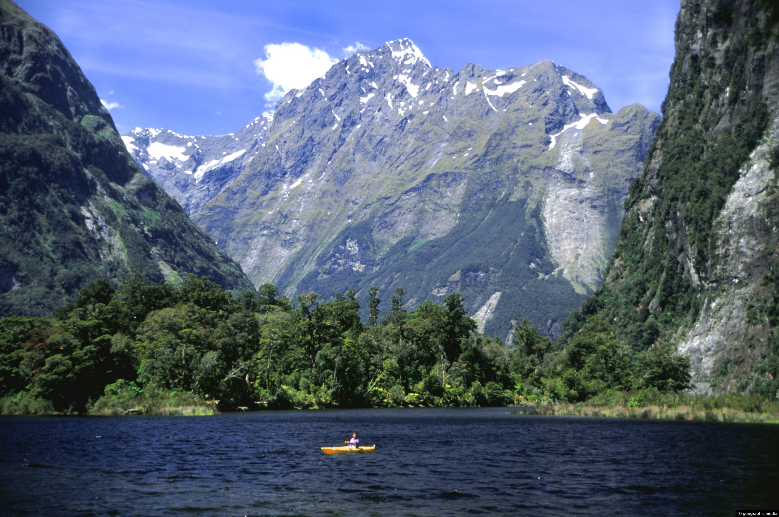
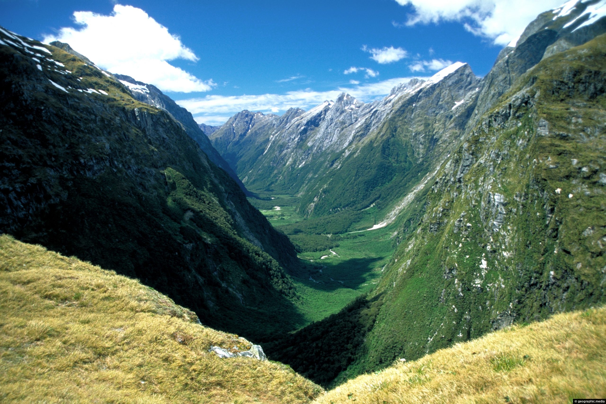
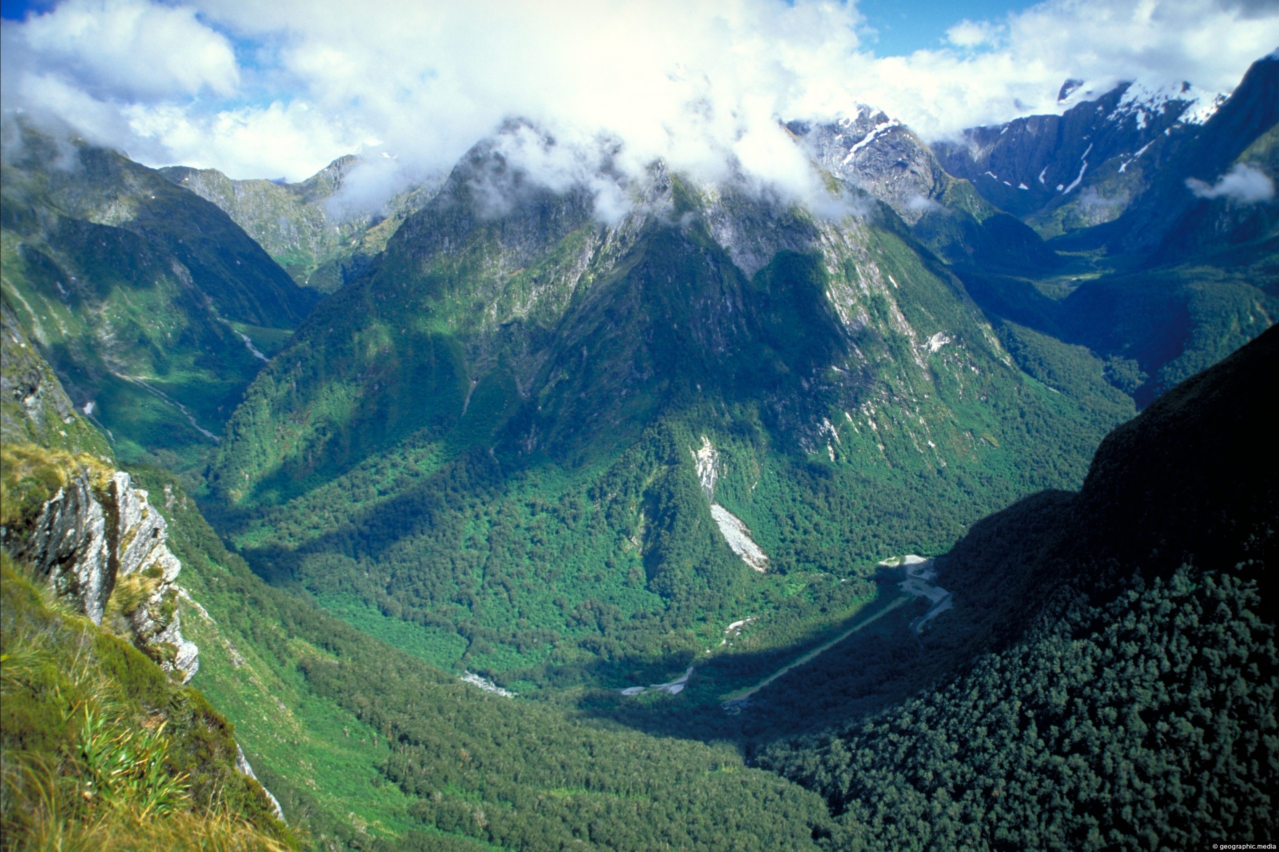
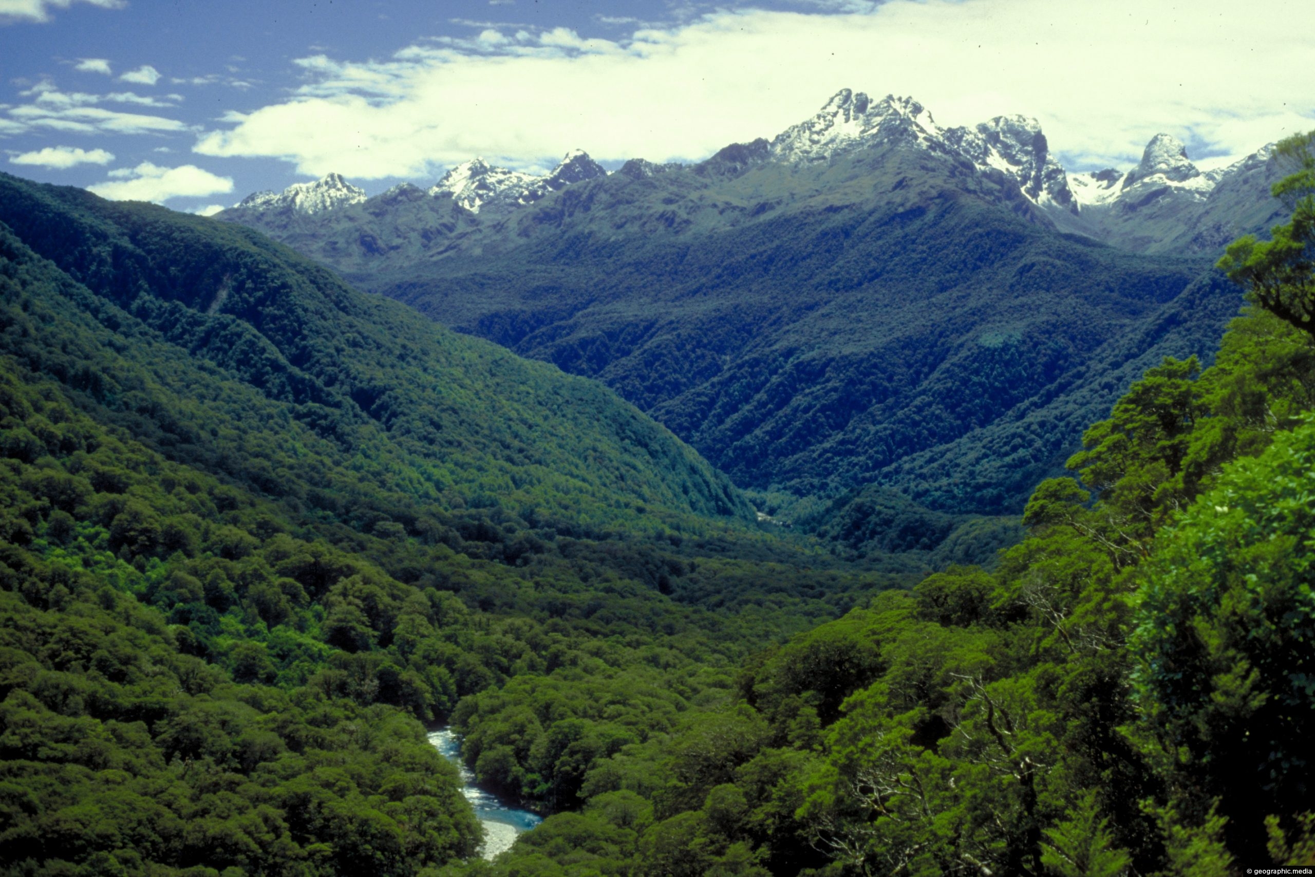
View of Arthur River from the Milford Track in New Zealand. This river is sourced from snow melt and rain high up in mountains of Fiordland. All this water eventually empties into Milford Sound and other fiords at an astounding rate through rivers and waterfalls.
ALL / Explore Oceania / Explore New Zealand / New Zealand Photos / Fiordland photos / Arthur River Fiordland National Park
All original royalty-free photos, shareable maps, and informative articles.
Arthur River Fiordland National Park
Page Views
This post has been viewed 3,660 times
Related Articles
-
Milford Sound in Fiordland National Park
Fiordland photos, Cliffs, Fiords, Landscape / Horizontal, Mountains, Sea
Milford Sound is one of the most spectacular sights in New Zealand. Located within Fiordland National Park, the fiord...
-
Milford Sound with Mitre Peak in view
Fiordland photos, Fiords, Landscape / Horizontal, Mountains, Sea
Milford Sound as seen from the coastline near the car park. In view is Mitre Peak, the sea, and...
-
A slice of Fiordland National Park
Fiordland photos, Forests, Mountains, Portrait / Vertical
Fiordland National Park is full of steep mountains flanked in rainforest that eventually rise high enough to reveal snowy...
-
Kayaking Milford Sound in Fiordland
Fiordland photos, Boats, Landscape / Horizontal, Mountains, Sea
Kayaking is a popular way to discover Milford Sound in Fiordland National Park. You get the chance to see...
-
Clinton Valley Fiordland National Park
Fiordland photos, Landscape / Horizontal, Mountains, Trails
Looking at Clinton Valley in Fiordland National Park. The famous Milford Track passes through here. This view is from...
-
View from Mackinnon Pass in Fiordland
Fiordland photos, Forests, Landscape / Horizontal, Mountains, Trails
Fiordland has deep mountainous landscapes and thick forest cover. Pictured is cloud shrouding a mountain peak as seen from...
-
Hollyford Valley Fiordland National Park
Fiordland photos, Forests, Landscape / Horizontal, Mountains, Rivers
View of Hollyford Valley in Fiordland National Park in New Zealand. The Hollyford River runs through this valley and...
-
Sandfly Point Fiordland National Park
Fiordland photos, Portrait / Vertical, Trails
Sign at Sandfly Point signifying the end of the Milford Track. The sign is decorated with discarded hiking boots....
0 Comments
Latest Posts
Browse by Date
M | T | W | T | F | S | S |
---|---|---|---|---|---|---|
1 | 2 | 3 | 4 | 5 | ||
6 | 7 | 8 | 9 | 10 | 11 | 12 |
13 | 14 | 15 | 16 | 17 | 18 | 19 |
20 | 21 | 22 | 23 | 24 | 25 | 26 |
27 | 28 | 29 | 30 | 31 |
Search
Calendar
M | T | W | T | F | S | S |
---|---|---|---|---|---|---|
1 | 2 | 3 | 4 | 5 | ||
6 | 7 | 8 | 9 | 10 | 11 | 12 |
13 | 14 | 15 | 16 | 17 | 18 | 19 |
20 | 21 | 22 | 23 | 24 | 25 | 26 |
27 | 28 | 29 | 30 | 31 |
Popular Posts
- Awakening New Zealand video (100)
- Iguazu Falls as seen from Brazil (86)
- Metrocable Medellin (77)
- Spinnaker Hill View (68)
- Spinnaker Hill in Whitby Porirua (68)
- Pauatahanui Inlet (68)
- View from Whitby (68)
- The Devil’s Throat (62)
- Aerial View of Iguazu Falls (61)
- Porirua Harbour & Papakowhai (57)
- Lake Wakatipu (57)
- Salto Rivadavia & Iguassu River (56)
- Lake Tekapo & Lupins (54)
- Cascadas at Iguazu (53)
- Close up of Salto Rivadavia (53)
- Salto Rivadavia Misiones Province (53)
Subjects
AccommodationAnimalsArchitectureBeachesBirdsBoatsBridgesBuildingsCarsChurchesCitiesCliffsCoralCultureExtra Wide HorizontalFlowersForestsHarborsHomesIslandsLakesLandscape / HorizontalMapsMenMonumentsMountainsPalmsParksPeoplePlantsPortrait / VerticalRiversRoadsRuralSeaShopsSkyscrapersSnowSunsetsTownsTransportTreesVideosVolcanicWaterfalls
Recent Comments
- Lance on Concrete Hut Wainuiomata
- DavidJ on Concrete Hut Wainuiomata
- Tony on Concrete Hut Wainuiomata
- DavidJ on Wellington Night Skyline
- Ben on Auckland City Skyline from Westhaven Marina in 1998