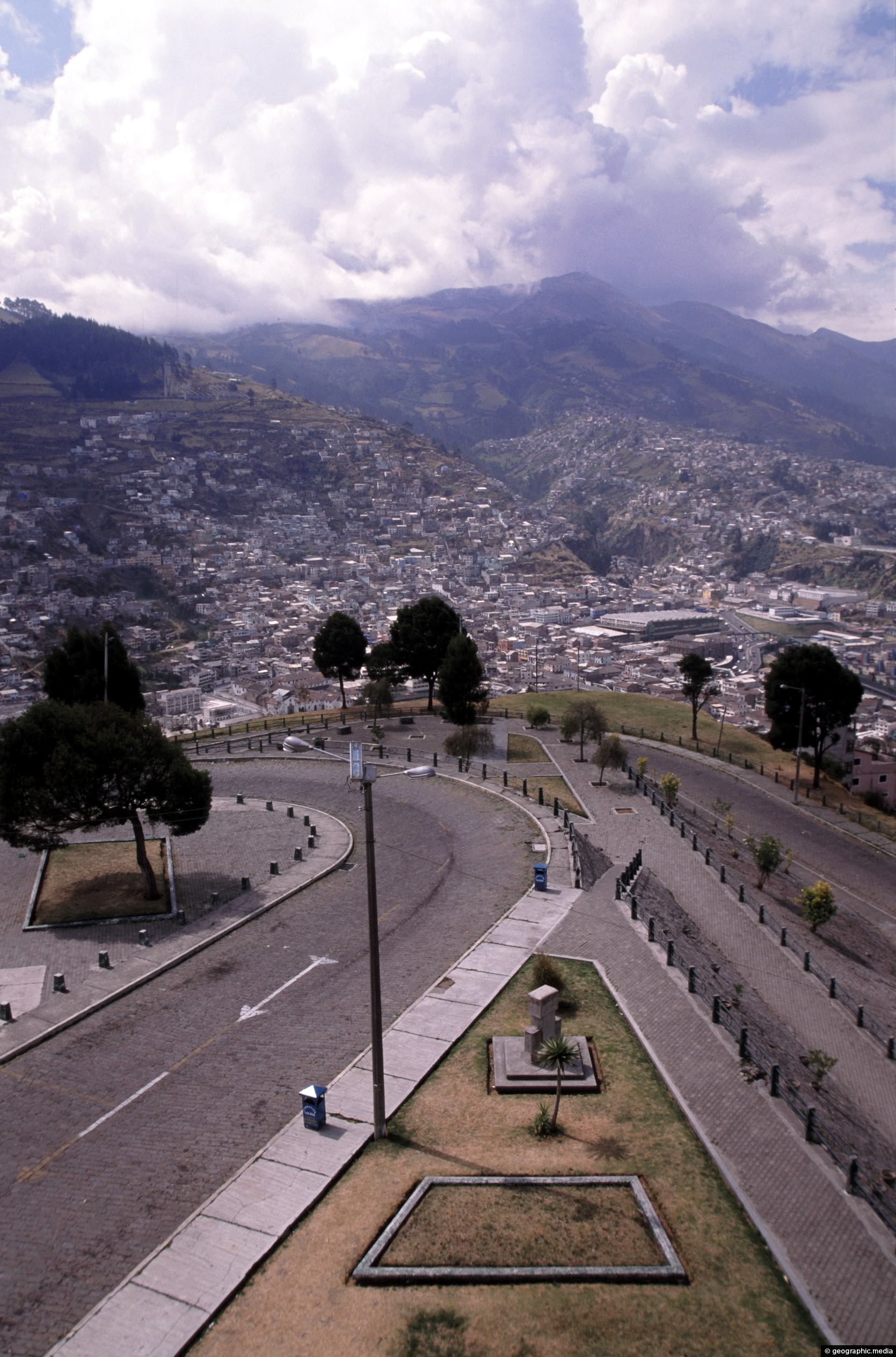
View of a road that descends down from El Panecillo Hill toward central Quito. At the bottom is the colonial part of Quito.
Click Jigshare icon to turn the image into a jigsaw. Or click on photo to download or view full screen image.

View of a road that descends down from El Panecillo Hill toward central Quito. At the bottom is the colonial part of Quito.
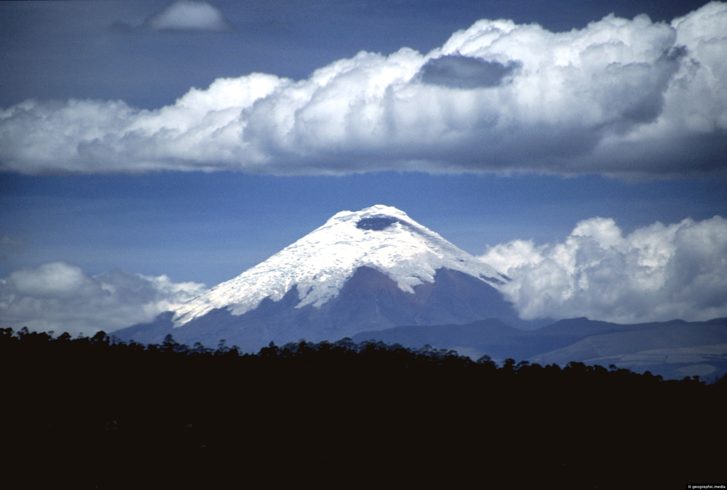
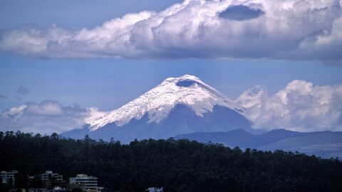
View of Cotopaxi Volcano located in the Andes mountains. This stratovolcano reaches a height of 5,897 metres, making it...
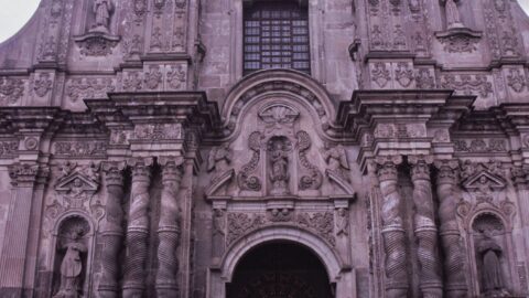
The La Compania Church showcases one of the most notable examples of Spanish Baroque architectural style in South America.
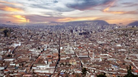
View of Quito from El Panecillo Hill showing how extensive the city’s colonial architecture is. The CBD can be...
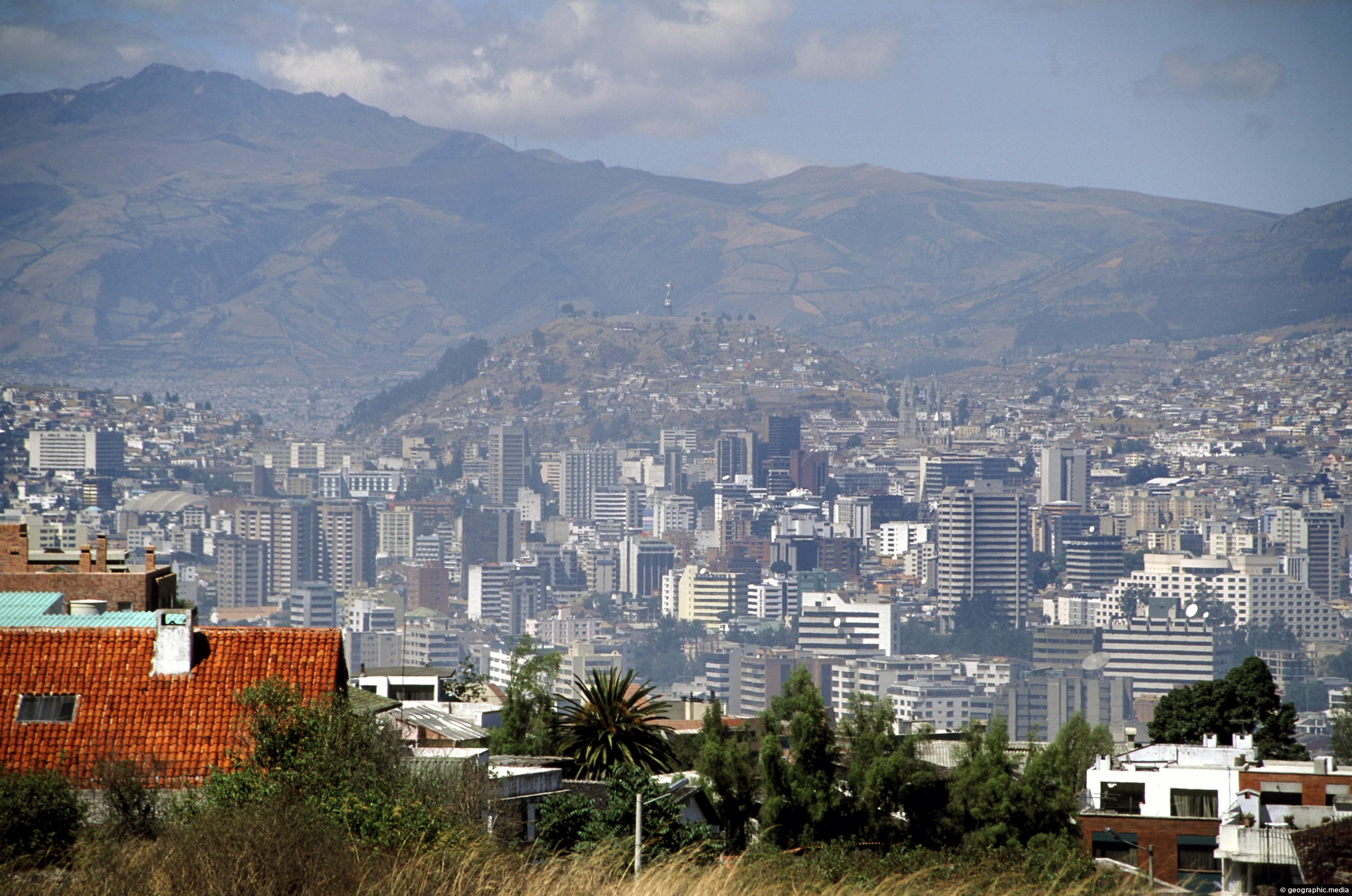
View of Quito’s central business district as seen from Calle Guanguiltagua (Guanguiltagua Street). La Virgen de Quito can be...
Pululahua is actually a volcanic caldera. It is located near Quito, the capital city of Ecuador. The word “Pululahua”...
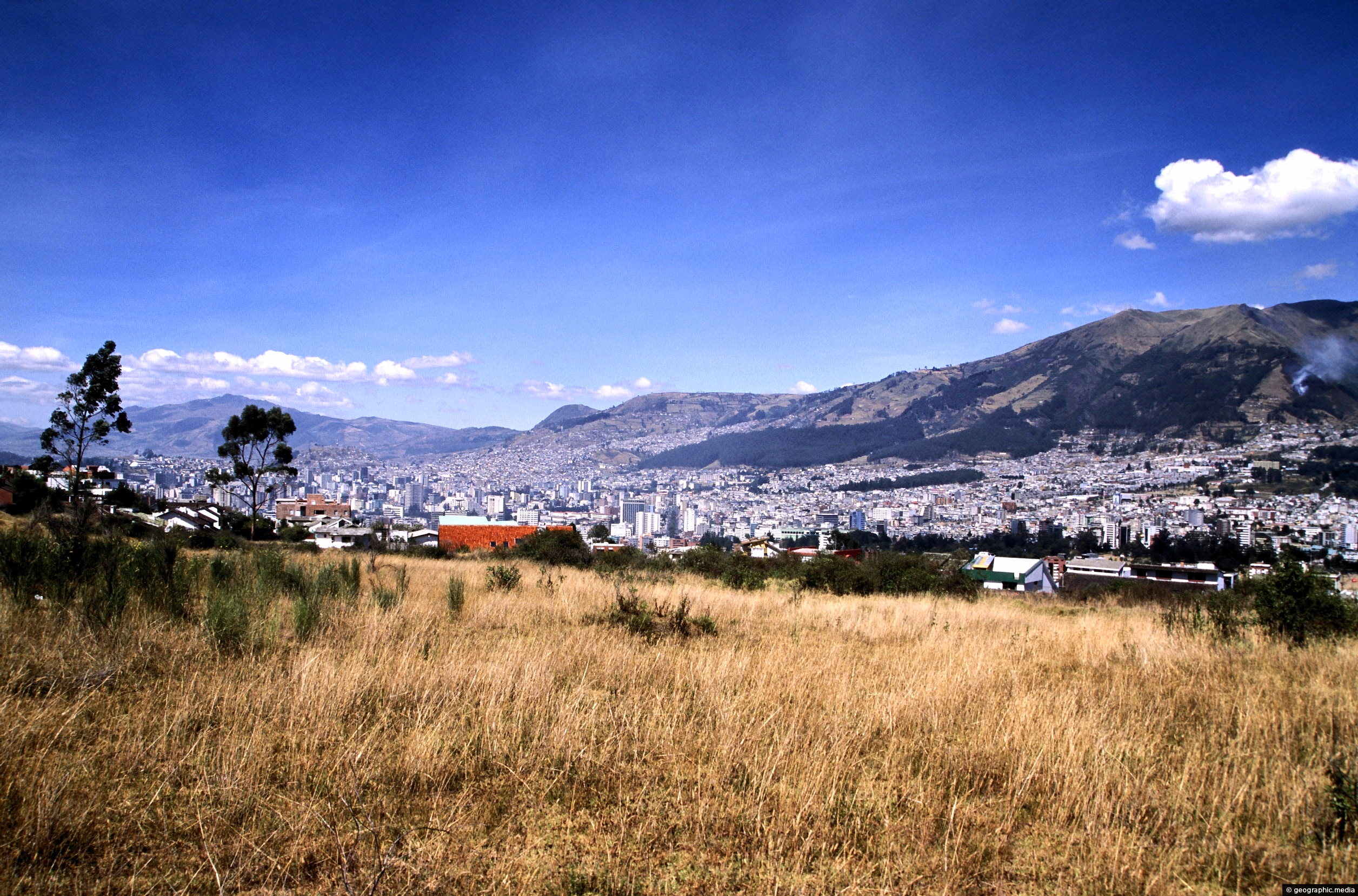
View from the edge of Guanguiltagua Metropolitan Park in the east looking south toward central Quito. The western hills...
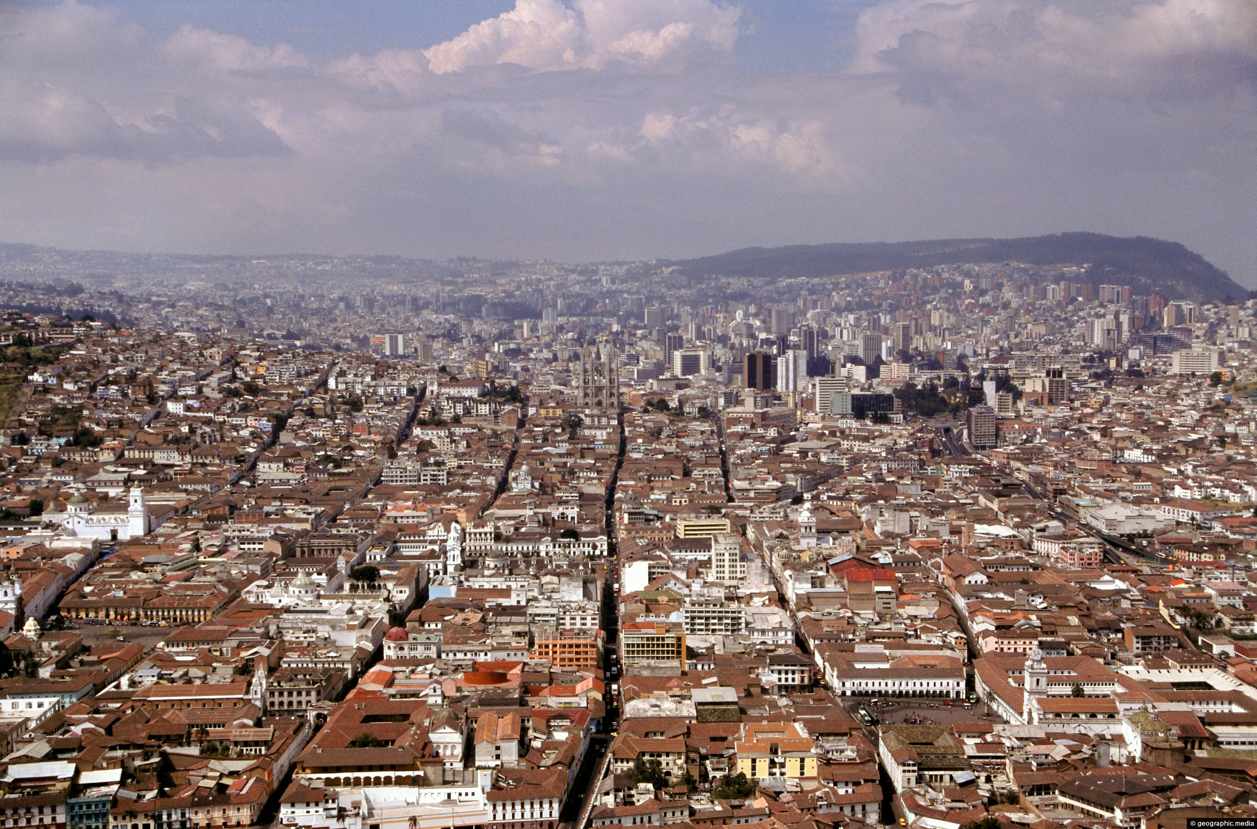
Extensive view of north Quito in Ecuador as seen from El Panecillo Hill. This hill also offers views of...
Looking at Cotopaxi volcano as seen from Quito. This volcano is part of the Andes mountains. Some homes and...
