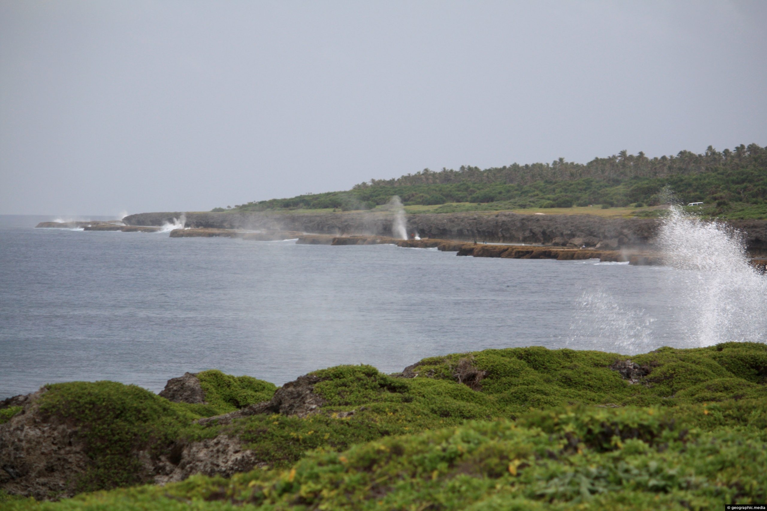
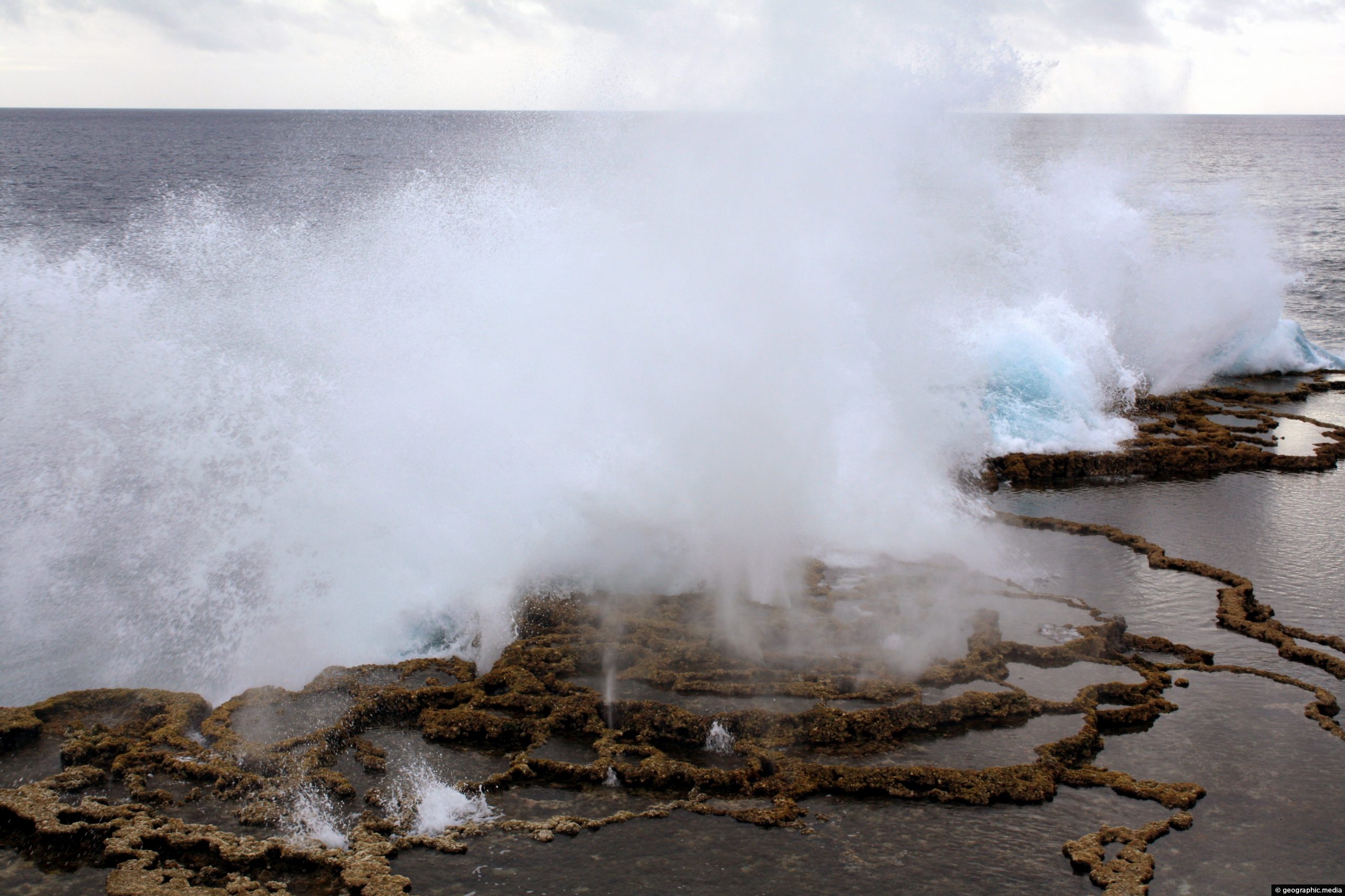
This location on the east side of Tongatpu Island is historically significant. British explorer Captain James Cook came ashore here when he visited Tongatapu Island back in 1777. He dubbed Tonga the “Friendly Islands” due to the warm welcome he received.
ALL / Explore Oceania / Explore Tonga / Tonga Photos / Tongatapu Island photos / Captain Cook’s Landing Place in Tongatapu Island
All original royalty-free photos, shareable maps, and informative articles.
Captain Cook’s Landing Place in Tongatapu Island
Page Views
This post has been viewed 499 times
Related Articles
-
Local Church in a small settlement on Tongatapu
Tongatapu Island photos, Buildings, Churches, Landscape / Horizontal
Looking at a colorful local church building in a small settlement on the island of Tongatapu in Tonga.
-
Footprints in Ha’atafu Beach
Tongatapu Island photos, Beaches, Landscape / Horizontal, Palms, Sea, Tropics
Leaving footprints on Ha’atafu Beach on Tongatapu Island.
-
Church service in Nukualofa Tonga
Tongatapu Island photos, Churches, Culture, Landscape / Horizontal, People
Most Tongans attend a church service of some kind on Sunday. Pictured is a local church service in the...
-
Waves crashing at Mapu a Vaea
Tongatapu Island photos, Coral, Landscape / Horizontal, Sea
Waves crashing into a coral reef barrier at Mapu a Vaea. This part of the Tongatapu Island coastline is...
-
Palm Trees on Tongatapu Island
Tongatapu Island photos, Landscape / Horizontal, Palms, Trees
Looking at a grove of palm trees on Tongatapu Island in Tonga. Palm trees are a crop in Tonga,...
-
Ha’atafu Beach on Tongatpu Island
Tongatapu Island photos, Beaches, Coral, Landscape / Horizontal, Palms, Tropics
Ha’atafu Beach is an idyllic stretch of beach and coral reef on Tongatapu Island. The coast here is a...
-
Swimming in the Sea at Nukualofa Tonga
Tongatapu Island photos, Landscape / Horizontal, People, Sea
Tongans enjoying a swim in the sea near Nukualofa. The town is located on the coastline so it is...
-
Mapu a Vaea at Tongatapu Island
Tongatapu Island photos, Beaches, Landscape / Horizontal, Sea
Mapu a Vaea is a 5 km (3 mi) stretch of the Tongatapu Island coastline. The surf crashes against...
0 Comments
Latest Posts
Popular Posts
- Awakening New Zealand video (100)
- Iguazu Falls as seen from Brazil (86)
- Metrocable Medellin (77)
- Spinnaker Hill View (68)
- Spinnaker Hill in Whitby Porirua (68)
- Pauatahanui Inlet (68)
- View from Whitby (68)
- The Devil’s Throat (62)
- Aerial View of Iguazu Falls (61)
- Porirua Harbour & Papakowhai (57)
- Lake Wakatipu (57)
- Salto Rivadavia & Iguassu River (56)
- Lake Tekapo & Lupins (54)
- Cascadas at Iguazu (53)
- Close up of Salto Rivadavia (53)
- Salto Rivadavia Misiones Province (53)
Subjects
AccommodationAnimalsArchitectureBeachesBirdsBoatsBridgesBuildingsCarsChurchesCitiesCliffsCoralCultureExtra Wide HorizontalFlowersForestsHarborsHomesIslandsLakesLandscape / HorizontalMapsMenMonumentsMountainsPalmsParksPeoplePlantsPortrait / VerticalRiversRoadsRuralSeaShopsSkyscrapersSnowSunsetsTownsTransportTreesVideosVolcanicWaterfalls
Recent Comments
- Lance on Concrete Hut Wainuiomata
- DavidJ on Concrete Hut Wainuiomata
- Tony on Concrete Hut Wainuiomata
- DavidJ on Wellington Night Skyline
- Ben on Auckland City Skyline from Westhaven Marina in 1998