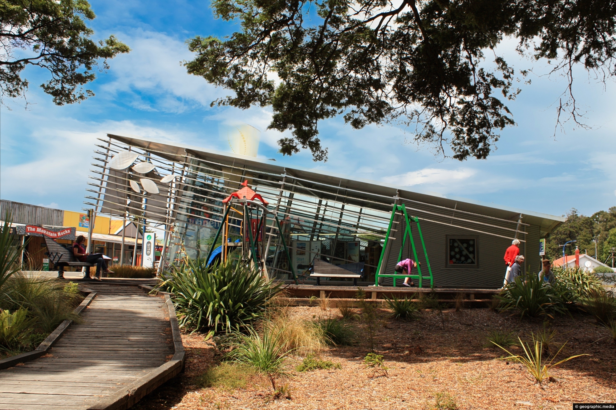
The Ohakune isite Visitor Information Centre specialize in local insights and advice for travelers exploring the Ruapehu region. They also provide general travel information on the rest of New Zealand.
ALL / Explore Oceania / Explore New Zealand / New Zealand Photos / Tongariro National Park photos / Ohakune isite Visitor Information Centre
All original royalty-free photos, shareable maps, and informative articles.
Ohakune isite Visitor Information Centre
Page Views
This post has been viewed 423 times
Related Articles
-
Ohakune Mountain Road View
Tongariro National Park photos, Landscape / Horizontal, Mountains, Roads, Snow, Volcanic
Driving up Ohakune Mountain Road with the snow capped peak of Ruapehu in view. The road starts near the...
-
Mt Ruapehu Pasture
Tongariro National Park photos, Landscape / Horizontal, Mountains, Rural, Snow, Volcanic
Lush green grass with Mt Ruapehu in view. Surrounding this volcano are a number of diverse landscapes. While most...
-
Mount Ngauruhoe View
Tongariro National Park photos, Landscape / Horizontal, Mountains, Snow, Volcanic
View of Mount Ngauruhoe and surrounding tussock hills in New Zealand’s Tongariro National Park. The volcano is an almost...
-
Ohakune & Ruapehu
Tongariro National Park photos, Cars, Landscape / Horizontal, Mountains, Roads, Shops, Snow, Volcanic
In view is the small town of Ohakune with Mount Ruapehu in the background. Ohakune is a great base...
-
Boardwalk & Tarns
Tongariro National Park photos, Lakes, Landscape / Horizontal, Mountains, Snow, Volcanic, Wetlands
The boardwalk over a wetland area containing tarns which are small mountain lakes. The walkway protects the fragile natural...
-
Toetoe
Tongariro National Park photos, Landscape / Horizontal, Plants, Wetlands
Looking at a swamp covered in toetoe in Tongariro National Park. Toetoe, also known as Cortaderia toetoe, is a...
-
Ruapehu Lava Field
Tongariro National Park photos, Landscape / Horizontal, Mountains, Volcanic
View of a lava field on the southern slopes of Mount Ruapehu. Created by an eruption where lava flowed...
-
Mangawhero Falls Walk
Tongariro National Park photos, Landscape / Horizontal, Mountains, Snow, Volcanic, Wetlands
This section of the Mangawhero Falls Walk uses a boardwalk in order to navigate an area of tarns. Tarns...
0 Comments
Calendar
M | T | W | T | F | S | S |
---|---|---|---|---|---|---|
1 | 2 | |||||
3 | 4 | 5 | 6 | 7 | 8 | 9 |
10 | 11 | 12 | 13 | 14 | 15 | 16 |
17 | 18 | 19 | 20 | 21 | 22 | 23 |
24 | 25 | 26 | 27 | 28 |
Popular Posts
- Awakening New Zealand video (100)
- Iguazu Falls as seen from Brazil (87)
- Metrocable Medellin (78)
- Pauatahanui Inlet (69)
- Spinnaker Hill View (68)
- Spinnaker Hill in Whitby Porirua (68)
- View from Whitby (68)
- The Devil’s Throat (62)
- Aerial View of Iguazu Falls (61)
- Porirua Harbour & Papakowhai (57)
- Lake Wakatipu (57)
- Salto Rivadavia & Iguassu River (56)
- Lake Tekapo & Lupins (54)
- Nelson View (53)
- Salto Rivadavia Misiones Province (53)
- Cascadas at Iguazu (53)
Subjects
AccommodationAnimalsArchitectureBeachesBirdsBoatsBridgesBuildingsCarsChurchesCitiesCoralCultureExtra Wide HorizontalFlowersForestsHarborsHomesIslandsLakesLandscape / HorizontalMapsMenMonumentsMountainsPalmsParksPeoplePlantsPortrait / VerticalRiversRoadsRuralSeaShopsSkyscrapersSnowSunsetsTownsTrailsTransportTreesVideosVolcanicWaterfalls
Recent Comments
- Lance on Concrete Hut Wainuiomata
- Tony on Concrete Hut Wainuiomata
- DavidJ on Wellington Night Skyline
- Ben on Auckland City Skyline from Westhaven Marina in 1998
- Ben on Auckland Harbour Bridge view