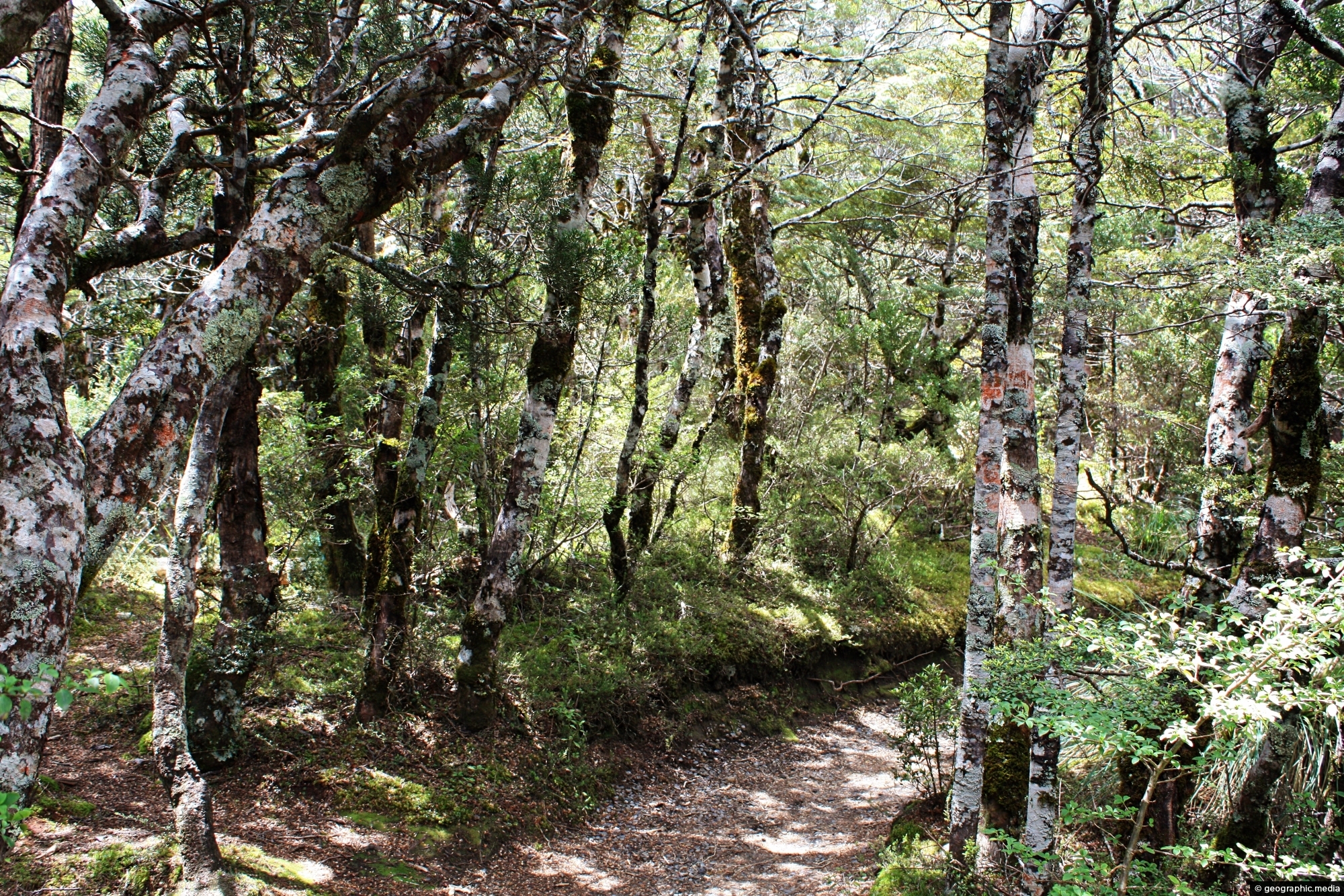
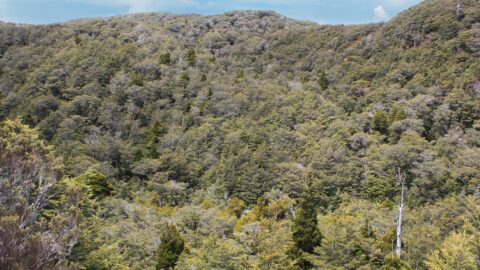
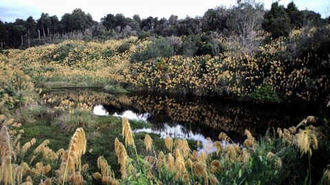
Below Mount Ruapehu and on the lower flanks are areas of native forest. There are a number of trails that allow exploration of these ancient forests. The photo is taken near the beginning of the Mangawhero Falls Walk.
Forest Walk on Ruapehu
Page Views
This post has been viewed 359 times
Related Articles
-
Mount Ngauruhoe & Highway
Tongariro National Park photos, Landscape / Horizontal, Mountains, Snow, Volcanic
Mount Ngauruhoe comes into view on State Highway 47 in Tongariro National Park. The volcano is part of the...
-
Toetoe
Tongariro National Park photos, Landscape / Horizontal, Plants, Wetlands
Looking at a swamp covered in toetoe in Tongariro National Park. Toetoe, also known as Cortaderia toetoe, is a...
-
Native Forest on Ruapehu
Tongariro National Park photos, Forests, Landscape / Horizontal, Plants
While much of the landscape around Mount Ruapehu consists of low scrub and tussock, there are also some tracts...
-
Mangawhero Falls Walk
Tongariro National Park photos, Landscape / Horizontal, Mountains, Snow, Volcanic, Wetlands
This section of the Mangawhero Falls Walk uses a boardwalk in order to navigate an area of tarns. Tarns...
-
Ruapehu Forest Canopy
Tongariro National Park photos, Forests, Landscape / Horizontal, Plants
Looking up at the canopy of a forest on the lower flanks of Mount Ruapehu. These are predominately mountain...
-
Mt Ruapehu Pasture
Tongariro National Park photos, Landscape / Horizontal, Mountains, Rural, Snow, Volcanic
Lush green grass with Mt Ruapehu in view. Surrounding this volcano are a number of diverse landscapes. While most...
-
Ohakune Mountain Road View
Tongariro National Park photos, Landscape / Horizontal, Mountains, Roads, Snow, Volcanic
Driving up Ohakune Mountain Road with the snow capped peak of Ruapehu in view. The road starts near the...
-
Ruapehu Lava Field
Tongariro National Park photos, Landscape / Horizontal, Mountains, Volcanic
View of a lava field on the southern slopes of Mount Ruapehu. Created by an eruption where lava flowed...
0 Comments
Calendar
M | T | W | T | F | S | S |
---|---|---|---|---|---|---|
1 | ||||||
2 | 3 | 4 | 5 | 6 | 7 | 8 |
9 | 10 | 11 | 12 | 13 | 14 | 15 |
16 | 17 | 18 | 19 | 20 | 21 | 22 |
23 | 24 | 25 | 26 | 27 | 28 | 29 |
30 |
Popular Posts
- Awakening New Zealand video (100)
- Iguazu Falls as seen from Brazil (87)
- Metrocable Medellin (78)
- Pauatahanui Inlet (69)
- Spinnaker Hill View (68)
- Spinnaker Hill in Whitby Porirua (68)
- View from Whitby (68)
- The Devil’s Throat (62)
- Aerial View of Iguazu Falls (61)
- Porirua Harbour & Papakowhai (57)
- Lake Wakatipu (57)
- Salto Rivadavia & Iguassu River (56)
- Lake Tekapo & Lupins (54)
- Nelson View (53)
- Salto Rivadavia Misiones Province (53)
- Cascadas at Iguazu (53)
Subjects
AccommodationAnimalsArchitectureBeachesBirdsBoatsBridgesBuildingsCarsChurchesCitiesCoralCultureExtra Wide HorizontalFlowersForestsHarborsHomesIslandsLakesLandscape / HorizontalMapsMenMonumentsMountainsPalmsParksPeoplePlantsPortrait / VerticalRiversRoadsRuralSeaShopsSkyscrapersSnowSunsetsTownsTrailsTransportTreesVideosVolcanicWaterfalls
Recent Comments
- Lance on Concrete Hut Wainuiomata
- Tony on Concrete Hut Wainuiomata
- DavidJ on Wellington Night Skyline
- Ben on Auckland City Skyline from Westhaven Marina in 1998
- Ben on Auckland Harbour Bridge view