
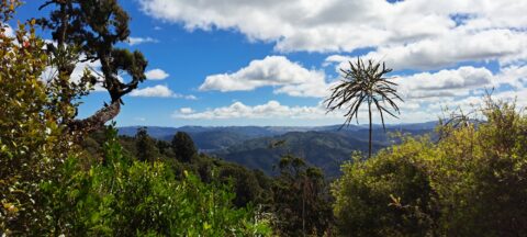
Observing the hills leading towards Wainuiomata from the summit of a ridge in the Remutaka Range, precisely along the...
Remutaka Range photos
About
About the Remutaka Range
Photos of the Remutaka Range in the Wellington region
The Remutaka Range comprises the southern part of the largest chain of mountains on New Zealand’s North Island. This chain of mountains runs from the Gisborne Region to the south coast in the Wellington Region. Additionally, it forms the boundary between Wellington and the Wairarapa.
Turakirae Head, located on the southern coast of the North Island, marks the extreme southern end of the range, while the northern boundary is marked by the Remutaka Hill Road. The Tararua Range lies beyond the latter boundary.
The western side of the range is lush due to the moist air rising and producing precipitation, while the eastern side is warmer and drier, making it suitable for the thriving wine industry on the plains below.
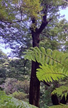
The range is home to temperate beech and rainforests, as well as alpine vegetation at higher altitudes. There are numerous bush trails that showcase the diverse flora and are accompanied by rivers such as the Orongorongo River and Wainuiomata River.
Although the Remutaka Range is not well-known to international tourists, locals consider it a destination for bushwalking and to escape from the hustle and bustle of the city. Hunting is allowed in the bush, with the exception of the Remutaka Forest Park located in the Lower Hutt suburb of Wainuiomata.
For more photos of the Remutaka (Rimutaka) Range, visit Virtual New Zealand.
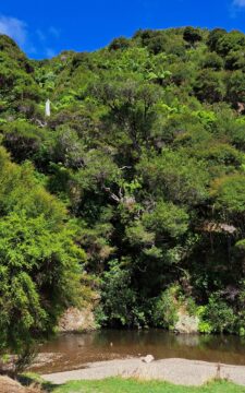
A natural swimming area in Wainuiomata Regional Park. This is Wainuiomata River which has numerous swimming areas.
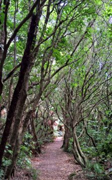
View of a typical walking trail in Catchpool Valley, located at the foothills of the Remutaka Range, in Wainuiomata.
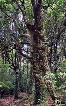
Unusual double trunk tree located in Catchpool Valley in the Remutaka Forest Park, Wainuiomata.
Walking across Catchpool Stream from the Catchpool Loop Track in the Remutaka Forest Park, Wainuiomata.
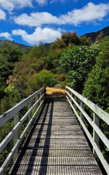
Walking trails in the Remutaka Forest Park contain numerous walking bridges to get you across creeks that flow through...
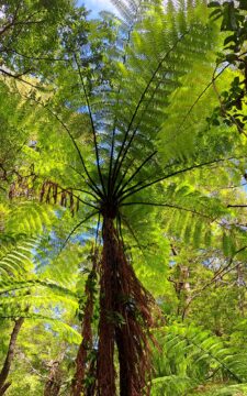
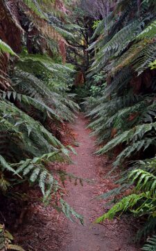
Sections of Remutaka Forest Park contain large fern trees, including black ferns and silver ferns with small fern plants...
The Five Mile Track within the Remutaka Forest Park, more specifically in Catchpool Valley, is an easy walk that...
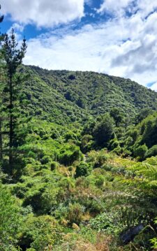
Perspective of Catchpool Valley in Wainuiomata, observed from the Five Mile Loop Track. The path swiftly delves into a...
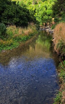
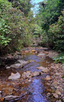
Catchpool Stream in Wainuiomata is a tributary of Wainuiomata River. The stream flows through the Remutaka Range and out...
Catchpool Loop Track is a short 30 minute walk in the Remutaka Forest Park. It is a great introduction...
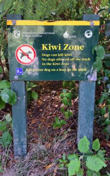
A sign alerting to walkers in the Remutaka Forest Park that there are kiwi birds in the forest and...

Recent Comments