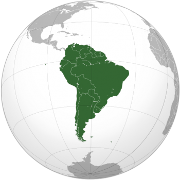
Extremities of the South American continent starting in the north with Colombia and Argentina in the south with the largest country Brazil taking up most of the eastern side of the continent. Most of the continent lies south of the equator with the southern tip of the continent almost touching the frozen continent of Antarctica. South America is surrounded by the Pacific Ocean to the west, Atlantic Ocean to the east, and Southern Ocean to the south.
ALL / Explore South America / South America Location Map
All original royalty-free photos, shareable maps, and informative articles.
South America Location Map
Page Views
This post has been viewed 1,264 times
0 Comments
Latest Posts
Popular Posts
- Awakening New Zealand video (100)
- Iguazu Falls as seen from Brazil (86)
- Metrocable Medellin (77)
- Spinnaker Hill View (68)
- Pauatahanui Inlet (68)
- View from Whitby (68)
- Spinnaker Hill in Whitby Porirua (67)
- The Devil’s Throat (62)
- Aerial View of Iguazu Falls (61)
- Porirua Harbour & Papakowhai (57)
- Lake Wakatipu (57)
- Salto Rivadavia & Iguassu River (56)
- Lake Tekapo & Lupins (54)
- Cascadas at Iguazu (53)
- Close up of Salto Rivadavia (53)
- Salto Rivadavia Misiones Province (53)
Subjects
AccommodationAnimalsArchitectureBeachesBirdsBoatsBridgesBuildingsCarsChurchesCitiesCliffsCoralCultureExtra Wide HorizontalFlowersForestsHarborsHomesIslandsLakesLandscape / HorizontalMapsMenMonumentsMountainsPalmsParksPeoplePlantsPortrait / VerticalRiversRoadsRuralSeaShopsSkyscrapersSnowSunsetsTownsTransportTreesVideosVolcanicWaterfalls
Recent Comments
- Lance on Concrete Hut Wainuiomata
- DavidJ on Concrete Hut Wainuiomata
- Tony on Concrete Hut Wainuiomata
- DavidJ on Wellington Night Skyline
- Ben on Auckland City Skyline from Westhaven Marina in 1998