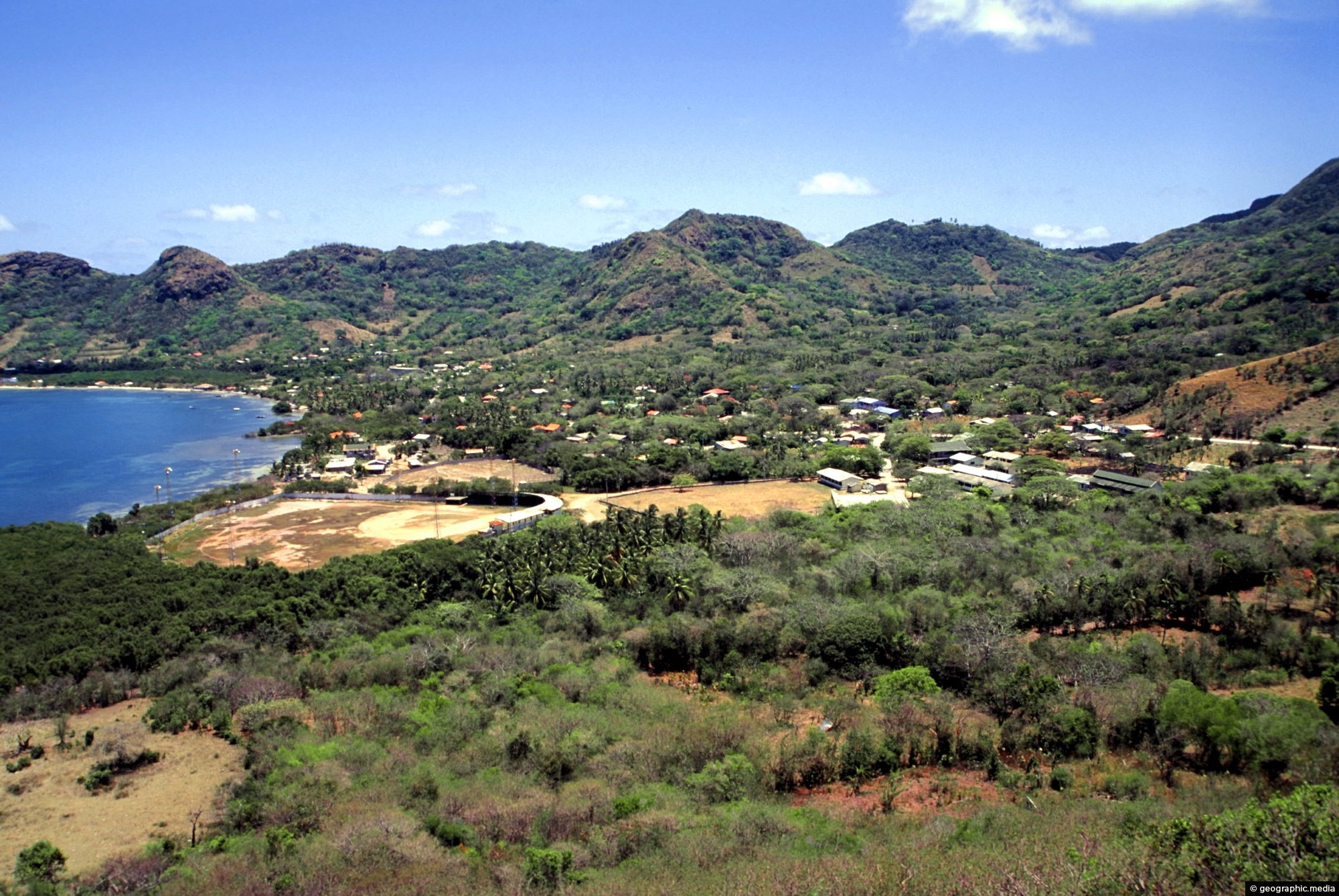
Santa Isabel is the largest town on Providencia Island and is located on the northern coast. It is where most of the island’s services and businesses are located. The town has a small airport, a few hotels, restaurants, and shops, and is also the main port for boats and ferries that come to and from the island.
ALL / Explore South America / Explore Colombia / Colombia Photos / Providencia photos / Santa Isabel Providencia Colombia
All original royalty-free photos, shareable maps, and informative articles.
Santa Isabel Providencia Colombia
Page Views
This post has been viewed 251 times
Related Articles
-
Palms at Manzanillo Bay in Providencia
Providencia photos, Beaches, Islands, Landscape / Horizontal, Palms, Sea, Trees
Coconut palms leaning over the white sand of Manzanillo Bay. One of many bays on Providencia Island, the palms...
-
View of Santa Catalina Island
Providencia photos, Islands, Landscape / Horizontal, Mountains, Sea
View of Santa Catalina Island as seen from the mountainous interior of Providencia Island. The exact location is the...
-
Mesoamerican Barrier Reef near Providencia
Providencia photos, Landscape / Horizontal, Reefs, Sea
The Mesoamerican Barrier Reef System is over 1000 km (621 mi) long. Running along the coast of Belize it...
-
Afro-Colombians on Providencia Hilltop
Providencia photos, Islands, Landscape / Horizontal, Men, Mountains, People, Sea, Trails
Two locals sitting atop the highest peak on Providencia Island. In view is Santa Catalina a neighboring island. Getting...
-
Coral Reef Providencia Island
Providencia photos, Coral, Islands, Landscape / Horizontal, Sea
Coral Reef off the coast of Providencia Island in the Caribbean Sea. Providencia also called Isla de Providencia is...
-
Santa Catalina and Providencia Island
Providencia photos, Islands, Landscape / Horizontal, Reefs, Sea
Bridge connecting Santa Catalina Island with Providencia Island. Santa Catalina is the smaller of the two islands. It is...
-
Providencia Island Interior
Providencia photos, Islands, Landscape / Horizontal, Mountains, Sea
Looking down from the highest point in the interior of Providencia Island at the surrounding landscape. Unlike nearby San...
-
Palms and Trail in Providencia
Providencia photos, Landscape / Horizontal, Palms, Trails, Trees
This trail through a palms forest eventually leads to the mountainous interior of Providencia Island. The highest peak on...
0 Comments
Calendar
M | T | W | T | F | S | S |
---|---|---|---|---|---|---|
1 | 2 | |||||
3 | 4 | 5 | 6 | 7 | 8 | 9 |
10 | 11 | 12 | 13 | 14 | 15 | 16 |
17 | 18 | 19 | 20 | 21 | 22 | 23 |
24 | 25 | 26 | 27 | 28 |
Popular Posts
- Awakening New Zealand video (100)
- Iguazu Falls as seen from Brazil (87)
- Metrocable Medellin (78)
- Pauatahanui Inlet (69)
- Spinnaker Hill in Whitby Porirua (68)
- Spinnaker Hill View (68)
- View from Whitby (68)
- The Devil’s Throat (62)
- Aerial View of Iguazu Falls (61)
- Porirua Harbour & Papakowhai (57)
- Lake Wakatipu (57)
- Salto Rivadavia & Iguassu River (56)
- Lake Tekapo & Lupins (54)
- Nelson View (53)
- Salto Rivadavia Misiones Province (53)
- Cascadas at Iguazu (53)
Subjects
AccommodationAnimalsArchitectureBeachesBirdsBoatsBridgesBuildingsCarsChurchesCitiesCoralCultureExtra Wide HorizontalFlowersForestsHarborsHomesIslandsLakesLandscape / HorizontalMapsMenMonumentsMountainsPalmsParksPeoplePlantsPortrait / VerticalRiversRoadsRuralSeaShopsSkyscrapersSnowSunsetsTownsTrailsTransportTreesVideosVolcanicWaterfalls
Recent Comments
- Lance on Concrete Hut Wainuiomata
- Tony on Concrete Hut Wainuiomata
- DavidJ on Wellington Night Skyline
- Ben on Auckland City Skyline from Westhaven Marina in 1998
- Ben on Auckland Harbour Bridge view