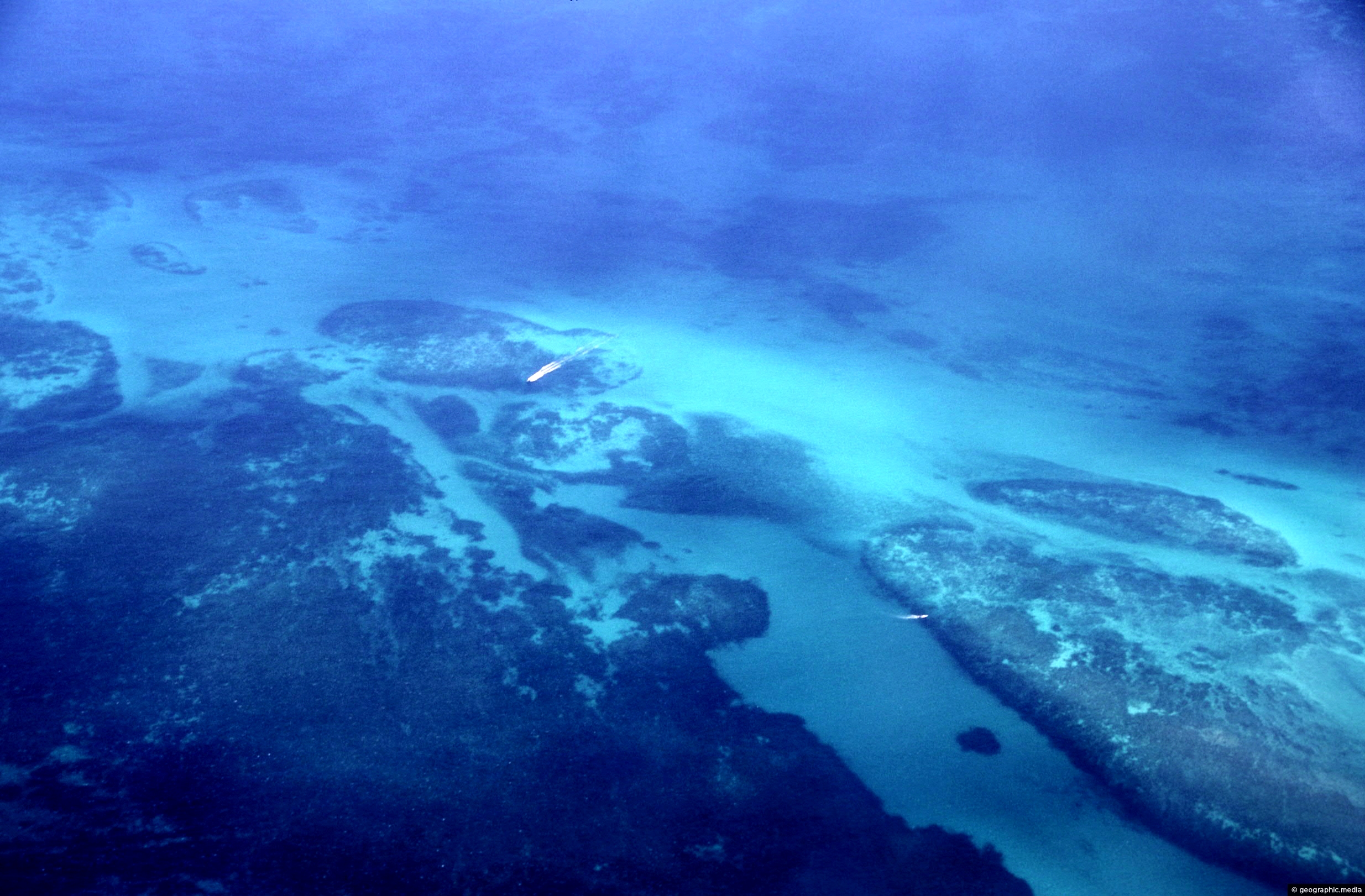
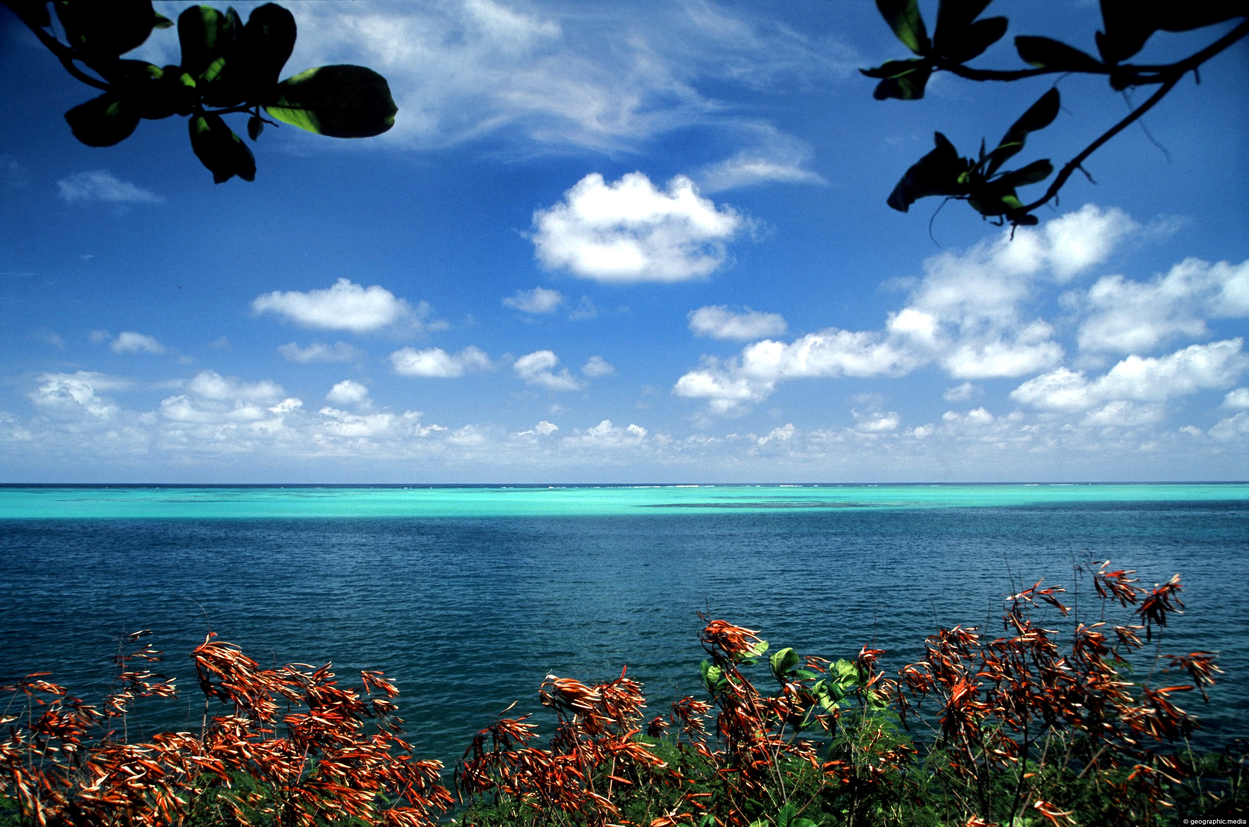
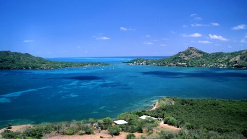
The Mesoamerican Barrier Reef System is over 1000 km (621 mi) long. Running along the coast of Belize it extends south of the Yucatán Peninsula in Mexico to Honduras. This section of the reef is close to the island of Providencia near Honduras, but is sovereign territory of Colombia.
ALL / Explore South America / Explore Colombia / Colombia Photos / Providencia photos / Mesoamerican Barrier Reef near Providencia
All original royalty-free photos, shareable maps, and informative articles.
Mesoamerican Barrier Reef near Providencia
Page Views
This post has been viewed 2,426 times
Related Articles
-
Manzanillo Beach
Providencia photos, Beaches, Islands, Landscape / Horizontal, Palms, Sea, Trees
Manzanillo beach is a long white sand beach located along the southeastern coast of the Caribbean island of Providencia....
-
Caribbean Sea Colombia
Providencia photos, Beaches, Islands, Landscape / Horizontal, Sea
View of the Caribbean Sea in Colombia from the paradise island of Providencia. The sea here has coral gardens...
-
View of Santa Catalina Island
Providencia photos, Islands, Landscape / Horizontal, Mountains, Sea
View of Santa Catalina Island as seen from the mountainous interior of Providencia Island. The exact location is the...
-
Afro-Colombians on Providencia Hilltop
Providencia photos, Islands, Landscape / Horizontal, Men, Mountains, People, Sea, Trails
Two locals sitting atop the highest peak on Providencia Island. In view is Santa Catalina a neighboring island. Getting...
-
Coral Reef Providencia Island
Providencia photos, Coral, Islands, Landscape / Horizontal, Sea
Coral Reef off the coast of Providencia Island in the Caribbean Sea. Providencia also called Isla de Providencia is...
-
Palms at Manzanillo Bay in Providencia
Providencia photos, Beaches, Islands, Landscape / Horizontal, Palms, Sea, Trees
Coconut palms leaning over the white sand of Manzanillo Bay. One of many bays on Providencia Island, the palms...
-
Santa Catalina and Providencia Island
Providencia photos, Islands, Landscape / Horizontal, Reefs, Sea
Bridge connecting Santa Catalina Island with Providencia Island. Santa Catalina is the smaller of the two islands. It is...
-
Aerial View of Providencia Colombia
Providencia photos, Beaches, Islands, Landscape / Horizontal, Sea
Aerial View of Providencia Island in Colombia with the main road in view. The white and beach is Manzanillo...
0 Comments
Latest Posts
Popular Posts
- Awakening New Zealand video (100)
- Iguazu Falls as seen from Brazil (86)
- Metrocable Medellin (77)
- Spinnaker Hill View (68)
- Spinnaker Hill in Whitby Porirua (68)
- Pauatahanui Inlet (68)
- View from Whitby (68)
- The Devil’s Throat (62)
- Aerial View of Iguazu Falls (61)
- Porirua Harbour & Papakowhai (57)
- Lake Wakatipu (57)
- Salto Rivadavia & Iguassu River (56)
- Lake Tekapo & Lupins (54)
- Cascadas at Iguazu (53)
- Close up of Salto Rivadavia (53)
- Salto Rivadavia Misiones Province (53)
Subjects
AccommodationAnimalsArchitectureBeachesBirdsBoatsBridgesBuildingsCarsChurchesCitiesCliffsCoralCultureExtra Wide HorizontalFlowersForestsHarborsHomesIslandsLakesLandscape / HorizontalMapsMenMonumentsMountainsPalmsParksPeoplePlantsPortrait / VerticalRiversRoadsRuralSeaShopsSkyscrapersSnowSunsetsTownsTransportTreesVideosVolcanicWaterfalls
Recent Comments
- Lance on Concrete Hut Wainuiomata
- DavidJ on Concrete Hut Wainuiomata
- Tony on Concrete Hut Wainuiomata
- DavidJ on Wellington Night Skyline
- Ben on Auckland City Skyline from Westhaven Marina in 1998