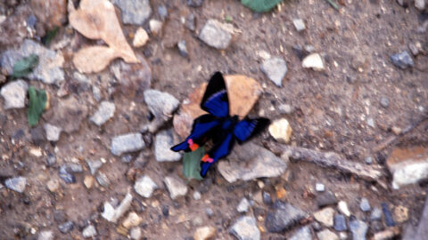
The Cream-spotted Tigerwing (Dryadula phaetusa) is a species of butterfly found in Central and South America, including Colombia. It is known for its distinctive orange and black pattern on its wings. It is found in lowland forests including rainforests, cloud forests, and dry deciduous forests.
ALL / Explore South America / Explore Colombia / Colombia Photos / Anapoima photos / Cream-spotted Tigerwing
All original royalty-free photos, shareable maps, and informative articles.
Cream-spotted Tigerwing
Page Views
This post has been viewed 661 times
Related Articles
-
Iglesia Santa Ana De Anapoima
Anapoima photos, Buildings, Churches, Landscape / Horizontal
Iglesia Santa Ana de Anapoima is a church located in the town of Anapoima, Colombia. It is a historic...
-
Child Carrying Water
Anapoima photos, Children, People, Portrait / Vertical
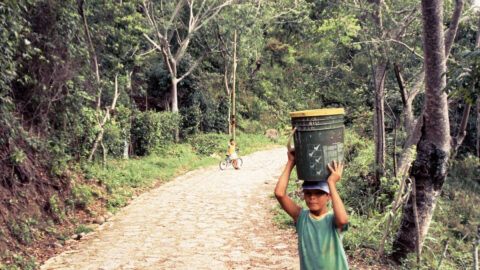
A child carrying water on a rural path to his home and farm on the outskirts of Anapoima, a...
-
Church of Santa Ana in Anapoima
Anapoima photos, Buildings, Churches, Landscape / Horizontal
The Church of Santa Ana in Anapoima is one of the main buildings in the town square. It is...
-
Classic Car in Anapoima Colombia
Anapoima photos, Cars, Landscape / Horizontal, Roads, Towns, Transport
Cars in Colombia are expensive to import, so older vehicles are regularly maintained. Consequently, there are many classic cars...
-
Farm in Anapoima
Anapoima photos, Landscape / Horizontal, Rural
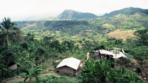
Looking at a farm and home in the hills surrounding Anapoima. Crops grown here include coffee, sugarcane, and bananas.
-
Farmland in Anapoima Colombia
Anapoima photos, Landscape / Horizontal, Rural
Anapoima is located among farmland near the city of Bogota. At an altitude of 700 meters above sea level,...
-
Red Pink Leaves
Anapoima photos, Flowers, Landscape / Horizontal, Plants
A plant with unusual red-pink leaves. If you know the name of this plant, could you leave a comment...
-
Anapoima Town
Anapoima photos, Landscape / Horizontal, Rural, Towns
Looking at the town of Anapoima from the surrounding countryside and forest. The town is located on the flanks...
0 Comments
Popular Posts
- Awakening New Zealand video (100)
- Iguazu Falls as seen from Brazil (87)
- Metrocable Medellin (78)
- Pauatahanui Inlet (69)
- Spinnaker Hill View (69)
- Spinnaker Hill in Whitby Porirua (69)
- View from Whitby (68)
- The Devil’s Throat (63)
- Aerial View of Iguazu Falls (61)
- Porirua Harbour & Papakowhai (58)
- Lake Wakatipu (57)
- Salto Rivadavia & Iguassu River (56)
- Salto Rivadavia Misiones Province (54)
- Close up of Salto Rivadavia (54)
- Cascadas at Iguazu (54)
- Lake Tekapo & Lupins (54)
Subjects
AccommodationAnimalsArchitectureBeachesBirdsBoatsBridgesBuildingsCarsChurchesCitiesCoralCultureExtra Wide HorizontalFlowersForestsHarborsHomesIslandsLakesLandscape / HorizontalMapsMenMonumentsMountainsPalmsParksPeoplePlantsPortrait / VerticalRiversRoadsRuralSeaShopsSkyscrapersSnowSunsetsTownsTrailsTransportTreesVideosVolcanicWaterfalls
Recent Comments
- DavidJ on The True Size of Australia
- Anonymous on The True Size of Australia
- Lance on Concrete Hut Wainuiomata
- Tony on Concrete Hut Wainuiomata
- DavidJ on Wellington Night Skyline