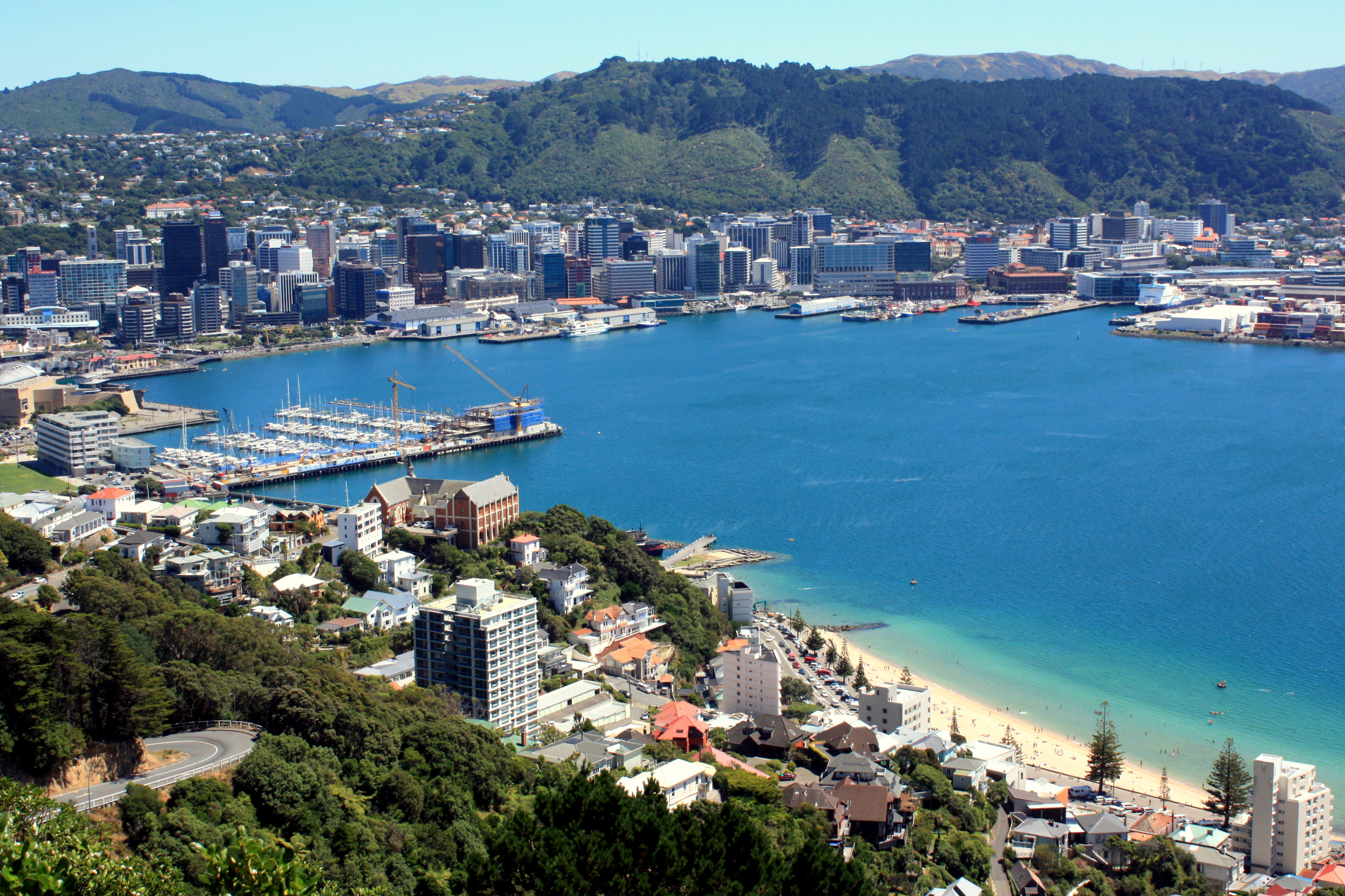
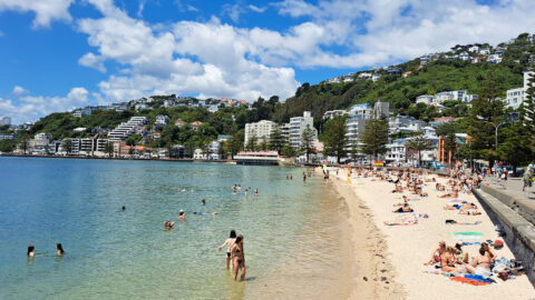
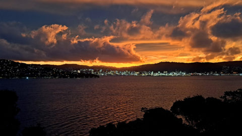
Aerial view of Wellington city and harbor as seen from Mount Victoria, circa 2012. The beach is Oriental Bay which is closest beach to the CBD. See the same view in 1989 and 1990.
All original royalty-free photos, shareable maps, and informative articles.
Wellington City & Harbour
-
Rocky Coastline at Island Bay
Wellington photos, Islands, Landscape / Horizontal, Sea
Standing on the southern coastline of Wellington and looking toward Island Bay with Taputeranga Island in view. Photo taken...
-
Beehive Building in Black & White
Wellington photos, Black and White, Buildings, Extra Wide Horizontal, Government
Wellington’s iconic architectural building, known as the Beehive is the Executive Wing of Parliament. The building stands proudly in...
-
Pinus Radiata Forest in Wellington
Wellington photos, Forests, Trees
Looking up at the canopy of a pinus radiata forest on the coast of Wellington Harbour. Pinus radiata is...
-
Mount Victoria View of Wellington 1990
Wellington photos, Buildings, Buses, Cities, Forests, Landscape / Horizontal, Sea, Skyscrapers
Mount Victoria view of Wellington city and harbor, circa 1990. The Wellington Bus Terminus is in view. Today, a...
-
Wellington Highways and Harbor
Wellington photos, Extra Wide Horizontal, Harbors, Roads, Sea
Looking down on Hutt Road and State Highway One with Wellington Harbour in view and the Remutaka Range in...
-
Somes Island & Wellington Harbour
Wellington photos, Islands, Landscape / Horizontal, Mountains, Sea
Somes Island lies in the centre of Wellington Harbour in New Zealand. The largest of three islands, it is...
-
Oriental Bay & Clouds
Wellington photos, Beaches, Cities, Landscape / Horizontal, Sea
Oriental Bay and distinctive clouds, with the Wellington city center in view. Photo taken from the Oriental Bay Pavilion.
-
Wellington Cable Car
Wellington photos, Buildings, Cities, Landscape / Horizontal, Transport
The Wellington cable Car connects downtown Wellington with Victoria University and the Wellington Botanic Gardens.
Popular Posts
- Awakening New Zealand video (100)
- Iguazu Falls as seen from Brazil (87)
- Metrocable Medellin (78)
- Spinnaker Hill in Whitby Porirua (69)
- Pauatahanui Inlet (69)
- View from Whitby (68)
- Spinnaker Hill View (68)
- The Devil’s Throat (63)
- Aerial View of Iguazu Falls (61)
- Porirua Harbour & Papakowhai (58)
- Lake Wakatipu (57)
- Salto Rivadavia & Iguassu River (56)
- Close up of Salto Rivadavia (54)
- Salto Rivadavia Misiones Province (54)
- Cascadas at Iguazu (54)
- Lake Tekapo & Lupins (54)
Subjects
Recent Comments
- DavidJ on The True Size of Australia
- Anonymous on The True Size of Australia
- Lance on Concrete Hut Wainuiomata
- Tony on Concrete Hut Wainuiomata
- DavidJ on Wellington Night Skyline


