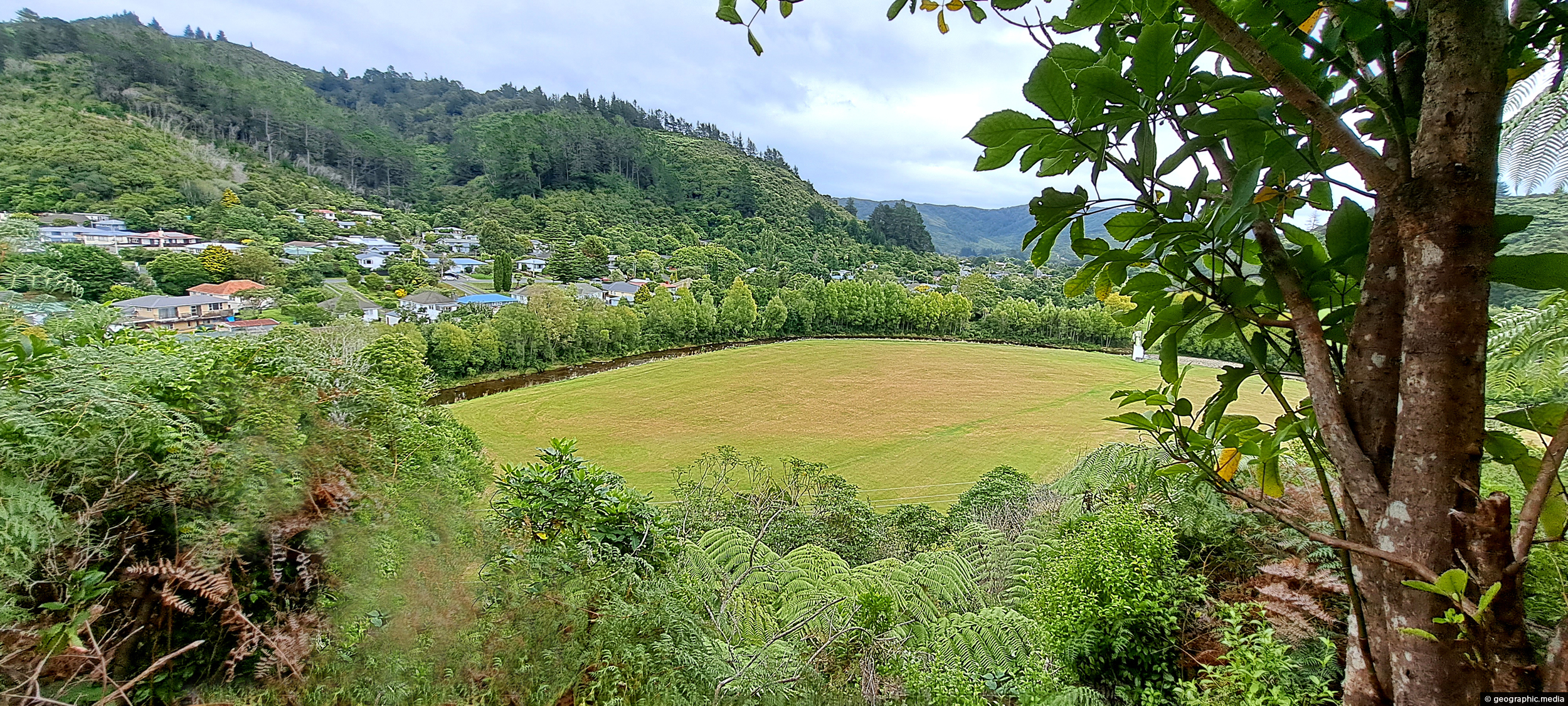
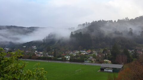
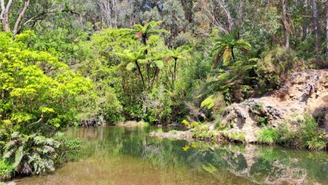
Looking at the eastern side of Richard Prouse Park from high up a nearby hillside. Houses on Hine Road can be seen in the background. Richard Prouse Park was named after Richard Prouse, a former mayor of Wellington who served in the late 19th century.
ALL / Explore Oceania / Explore New Zealand / New Zealand Photos / Wainuiomata photos / Richard Prouse Park Eastern View
All original royalty-free photos, shareable maps, and informative articles.
Richard Prouse Park Eastern View
Page Views
This post has been viewed 756 times
Related Articles
-
Morton Dam in Wainuiomata
Wainuiomata photos, Dams
Looking at Morton Dam in the year 2024, after being decommissioned some 36 years before. It once supplied the...
-
Wainuiomata Waterworks Museum History
Wainuiomata photos, Extra Wide Horizontal, Museums
The walls tell stories of the history of the Wainuiomata waterworks. The waterworks has two dams, one decommissioned and...
-
Nikau Creek Track
Wainuiomata photos, Ferns, Forests, Portrait / Vertical
The Nikau Creek Track is a short 30 minute walk that takes you through the podocarp rainforest found in...
-
Native Bush Vista Wainuiomata
Wainuiomata photos, Extra Wide Horizontal, Forests
Looking at hills covered in native bush in one the largest areas of lowland native forests in the lower...
-
Remains of a Power Generator
Wainuiomata photos, Extra Wide Horizontal, Forests
These remnants are believed to be part of a power generator that was used during the construction of the...
-
Old Pumping Station
Wainuiomata photos, Extra Wide Horizontal, Tunnels
Old pumping station which has been inundated by native forest growth. The station housed a water flow meter system...
-
Upper Reaches of Wainuiomata River
Wainuiomata photos, Forests, Portrait / Vertical, Rivers
Looking at an almost inaccessible part of the Wainuiomata River. There are no tracks leading here, but you gain...
-
Underground Shaft in Wainuiomata
Wainuiomata photos, Extra Wide Horizontal, Tunnels
This underground shaft in Wainuiomata was originally constructed in the 1880s. It was abandoned 1899 and is now completely...
0 Comments
Calendar
M | T | W | T | F | S | S |
---|---|---|---|---|---|---|
1 | 2 | |||||
3 | 4 | 5 | 6 | 7 | 8 | 9 |
10 | 11 | 12 | 13 | 14 | 15 | 16 |
17 | 18 | 19 | 20 | 21 | 22 | 23 |
24 | 25 | 26 | 27 | 28 |
Popular Posts
- Awakening New Zealand video (100)
- Iguazu Falls as seen from Brazil (87)
- Metrocable Medellin (78)
- Pauatahanui Inlet (69)
- Spinnaker Hill in Whitby Porirua (68)
- Spinnaker Hill View (68)
- View from Whitby (68)
- The Devil’s Throat (62)
- Aerial View of Iguazu Falls (61)
- Porirua Harbour & Papakowhai (57)
- Lake Wakatipu (57)
- Salto Rivadavia & Iguassu River (56)
- Lake Tekapo & Lupins (54)
- Nelson View (53)
- Salto Rivadavia Misiones Province (53)
- Cascadas at Iguazu (53)
Subjects
AccommodationAnimalsArchitectureBeachesBirdsBoatsBridgesBuildingsCarsChurchesCitiesCoralCultureExtra Wide HorizontalFlowersForestsHarborsHomesIslandsLakesLandscape / HorizontalMapsMenMonumentsMountainsPalmsParksPeoplePlantsPortrait / VerticalRiversRoadsRuralSeaShopsSkyscrapersSnowSunsetsTownsTrailsTransportTreesVideosVolcanicWaterfalls
Recent Comments
- Lance on Concrete Hut Wainuiomata
- Tony on Concrete Hut Wainuiomata
- DavidJ on Wellington Night Skyline
- Ben on Auckland City Skyline from Westhaven Marina in 1998
- Ben on Auckland Harbour Bridge view