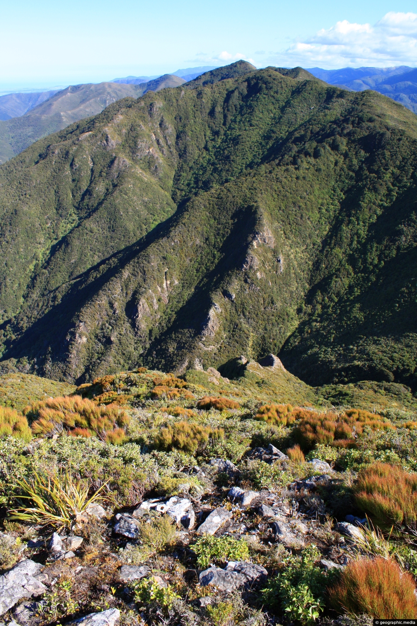
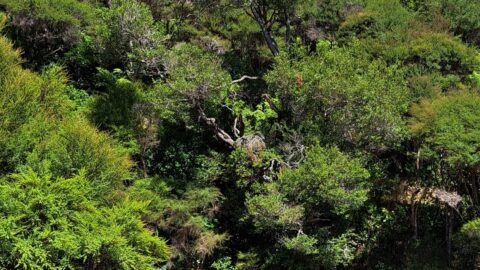
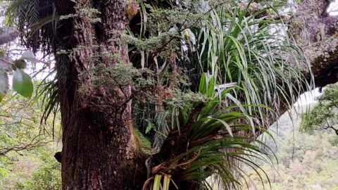
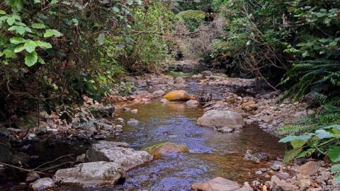
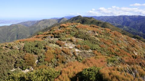
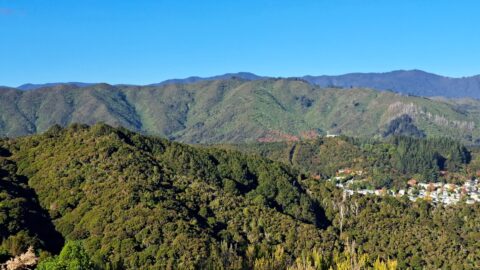
Subalpine view of the Remutaka Range, looking south, with Mount Climie prominently visible. Tunnel Gully serves as a key access point to Mount Climie, starting from a designated car park near Kaitoke. The area features a network of walking and mountain biking tracks, passing through native forest and remnants of historic railway tunnels. The **Mt Climie Track** leads to the summit, which, at 860 metres, offers panoramic views over the Hutt Valley, Wellington Harbour, and beyond. The summit also hosts radio transmission towers, a notable landmark visible from lower elevations.
ALL / Explore Oceania / Explore New Zealand / New Zealand Photos / Remutaka Range photos / Mt Climie Remutaka Range
All original royalty-free photos, shareable maps, and informative articles.
Mt Climie Remutaka Range
Page Views
This post has been viewed 658 times
Related Articles
-
Trees Growing out of a Slip
Remutaka Range photos, Extra Wide Horizontal, Forests, Trees
These trees moved down a steep hillside due to a slip or small landslide. The trees appear to have...
-
Remutaka Foothills
Remutaka Range photos, Extra Wide Horizontal, Forests
View of the Remutaka foothills located inside Wainuiomata Regional Park. The park borders one of the most extensive tracts...
-
Catchpool Stream in Wainuiomata
Remutaka Range photos, Forests, Portrait / Vertical, Rivers
Catchpool Stream in Wainuiomata is a tributary of Wainuiomata River. The stream flows through the Remutaka Range and out...
-
Natural Swimming Area
Remutaka Range photos, Forests, Portrait / Vertical, Rivers
A natural swimming area in Wainuiomata Regional Park. This is Wainuiomata River which has numerous swimming areas.
-
Remutaka Foothill
Remutaka Range photos, Extra Wide Horizontal, Forests
Looking at the foothills of the Remutaka Range in the Wellington region. In view is a mixture of native...
-
Remutaka Foothills
Remutaka Range photos, Forests, Lakes, Landscape / Horizontal, Mountains
Looking at the eastern foothills of the Remutaka range with the Wairarapa region below. Lake Wairarapa can be seen...
-
Mist over the Wainuiomata Basin
Remutaka Range photos, Extra Wide Horizontal, Mountains
Mist over the Wainuiomata Basin and surrounding hills. Photo taken from the western hills between Wainuiomata and the rest...
-
Wainuiomata Hills & Remutaka
Remutaka Range photos, Extra Wide Horizontal, Mountains
Gazing at the hills of Wainuiomata, with the Remutaka Range serving as a scenic backdrop. Wainuiomata is divided from...
0 Comments
Calendar
M | T | W | T | F | S | S |
---|---|---|---|---|---|---|
1 | 2 | 3 | 4 | |||
5 | 6 | 7 | 8 | 9 | 10 | 11 |
12 | 13 | 14 | 15 | 16 | 17 | 18 |
19 | 20 | 21 | 22 | 23 | 24 | 25 |
26 | 27 | 28 | 29 | 30 | 31 |
Popular Posts
- Awakening New Zealand video (100)
- Iguazu Falls as seen from Brazil (87)
- Metrocable Medellin (78)
- Pauatahanui Inlet (69)
- Spinnaker Hill in Whitby Porirua (68)
- Spinnaker Hill View (68)
- View from Whitby (68)
- The Devil’s Throat (62)
- Aerial View of Iguazu Falls (61)
- Porirua Harbour & Papakowhai (57)
- Lake Wakatipu (57)
- Salto Rivadavia & Iguassu River (56)
- Lake Tekapo & Lupins (54)
- Nelson View (53)
- Salto Rivadavia Misiones Province (53)
- Cascadas at Iguazu (53)
Subjects
AccommodationAnimalsArchitectureBeachesBirdsBoatsBridgesBuildingsCarsChurchesCitiesCoralCultureExtra Wide HorizontalFlowersForestsHarborsHomesIslandsLakesLandscape / HorizontalMapsMenMonumentsMountainsPalmsParksPeoplePlantsPortrait / VerticalRiversRoadsRuralSeaShopsSkyscrapersSnowSunsetsTownsTrailsTransportTreesVideosVolcanicWaterfalls
Recent Comments
- Lance on Concrete Hut Wainuiomata
- Tony on Concrete Hut Wainuiomata
- DavidJ on Wellington Night Skyline
- Ben on Auckland City Skyline from Westhaven Marina in 1998
- Ben on Auckland Harbour Bridge view