Te Pukeatea Bay is not on the main Abel Tasman Track, but is accessible by a loop track, boat, or by kayak. It is located next to Anchorage Bay.
ALL / About / Te Pukeatea Bay Kayaks Abel Tasman
All original royalty-free photos, shareable maps, and informative articles.
Te Pukeatea Bay Kayaks Abel Tasman
Page Views
This post has been viewed 2,011 times
Related Articles
-
Anchorage Beach
Abel Tasman photos, Beaches, Landscape / Horizontal, Sea
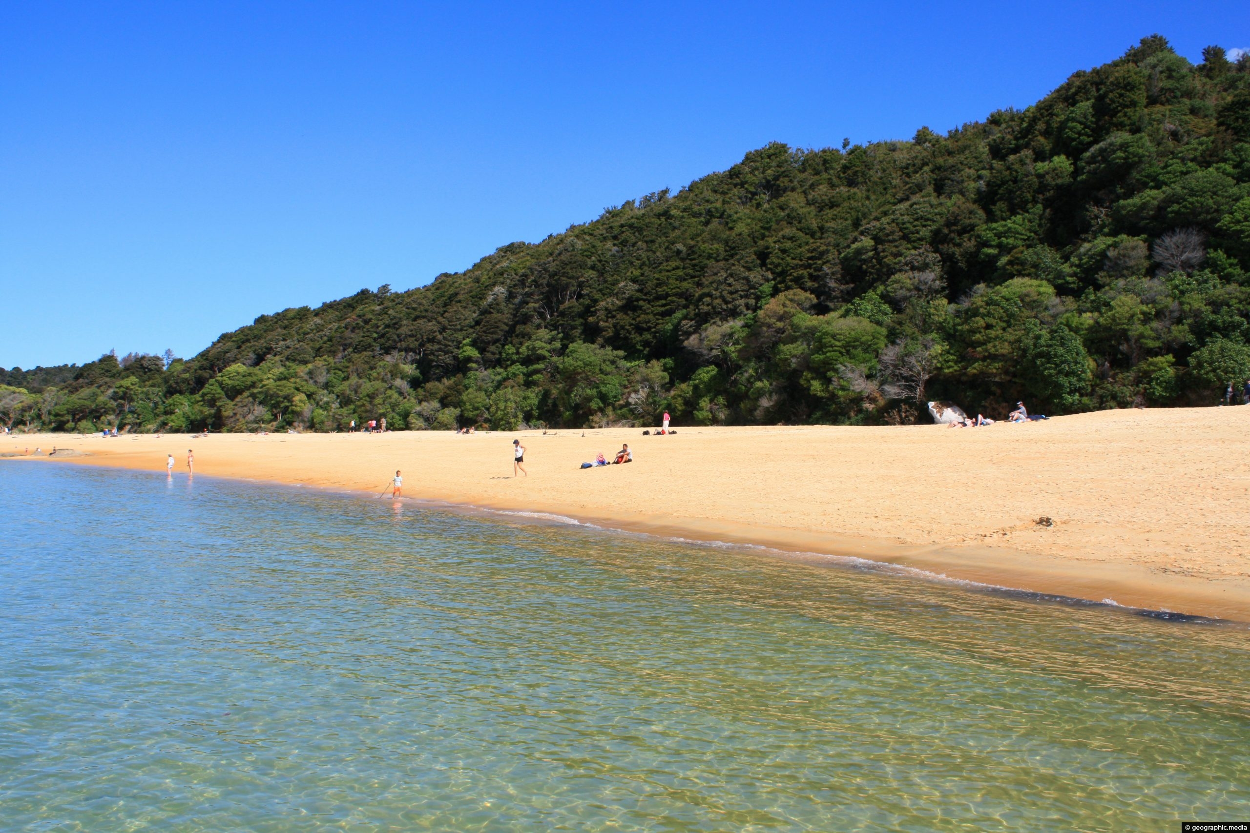
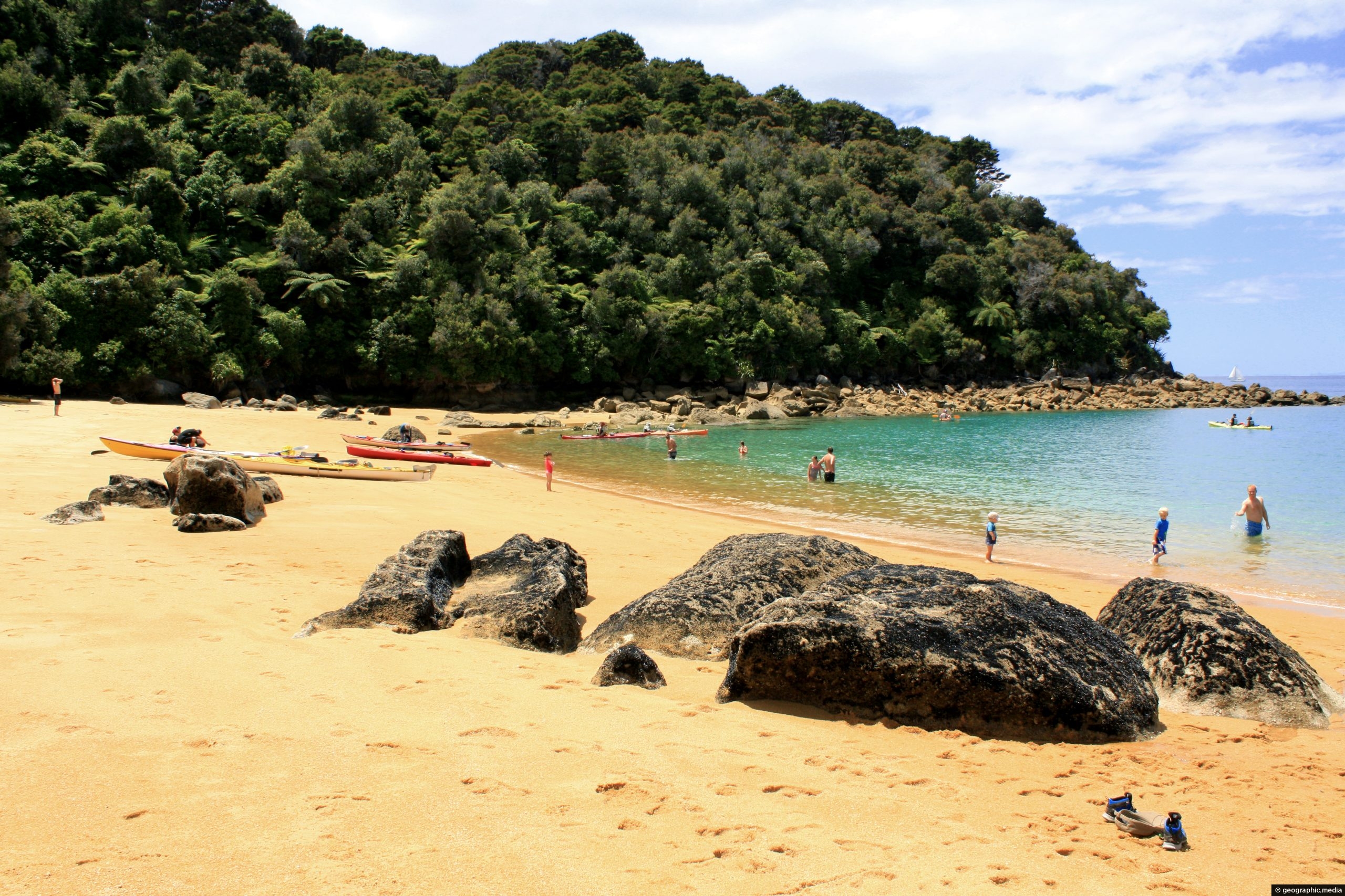
A small portion of the beach at Anchorage Bay in New Zealand’s Abel Tasman National Park. Anchorage is a...
-
Te Pukeatea Bay
Abel Tasman photos, Beaches, Landscape / Horizontal, Sea
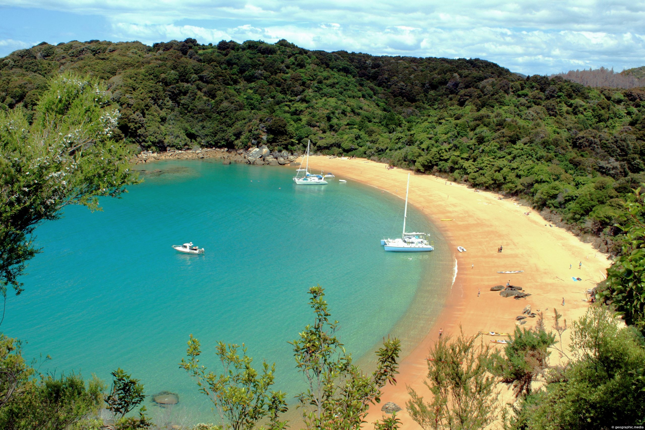
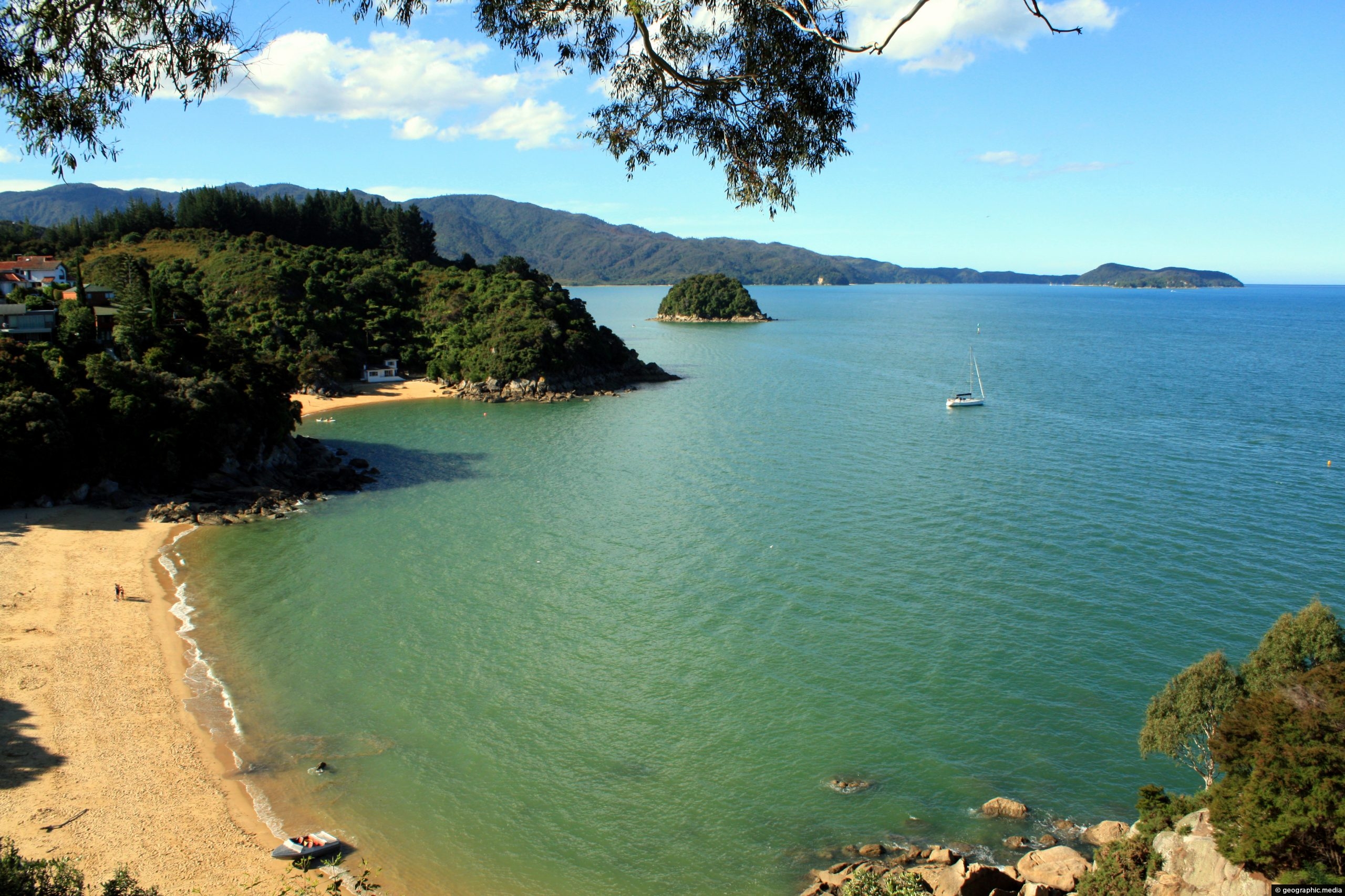
Expansive view of Te Pukeatea Bay in New Zealand’s Abel Tasman National Park. The beach is accessible by boat...
-
Split Apple Rock View
Abel Tasman photos, Geology, Landscape / Horizontal, Sea
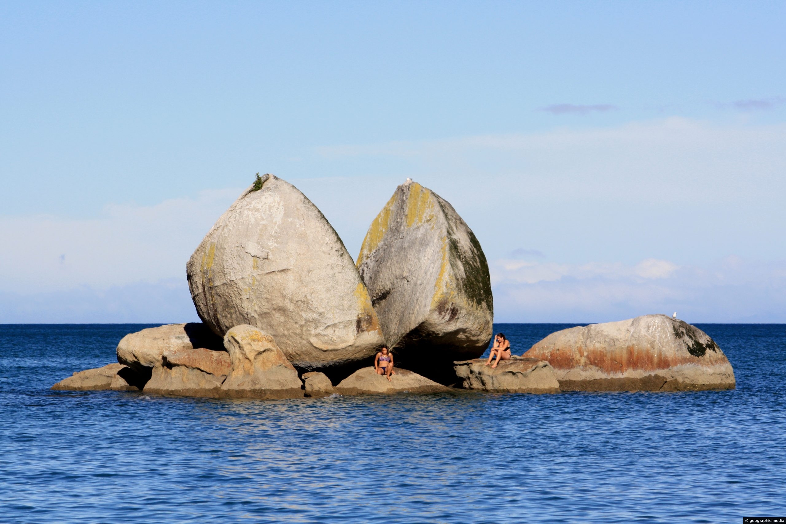
Split Apple Rock in Tasman Bay is a rock formation that shaped like an apple cut in half. Ferries...
-
Kayakers in Abel Tasman
Abel Tasman photos, Boats, Landscape / Horizontal, Sea, Transport
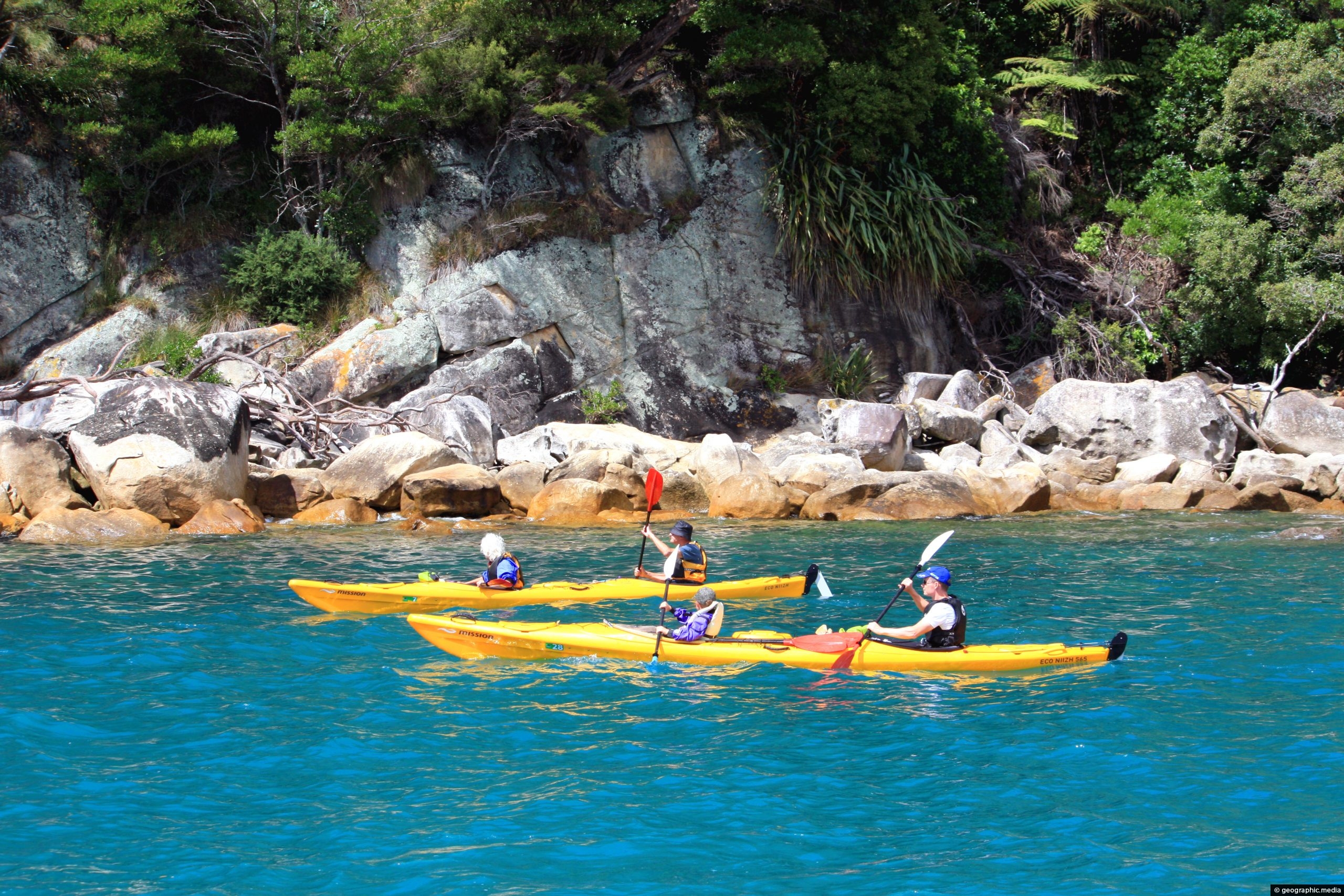
Kayakers exploring the scenic coastline of Abel Tasman National Park in New Zealand. Kayaking gives you access to some...
-
Te Pukeatea Bay Rocks
Abel Tasman photos, Beaches, Landscape / Horizontal, Sea
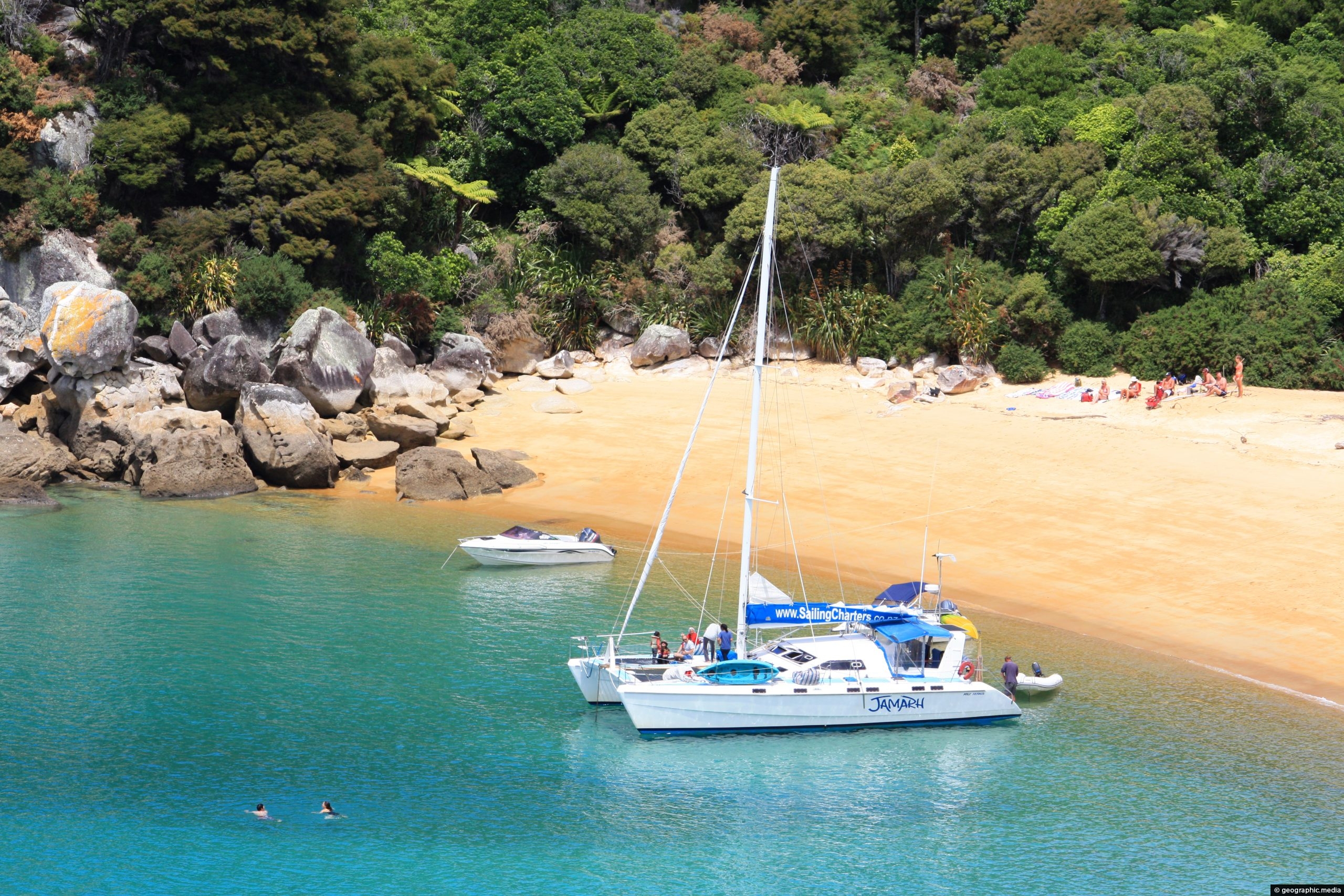
Rocks protrude from the sand at the eastern side of Te Pukeatea Bay, Abel Tasman National Park, New Zealand.
-
Bayview Lookout Abel Tasman
Abel Tasman photos, Beaches, Landscape / Horizontal, Sea
View of Breaker Bay and Honey Moon Bay in Tasman Bay as seen from Bayview Lookout. Abel Tasman National Park can...
-
Boats at Anchorage
Abel Tasman photos, Boats, Landscape / Horizontal, Sea, Transport
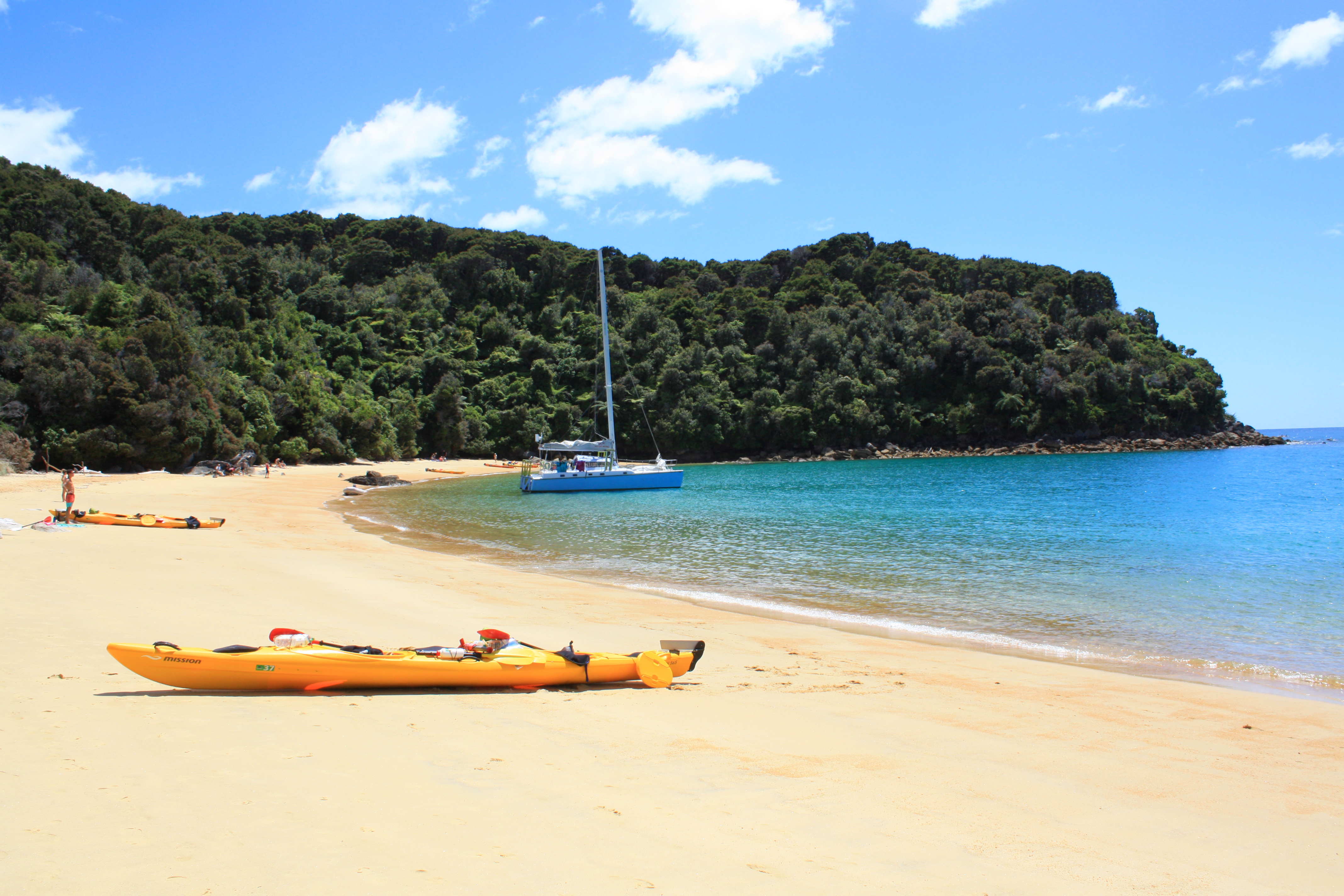
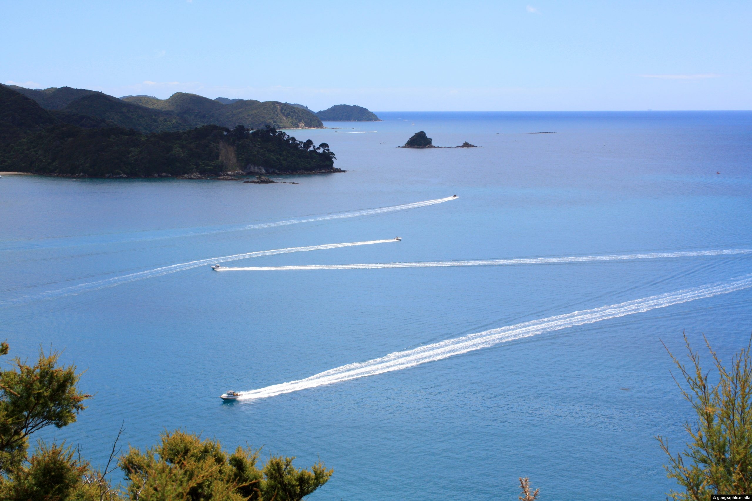
Boat traffic to and from Anchorage Bay in Abel Tasman National Park, New Zealand. The bay attracts boaties because...
-
Eastern Te Pukeatea Bay
Abel Tasman photos, Beaches, Boats, Landscape / Horizontal, Sea, Transport
View of the eastern part of Te Pukeatea Bay in Abel Tasman National Park, New Zealand. This area is...
0 Comments
Latest Posts
Browse by Date
M | T | W | T | F | S | S |
---|---|---|---|---|---|---|
1 | 2 | 3 | 4 | 5 | ||
6 | 7 | 8 | 9 | 10 | 11 | 12 |
13 | 14 | 15 | 16 | 17 | 18 | 19 |
20 | 21 | 22 | 23 | 24 | 25 | 26 |
27 | 28 | 29 | 30 | 31 |
Popular Posts
- Awakening New Zealand video (100)
- Iguazu Falls as seen from Brazil (86)
- Metrocable Medellin (77)
- Spinnaker Hill View (68)
- Pauatahanui Inlet (68)
- View from Whitby (68)
- Spinnaker Hill in Whitby Porirua (67)
- The Devil’s Throat (62)
- Aerial View of Iguazu Falls (61)
- Porirua Harbour & Papakowhai (57)
- Lake Wakatipu (57)
- Salto Rivadavia & Iguassu River (56)
- Lake Tekapo & Lupins (54)
- Cascadas at Iguazu (53)
- Close up of Salto Rivadavia (53)
- Salto Rivadavia Misiones Province (53)
Subjects
AccommodationAnimalsArchitectureBeachesBirdsBoatsBridgesBuildingsCarsChurchesCitiesCliffsCoralCultureExtra Wide HorizontalFlowersForestsHarborsHomesIslandsLakesLandscape / HorizontalMapsMenMonumentsMountainsPalmsParksPeoplePlantsPortrait / VerticalRiversRoadsRuralSeaShopsSkyscrapersSnowSunsetsTownsTransportTreesVideosVolcanicWaterfalls
Recent Comments
- Lance on Concrete Hut Wainuiomata
- DavidJ on Concrete Hut Wainuiomata
- Tony on Concrete Hut Wainuiomata
- DavidJ on Wellington Night Skyline
- Ben on Auckland City Skyline from Westhaven Marina in 1998