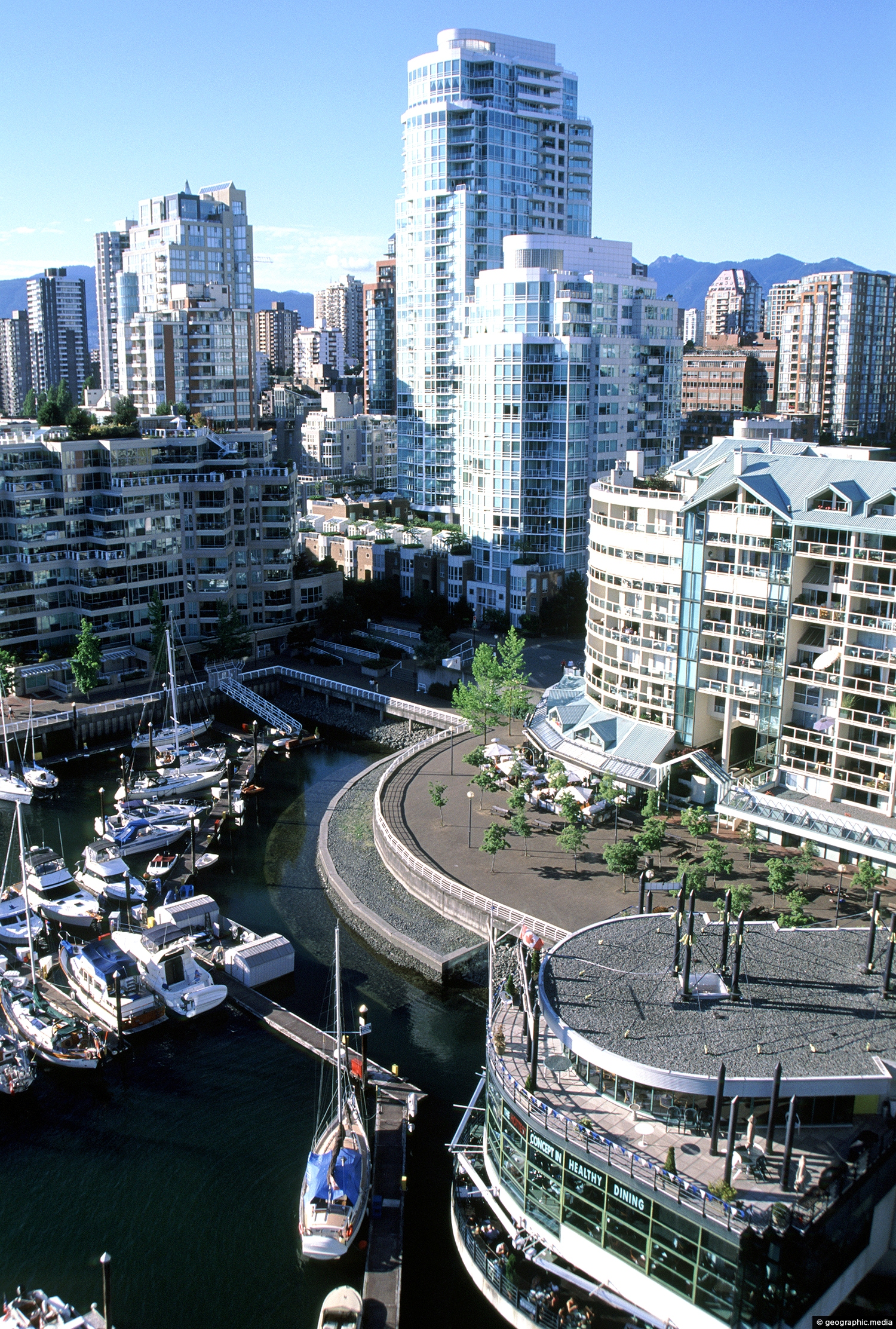
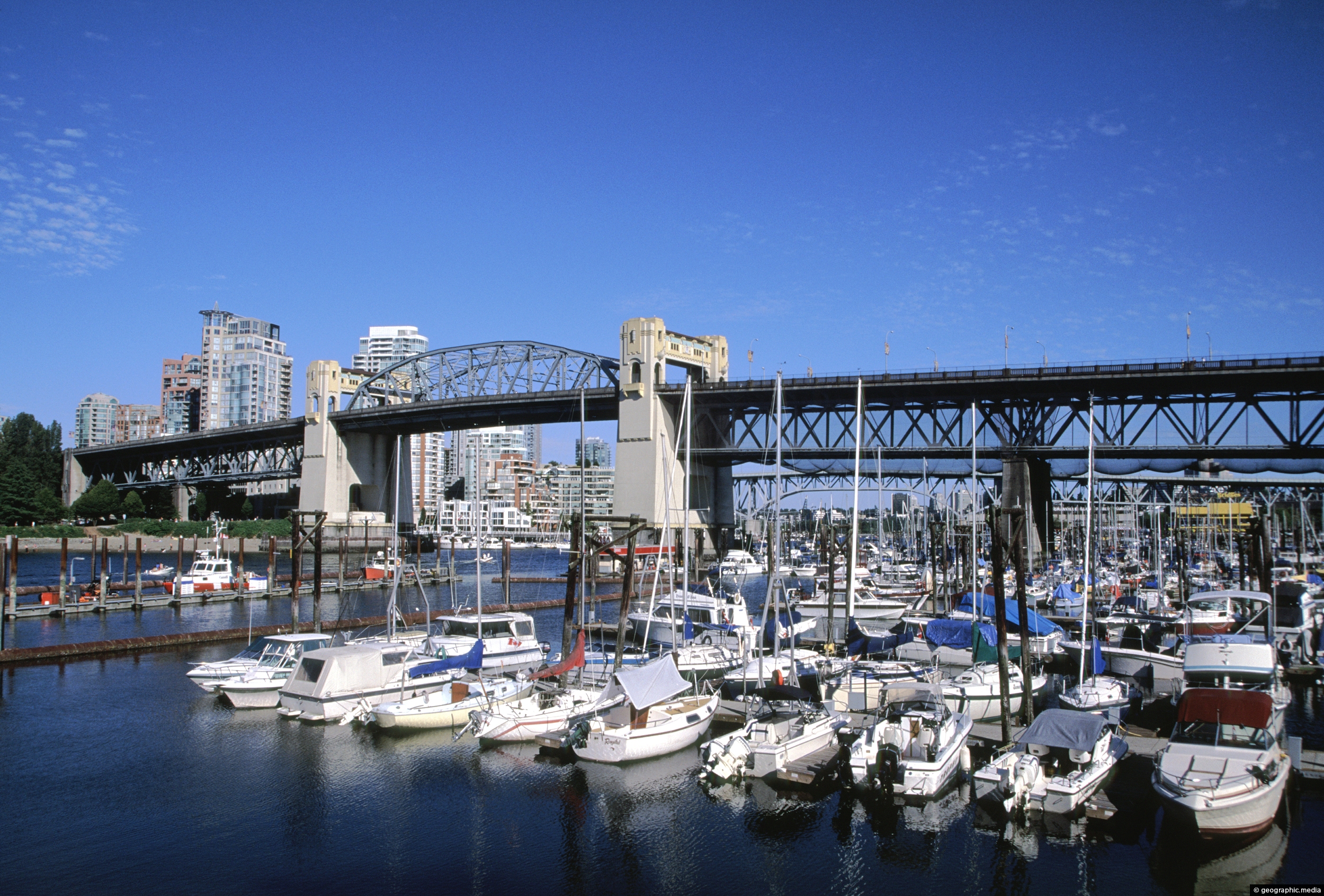
View of downtown Vancouver from Granville Bridge with Yacht Harbour Point in view. The waterfront, False Creek, was so named because an early survey thought the narrow passage of water was a creek.
ALL / Explore North America / Explore Canada / Canada Photos / Vancouver photos / Granville Bridge View in Vancouver
All original royalty-free photos, shareable maps, and informative articles.
Granville Bridge View in Vancouver
Page Views
This post has been viewed 2,921 times
Related Articles
-
Coastal Walkway in Vancouver BC
Vancouver photos, Beaches, Cities, Landscape / Horizontal
View of the coastal walkway near Sunset Beach in Vancouver, Canada.
-
Grizzly Bear in the Northshore Mountains
Vancouver photos, Animals, Landscape / Horizontal, Mammals
The Grizzly Bear is native to Canada. Its current range extends from Alaska, south through western Canada.
-
Douglas Fir Forest
Vancouver photos, Forests, Landscape / Horizontal
View of a Douglas Fir forest on the slopes of the North Shore Mountains of British Columbia.
-
Canada Flags in Vancouver Canada
Vancouver photos, Buildings, Cities, Flags, Portrait / Vertical, Skyscrapers
Canadian flags flapping in a Vancouver sea breeze against a deep blue sky. In view is False Creek and...
-
Waterfront Centre Food Court in Vancouver
Vancouver photos, Buildings, Cities, Portrait / Vertical
Lunch time in Vancouver. On sunny days, the Waterfront Centre Food Court is a favorite place for office workers...
-
Totem Pole on Grouse Mountain
Vancouver photos, Carvings, Culture, Portrait / Vertical
A totem pole atop Grouse Mountain on the outskirts of Vancouver. Another area in Vancouver containing totems is Stanley...
-
Grouse Mountain Skyride in Vancouver
Vancouver photos, Landscape / Horizontal, Mountains, Transport
The Grouse Mountain Skyride is an aerial tramway system that connects Vancouver to the top of Grouse Mountain. The...
-
Young Douglas Fir in British Columbia
Vancouver photos, Portrait / Vertical, Trees
A young Douglas Fir tree in a British Columbia forest. They are an evergreen conifer endemic to western North...
0 Comments
Calendar
M | T | W | T | F | S | S |
---|---|---|---|---|---|---|
1 | 2 | |||||
3 | 4 | 5 | 6 | 7 | 8 | 9 |
10 | 11 | 12 | 13 | 14 | 15 | 16 |
17 | 18 | 19 | 20 | 21 | 22 | 23 |
24 | 25 | 26 | 27 | 28 |
Popular Posts
- Awakening New Zealand video (100)
- Iguazu Falls as seen from Brazil (87)
- Metrocable Medellin (78)
- Pauatahanui Inlet (69)
- Spinnaker Hill View (68)
- Spinnaker Hill in Whitby Porirua (68)
- View from Whitby (68)
- The Devil’s Throat (62)
- Aerial View of Iguazu Falls (61)
- Porirua Harbour & Papakowhai (57)
- Lake Wakatipu (57)
- Salto Rivadavia & Iguassu River (56)
- Lake Tekapo & Lupins (54)
- Nelson View (53)
- Salto Rivadavia Misiones Province (53)
- Cascadas at Iguazu (53)
Subjects
AccommodationAnimalsArchitectureBeachesBirdsBoatsBridgesBuildingsCarsChurchesCitiesCoralCultureExtra Wide HorizontalFlowersForestsHarborsHomesIslandsLakesLandscape / HorizontalMapsMenMonumentsMountainsPalmsParksPeoplePlantsPortrait / VerticalRiversRoadsRuralSeaShopsSkyscrapersSnowSunsetsTownsTrailsTransportTreesVideosVolcanicWaterfalls
Recent Comments
- Lance on Concrete Hut Wainuiomata
- Tony on Concrete Hut Wainuiomata
- DavidJ on Wellington Night Skyline
- Ben on Auckland City Skyline from Westhaven Marina in 1998
- Ben on Auckland Harbour Bridge view