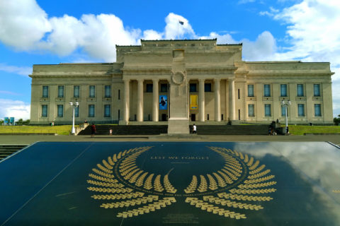
View of the Auckland War Memorial Museum located in the Auckland Domain. Constructed in the 1920s, the neo-classicist architectural...
Auckland photos
About Auckland
Our photos of Auckland capture the unique mix of urban landscape, coastlines, and nature that merge together in New Zealand’s largest city. While it is the country’s biggest urban area, it is also surrounded by two beautiful harbors, Pacific beaches, and forested hills.
Auckland is the name of a region and a city. It is the most populous city in the country. In fact, the amount of people here outnumber all citizens of the South Island, about a third of the country in total. The largest Polynesian population in the world is contained in Auckland even outnumbering their total population elsewhere.
Auckland frequently ranks in the top five cities worldwide for livability, according to the Mercer Quality of Living Survey. The city scores highly for various reasons, such as its accessibility to natural reserves and beaches. As a result, boating is a popular pastime among Aucklanders, with more boats per person than any other city in the world. The Southern Hemisphere’s biggest marina, Westhaven Marina, is located near the city center.
The SkyTower, the tallest structure in the Southern Hemisphere, dominates Auckland’s skyline. The nearby Auckland Harbour Bridge spans the Waitemata Harbour, offering access to the picturesque Northshore. Looking out to sea from the beaches in the area provides an unobstructed view of Rangitoto Island, a conical volcano. Auckland also has stunning beaches on the west coast, such as Piha and Bethells Beach.
Auckland sits on a volcanic field consisting of 50 extinct volcanoes, many of which have been transformed into nature reserves with scenic viewpoints at their peaks. Some noteworthy cones include One Tree Hill, Mt Eden, and Mt Victoria.
For earlier photos of Auckland, visit Virtual New Zealand.
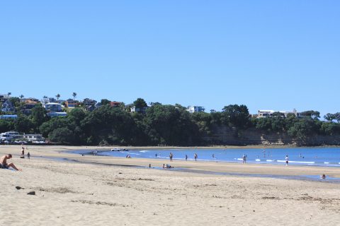
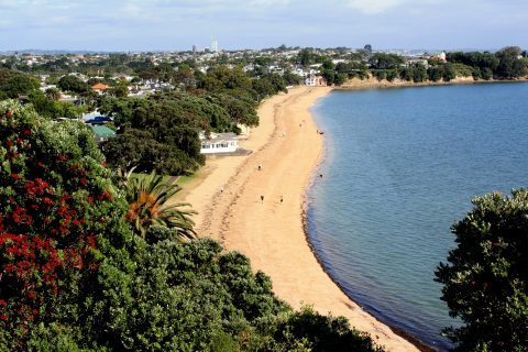
Looking north along the beach in Browns Bay in Auckland’s North Shore. The beach is good for swimming and...
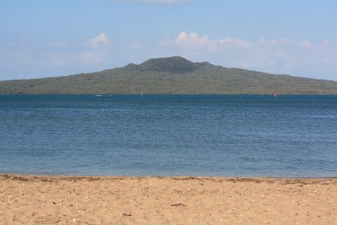
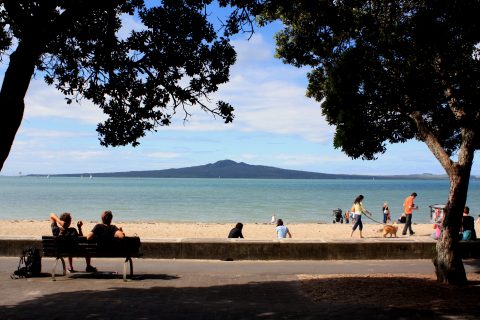
Rangitoto Island from Cheltenham Beach in Auckland
Auckland photos, Beaches, Landscape / Horizontal, Sea, VolcanicLooking at Rangitoto Island a volcanic cone within Auckland. It is the youngest and biggest volcano in the Auckland...
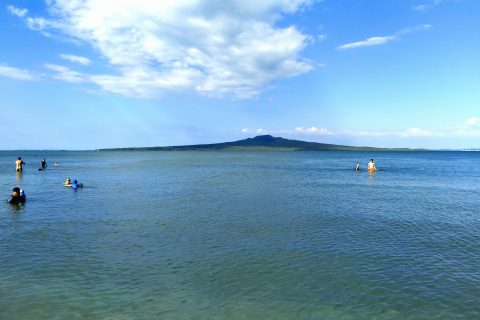
Rangitoto view from the North Shore in Auckland
Auckland photos, Islands, Landscape / Horizontal, Sea, VolcanicPeople enjoying an evening swim in an Auckland beach with a view of Rangitoto Island. This volcano in the...
Looking south along a sandy strip known as Cheltenham Beach. Located in the Auckland suburb of Devonport, it is...
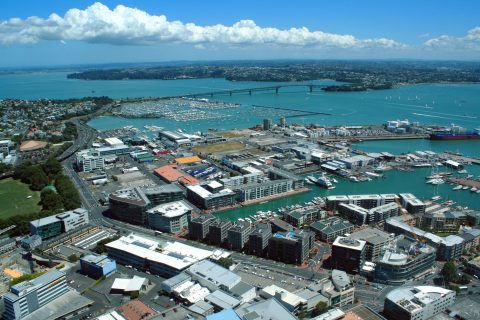
The waterfront as seen from the Auckland Sky Tower. The Auckland Harbour Bridge and Westhaven Marina are both in...
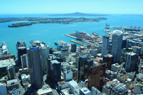
View of the Auckland CBD looking toward the harbour with Rangitoto Island further out in the Hauraki Gulf.
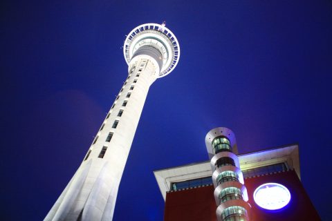
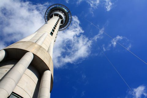
View of SkyCity Auckland Casino and the Auckland Skytower. The SkyTower is the tallest structure in New Zealand and...
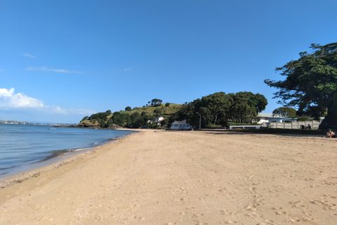
View of Cheltenham Beach in the New Zealand city of Auckland. Located on the North Shore in the suburb of...
View of Mission Bay in Auckland
Auckland photos, Beaches, Islands, Landscape / Horizontal, People, SeaView of the beach at Mission Bay in Auckland, with Rangitoto Island in view. Mission Bay is the most...
Auckland Skytower with bungee cords in view. These cords are part of the highest bungee jump in New Zealand....
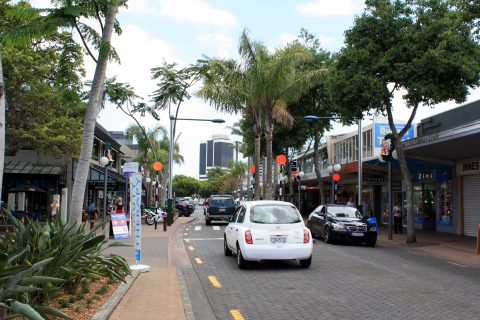
Takapuna is a suburb and beach in the North Shore of Auckland. Pictured is Hurstmere Road, the location for...
Calendar
| M | T | W | T | F | S | S |
|---|---|---|---|---|---|---|
| 1 | ||||||
| 2 | 3 | 4 | 5 | 6 | 7 | 8 |
| 9 | 10 | 11 | 12 | 13 | 14 | 15 |
| 16 | 17 | 18 | 19 | 20 | 21 | 22 |
| 23 | 24 | 25 | 26 | 27 | 28 | 29 |
| 30 | ||||||
Popular Posts
- Awakening New Zealand video (100)
- Iguazu Falls as seen from Brazil (87)
- Metrocable Medellin (78)
- Pauatahanui Inlet (69)
- Spinnaker Hill in Whitby Porirua (68)
- Spinnaker Hill View (68)
- View from Whitby (68)
- The Devil’s Throat (62)
- Aerial View of Iguazu Falls (61)
- Porirua Harbour & Papakowhai (57)
- Lake Wakatipu (57)
- Salto Rivadavia & Iguassu River (56)
- Lake Tekapo & Lupins (54)
- Nelson View (53)
- Salto Rivadavia Misiones Province (53)
- Cascadas at Iguazu (53)

Recent Comments