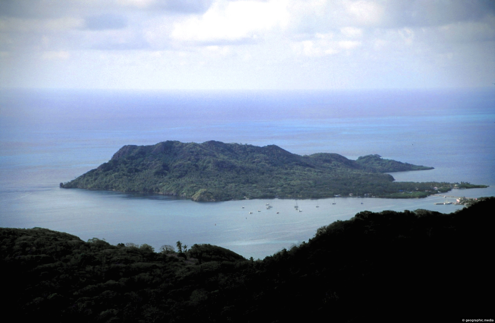
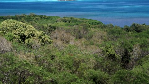
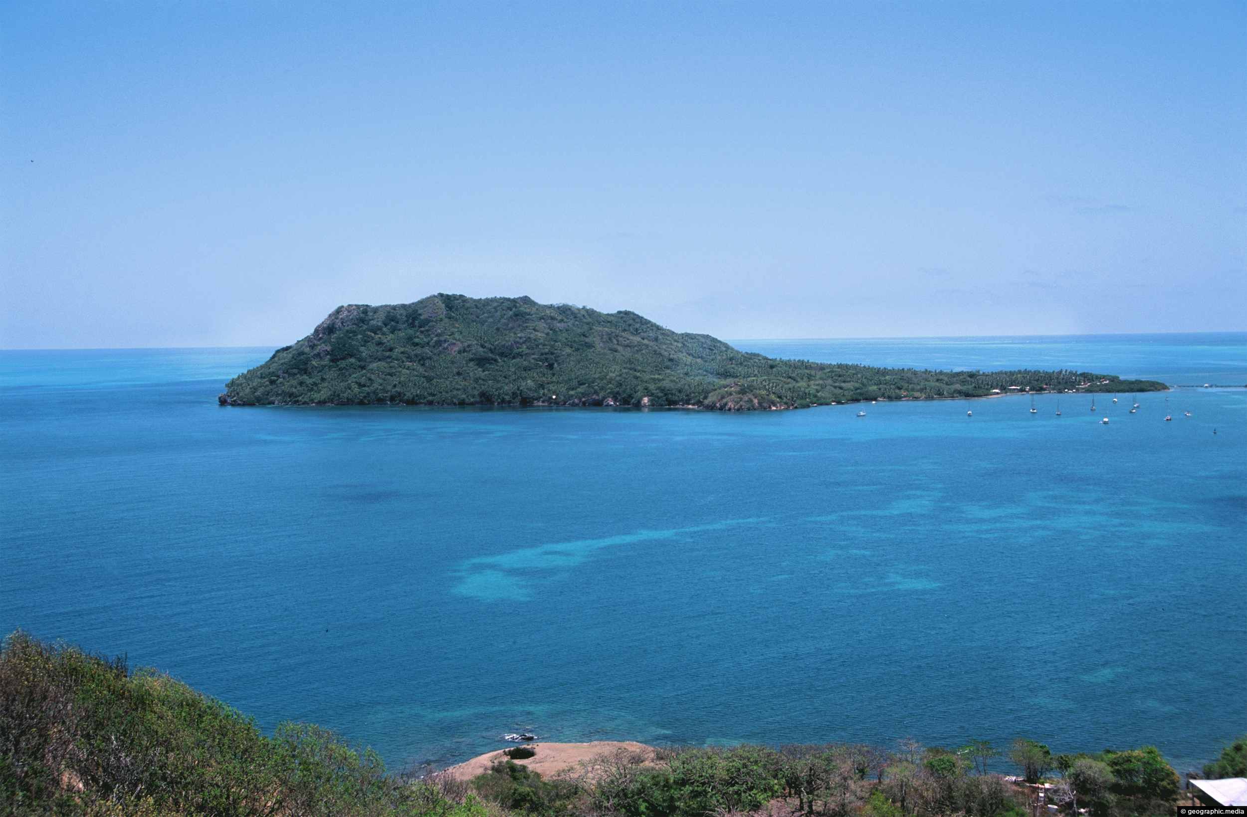
View of Santa Catalina Island as seen from the mountainous interior of Providencia Island. The exact location is the highest peak on the island is called El Pico.
ALL / Explore South America / Explore Colombia / Colombia Photos / Providencia photos / View of Santa Catalina Island
All original royalty-free photos, shareable maps, and informative articles.
View of Santa Catalina Island
Page Views
This post has been viewed 379 times
Related Articles
-
Santa Isabel Providencia Colombia
Providencia photos, Islands, Landscape / Horizontal, Sea, Towns
Santa Isabel is the largest town on Providencia Island and is located on the northern coast. It is where...
-
Manzanillo Beach
Providencia photos, Beaches, Islands, Landscape / Horizontal, Palms, Sea, Trees
Manzanillo beach is a long white sand beach located along the southeastern coast of the Caribbean island of Providencia....
-
Twin Beaches on Providencia Island
Providencia photos, Beaches, Islands, Landscape / Horizontal, Sea
A stretch of coastline with two great beaches on the island of Providencia. Located in the Caribbean Sea ,...
-
Caribbean Sea Colombia
Providencia photos, Beaches, Islands, Landscape / Horizontal, Sea
View of the Caribbean Sea in Colombia from the paradise island of Providencia. The sea here has coral gardens...
-
Providencia Island Interior
Providencia photos, Islands, Landscape / Horizontal, Mountains, Sea
Looking down from the highest point in the interior of Providencia Island at the surrounding landscape. Unlike nearby San...
-
Crab Cay Providencia
Providencia photos, Islands, Portrait / Vertical, Reefs, Sea
Looking out toward Crab Cay from Providencia Island. Crab Cay is an amazing dive spot with colorful coral gardens...
-
Santa Catalina as seen from Providencia
Providencia photos, Islands, Landscape / Horizontal, Reefs, Sea
Santa Catalina is an island connected to Providencia Island by a wharf. Both these islands were once connected by...
-
Palms and Trail in Providencia
Providencia photos, Landscape / Horizontal, Palms, Trails, Trees
This trail through a palms forest eventually leads to the mountainous interior of Providencia Island. The highest peak on...
0 Comments
Calendar
M | T | W | T | F | S | S |
---|---|---|---|---|---|---|
1 | ||||||
2 | 3 | 4 | 5 | 6 | 7 | 8 |
9 | 10 | 11 | 12 | 13 | 14 | 15 |
16 | 17 | 18 | 19 | 20 | 21 | 22 |
23 | 24 | 25 | 26 | 27 | 28 | 29 |
30 |
Popular Posts
- Awakening New Zealand video (100)
- Iguazu Falls as seen from Brazil (87)
- Metrocable Medellin (78)
- Pauatahanui Inlet (69)
- Spinnaker Hill in Whitby Porirua (68)
- Spinnaker Hill View (68)
- View from Whitby (68)
- The Devil’s Throat (62)
- Aerial View of Iguazu Falls (61)
- Porirua Harbour & Papakowhai (57)
- Lake Wakatipu (57)
- Salto Rivadavia & Iguassu River (56)
- Lake Tekapo & Lupins (54)
- Nelson View (53)
- Salto Rivadavia Misiones Province (53)
- Cascadas at Iguazu (53)
Subjects
AccommodationAnimalsArchitectureBeachesBirdsBoatsBridgesBuildingsCarsChurchesCitiesCoralCultureExtra Wide HorizontalFlowersForestsHarborsHomesIslandsLakesLandscape / HorizontalMapsMenMonumentsMountainsPalmsParksPeoplePlantsPortrait / VerticalRiversRoadsRuralSeaShopsSkyscrapersSnowSunsetsTownsTrailsTransportTreesVideosVolcanicWaterfalls
Recent Comments
- Lance on Concrete Hut Wainuiomata
- Tony on Concrete Hut Wainuiomata
- DavidJ on Wellington Night Skyline
- Ben on Auckland City Skyline from Westhaven Marina in 1998
- Ben on Auckland Harbour Bridge view